In recent years, the field of infrared imaging has witnessed a revolution, thanks to advancements in drone technology. As an experienced drone pilot and infrared technician at St. Louis Drone Services, I am excited to delve into the fascinating world of utilizing drones for infrared imaging. In this comprehensive article, we will explore the applications, benefits, equipment, and techniques involved in this cutting-edge field.
Introduction to Infrared Imaging
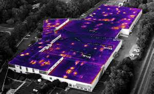
Infrared imaging, also known as thermography, is a technology that enables us to capture images based on the heat radiated by objects and surfaces. Unlike visible light, infrared radiation is invisible to the human eye, making it a valuable tool for various industries, including:
- Building Inspection: Identifying heat leaks, electrical issues, and insulation problems.
- Agriculture: Monitoring crop health and detecting irrigation problems.
- Search and Rescue: Locating individuals in low-light or obscured environments.
- Wildlife Conservation: Studying animal behavior and habitat analysis.
- Industrial Applications: Predictive maintenance, quality control, and process monitoring.
However, traditional methods of acquiring infrared data often involved ground-based equipment or manned aircraft, which could be costly, time-consuming, and limited in accessibility. This is where drones have stepped in to revolutionize the field.
Advantages of Infrared Drones
1. Cost-Effective
Traditional infrared inspections often require scaffolding, lifts, or helicopter rentals, driving up costs significantly. In contrast, drones are a cost-effective solution. They are less expensive to operate and can access hard-to-reach areas without the need for additional infrastructure.
2. Safety
Performing inspections in dangerous or high-risk environments can put human lives at stake. Drones eliminate this risk by allowing technicians to remotely access hazardous areas, ensuring their safety while collecting crucial data.
3. Efficiency and Speed
Drones equipped with thermal cameras can swiftly cover large areas, reducing the time required for inspections. This efficiency can be especially critical in time-sensitive situations, such as disaster response or equipment failures.

4. Data Accuracy
Infrared drones provide highly accurate thermal data, enabling precise analysis and decision-making. The images they capture are detailed and can reveal temperature variations as subtle as a few tenths of a degree Celsius.
5. Accessibility
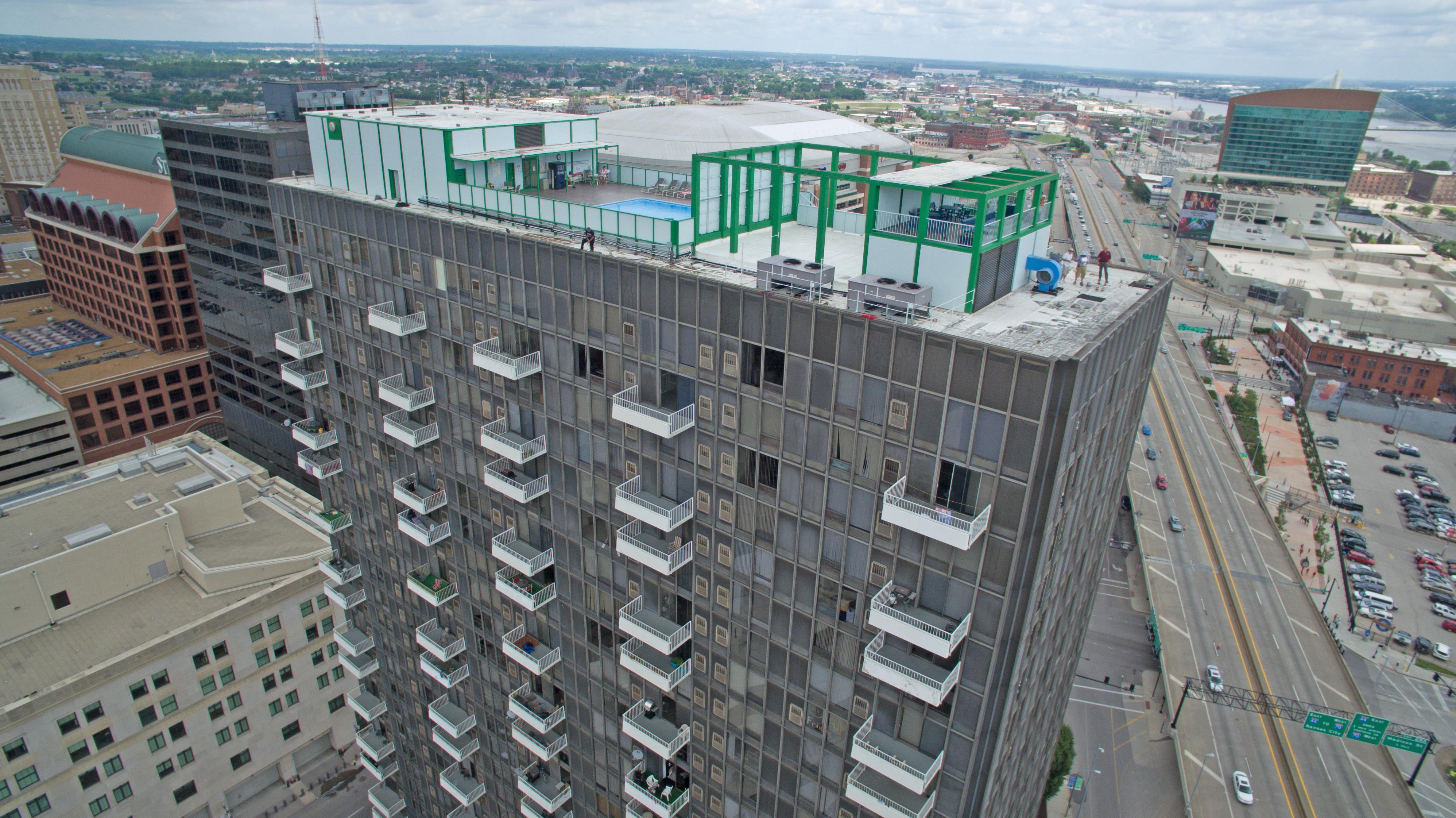
Drones can access areas that are difficult or impossible to reach by traditional means, such as the undersides of bridges, the tops of tall buildings, or remote wilderness locations.
Equipment and Technology
To harness the full potential of infrared imaging with drones, it’s essential to have the right equipment and technology at your disposal. At St. Louis Drone Services, we take pride in using cutting-edge tools to deliver top-notch results.
1. Thermal Cameras
The heart of any infrared drone setup is the thermal camera. These specialized cameras can detect heat emissions and convert them into visible images or data. Some popular brands in the industry include FLIR, DJI, and Seek Thermal.
2. High-Resolution Drones
Pairing the right drone with a thermal camera is crucial. High-resolution drones with stable flight capabilities, like the DJI Matrice series, provide a stable platform for capturing detailed infrared images.
3. Software and Data Analysis
Software plays a crucial role in the post-processing of thermal data. Tools like FLIR Tools or specialized drone thermal analysis software can help interpret and analyze the captured imagery.
Techniques for Infrared Imaging with Drones
Now that we have covered the advantages and essential equipment, let’s delve into some techniques that are employed when utilizing drones for infrared imaging.
1. Altitude and Angle Control
Maintaining the right altitude and camera angle is essential for accurate data collection. Drones must fly at an optimal height and angle to capture thermal data effectively.
2. Overlap in Image Capture
To ensure comprehensive coverage and avoid missing critical details, thermal images should have a degree of overlap. This ensures that no areas are left uninspected.
3. Stabilization and Calibration
Stabilization systems on drones are crucial for eliminating image distortion caused by drone movement. Calibrating the thermal camera is also vital to ensure accurate temperature readings.
4. Data Annotation
After capturing thermal images, it’s essential to annotate and categorize the data for analysis. This process helps identify anomalies and temperature variations effectively.
5. Integration with Other Sensors
For a holistic inspection, drones can be equipped with other sensors, such as LiDAR or multispectral cameras. Combining data from multiple sources can provide a more comprehensive view of the inspected area.
Applications of Infrared Imaging with Drones
The versatility of infrared imaging with drones opens up a wide range of applications across various industries. Let’s explore some of these applications in detail.
Building Inspection and Maintenance
One of the most common applications is building inspection and maintenance. Infrared drones can identify issues such as water leaks, insulation problems, and electrical faults in commercial and residential structures. This is particularly valuable for predictive maintenance and energy efficiency improvements.
Agriculture
In agriculture, drones equipped with thermal cameras can monitor crop health, detect irrigation problems, and assess soil conditions. Farmers can make data-driven decisions to optimize crop yields and reduce water usage.
Public Safety and Search and Rescue
Drones have proven invaluable in search and rescue operations. Thermal imaging can help locate missing persons, even in low-light or challenging environments. Drones equipped with thermal cameras are used by first responders to save lives.
Wildlife Conservation
Infrared drones have made significant contributions to wildlife conservation efforts. Researchers can monitor animal behavior, track poachers, and study ecosystems from the air without disturbing the natural environment.
Industrial Applications
Industries rely on thermal imaging drones for predictive maintenance, quality control, and process monitoring. Identifying equipment failures before they occur can save companies substantial amounts of money and prevent downtime.
Post-Production and Data Analysis
Collecting infrared data with drones is only the beginning of the process. The real value lies in post-production and data analysis. At St. Louis Drone Services, we excel in this crucial aspect of infrared imaging.
1. Data Interpretation
Our team of experienced technicians and analysts is well-versed in interpreting thermal data. We can identify anomalies, temperature variations, and potential issues, providing our clients with actionable insights.
2. Reporting
We take pride in delivering comprehensive and easy-to-understand reports to our clients. These reports include detailed findings, annotated images, and recommendations for any necessary actions.
3. Customization
St. Louis Drone Services understands that each client’s needs are unique. We offer customization options to tailor our services to your specific requirements, ensuring that you get the most out of your thermal imaging data.
4. Repurposing and Traction
We recognize the importance of repurposing your thermal imaging data to gain more traction and value. Whether it’s for marketing purposes or further analysis, we can help you leverage your data effectively.
Conclusion
In conclusion, the utilization of drones for infrared imaging has transformed the way we approach various industries and applications. At St. Louis Drone Services, we are proud to be at the forefront of this technology, offering full-service infrared drone production and post-production services.
As a full-service video creation company, St. Louis Drone Services has worked with many commercial businesses in the St. Louis area to create their building infrared reports. We have experienced drone videographers and producers to create insightful, accurate reporting. Whether it’s building inspections, agricultural assessments, public safety, wildlife conservation, or industrial applications, our team is equipped with the right equipment and creative crew service experience for accurate reporting.
If you are looking to harness the power of infrared imaging with drones for your specific needs, don’t hesitate to reach out to us. We are well-versed in all file types and styles of infrared media reporting and can tailor our services to meet your unique requirements. Contact St. Louis Drone Services today and let us help you unlock the potential of thermal imaging with drones.
Contact St. Louis Drone Services to discuss your infrared imaging needs and experience the difference that expertise and cutting-edge technology can make.
