Tag Archives: Drone

How Drone Videos Can Show Your Construction Progress Clearly

In today’s fast-paced business environment, the ability to showcase project progress in real-time can significantly enhance transparency and communication with stakeholders. For construction companies, using drone technology to capture video footage has emerged as a game-changer, providing a clear, bird’s-eye view of ongoing work. Here’s how drone videos can effectively convey your construction progress.

Drones can access areas that may be hazardous or difficult to reach, allowing for safe inspection of rooftops, scaffolding, and other elevated structures.

Enhanced Visual Documentation

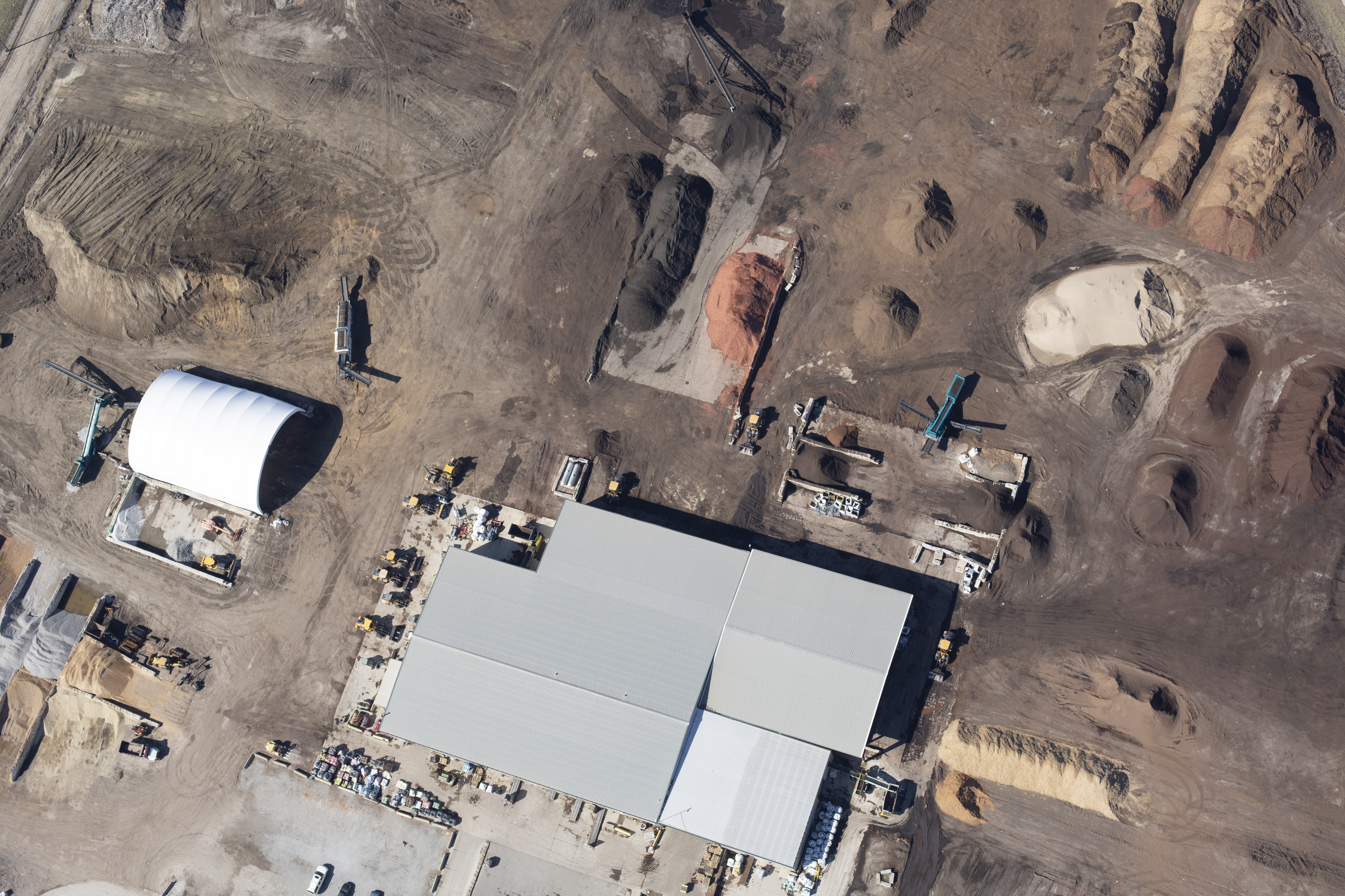
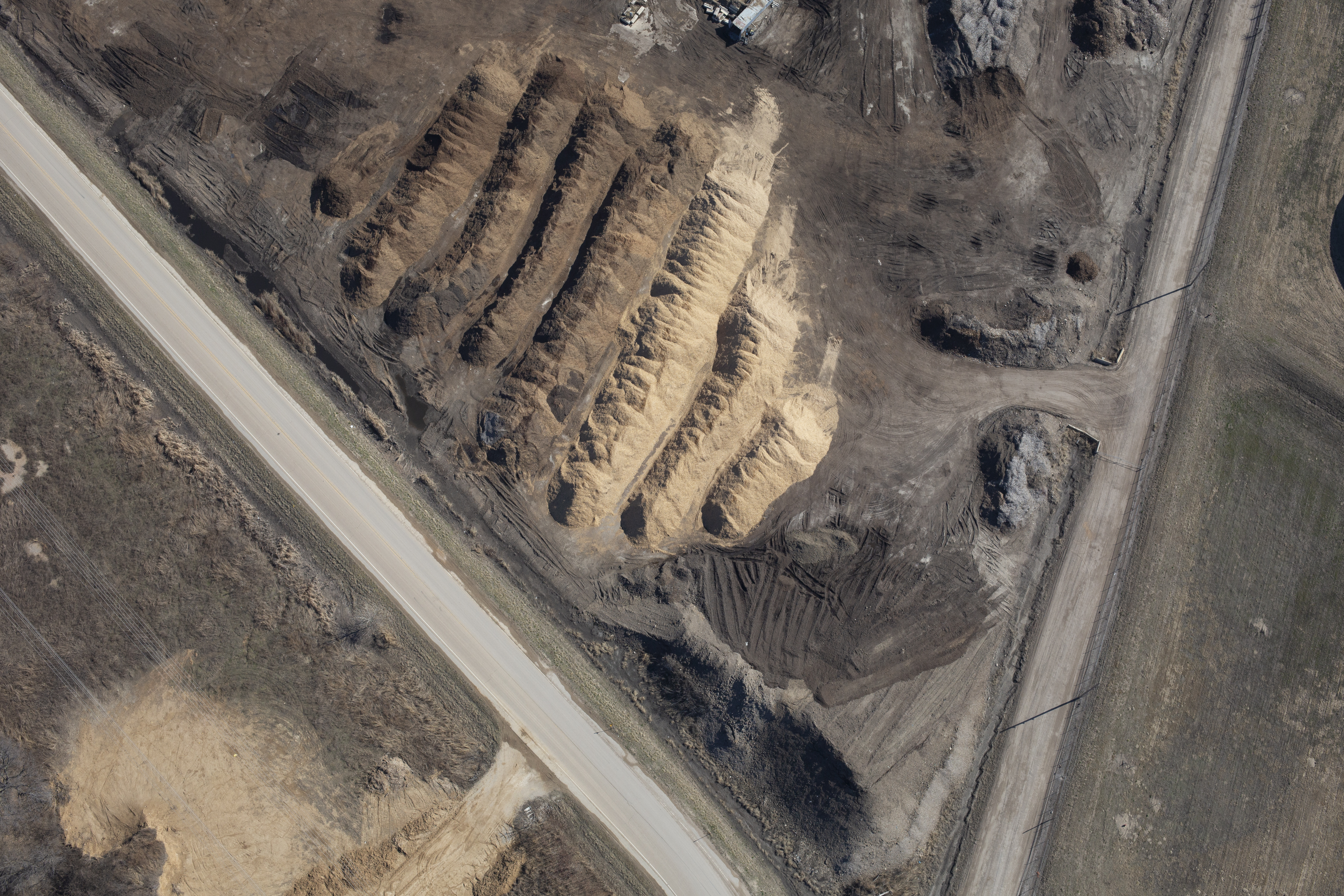
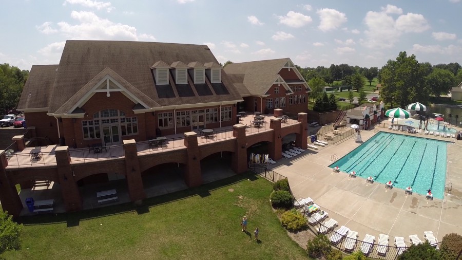
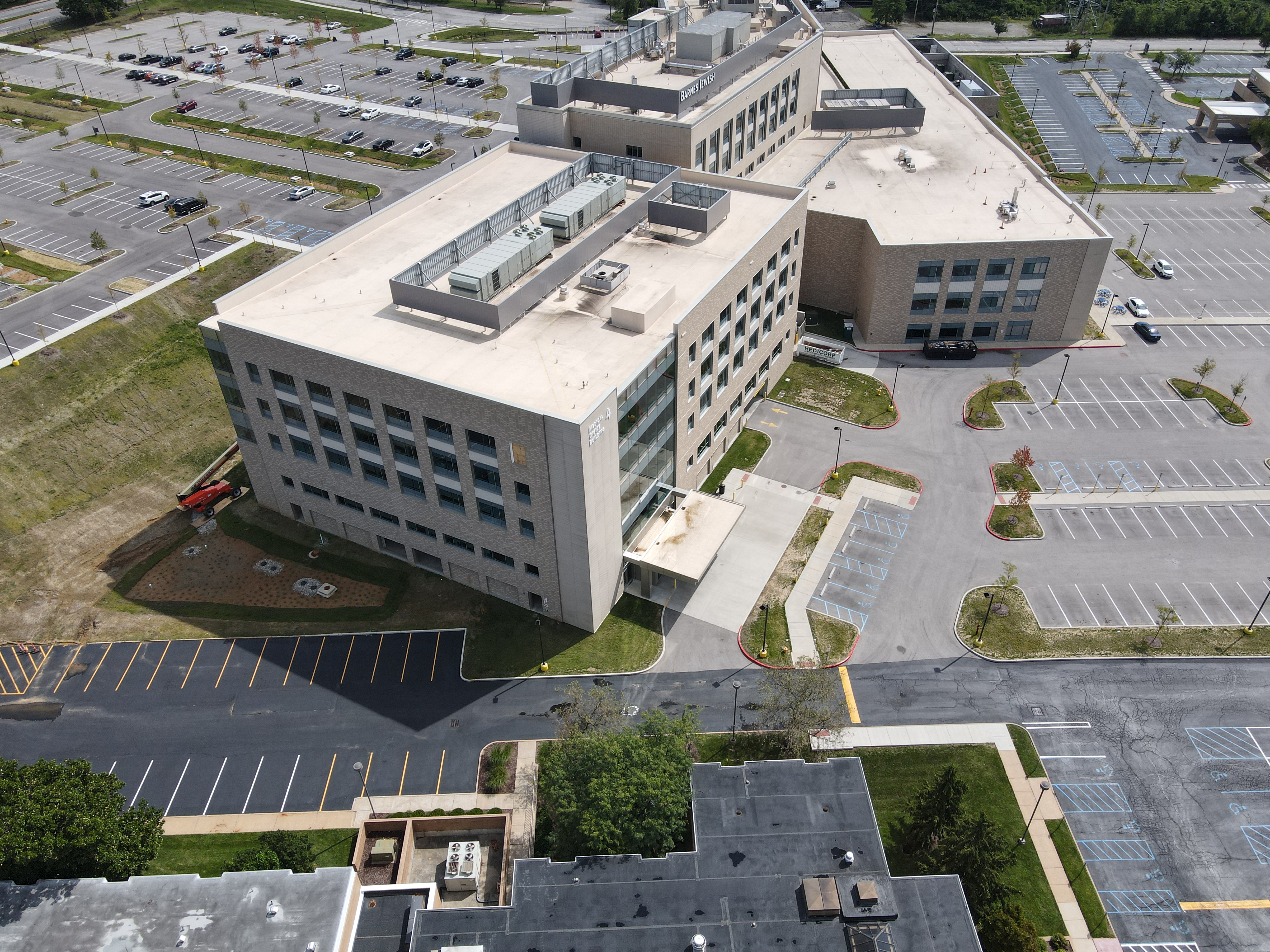
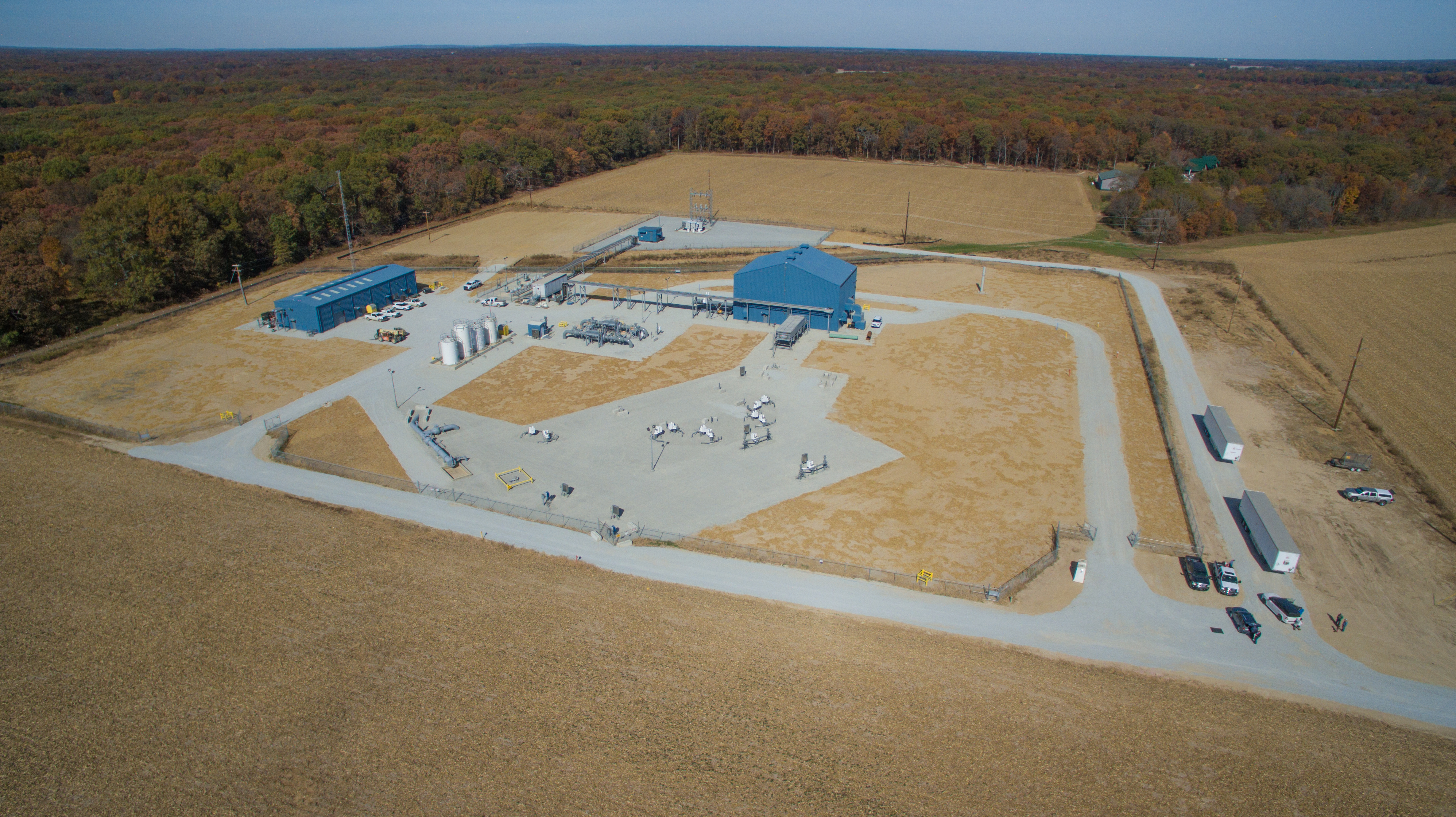
Traditional methods of documenting construction progress often involve ground-level photography and static images. While these methods have their place, they can fall short in delivering a comprehensive view of a site. Drone videos offer a dynamic perspective, allowing you to capture wide-angle shots that illustrate the entire site, showcasing everything from foundational work to structural development.

By integrating drone footage into your project reports, you can create a compelling narrative of progress that is easily digestible for stakeholders. This high-quality visual documentation not only enhances your presentations but also serves as a valuable resource for future projects.

Real-Time Monitoring

One of the most significant advantages of utilizing drones for construction progress videos is the capability for real-time monitoring. Drones can fly over construction sites at scheduled intervals, providing up-to-date footage that reflects current conditions. This immediacy allows project managers and decision-makers to assess progress, identify potential delays, and make informed decisions without the need for extensive on-site visits.

Moreover, real-time drone footage can enhance communication with clients, as they can witness the ongoing work and understand project timelines better. This transparency builds trust and strengthens client relationships.

Comprehensive Analysis and Reporting

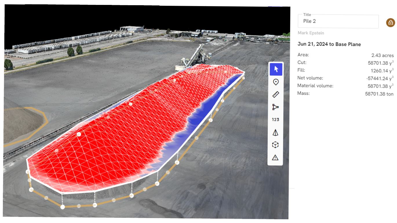
Drone videos can be used not just for documentation but also for in-depth analysis. By capturing aerial footage over time, you can create time-lapse videos that visually represent the evolution of a project from groundbreaking to completion. This type of reporting is invaluable for stakeholders, as it provides clear evidence of progress and adherence to timelines.

Furthermore, drones equipped with advanced imaging technology can capture detailed images that can be analyzed for various construction parameters, such as material placement, site logistics, and worker safety. This data can be used to optimize operations and improve efficiency on site.

Safety and Accessibility

Drones can access areas that may be hazardous or difficult to reach, allowing for safe inspection of rooftops, scaffolding, and other elevated structures. This capability not only minimizes risks associated with manual inspections but also ensures that you are capturing accurate footage from all necessary angles.

Additionally, drones can be utilized to assess damage after extreme weather events or accidents, providing immediate feedback that can guide recovery efforts. The ability to assess sites safely and quickly is a considerable advantage in maintaining project momentum.

Customizable Production for Diverse Media Requirements

At St Louis Drone Services, we understand that every construction project is unique, and we are committed to providing customized solutions tailored to your specific media requirements. As a full-service professional commercial photography and video production company since 1982, we offer a comprehensive suite of services that includes:

  • Full-Service Studio and Location Video and Photography: Our team can manage everything from initial concept development to final delivery.
  • Editing and Post-Production: Our skilled editors can enhance your footage, ensuring that it meets your branding standards and messaging goals.
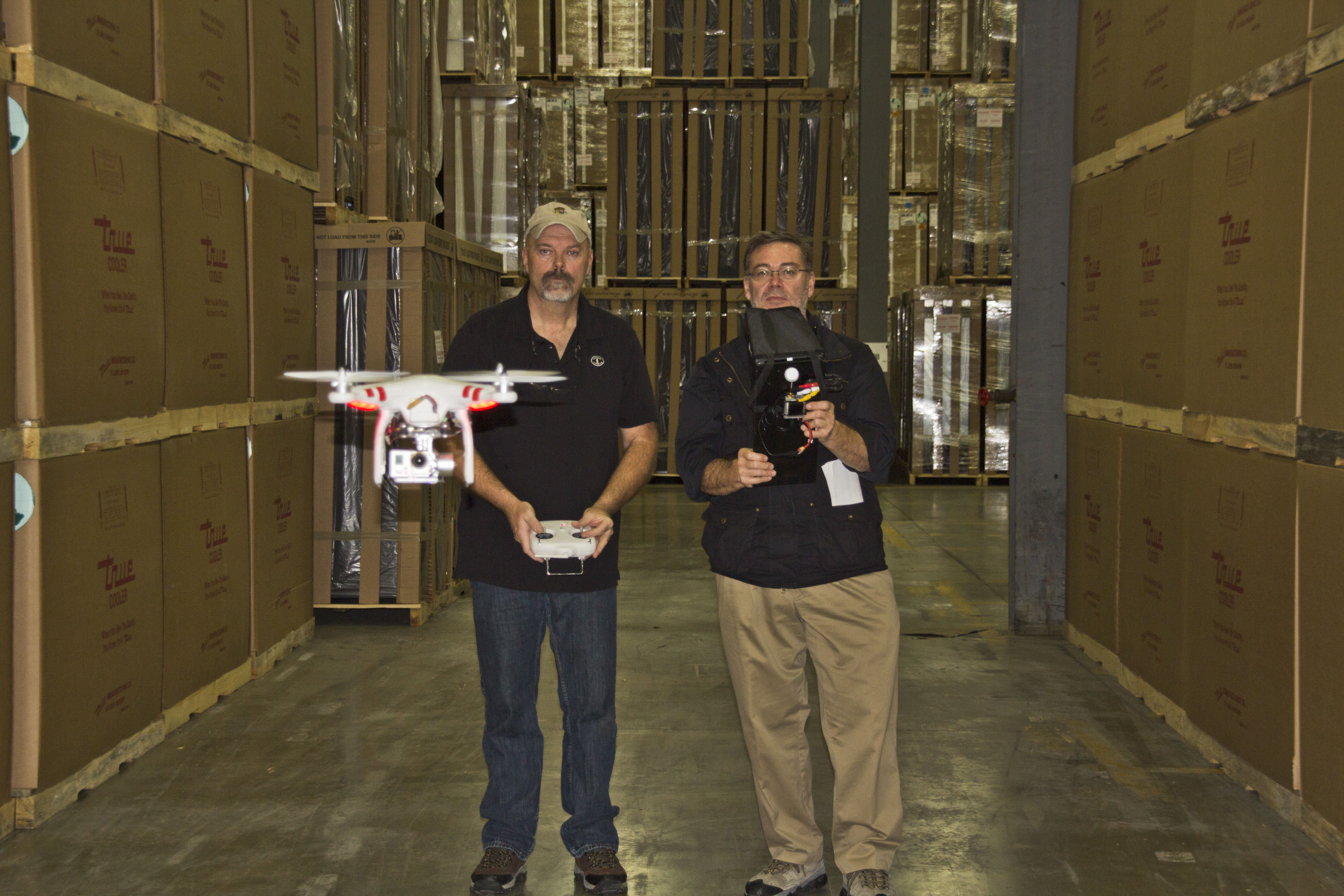
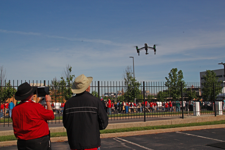
  • Licensed Drone Pilots: Our experienced drone operators are fully licensed and trained to capture stunning aerial footage safely and effectively.

Our private studio is equipped with advanced lighting and visual setups, making it perfect for small productions and interviews. We can seamlessly incorporate props and other elements to create a compelling set that resonates with your audience.

Conclusion

Incorporating drone technology into your construction project documentation can elevate your reporting capabilities and enhance stakeholder engagement. St Louis Drone Services stands ready to assist you in achieving your production goals. With our extensive experience working with businesses, marketing firms, and agencies in the St. Louis area, we have the right equipment and creative crew service experience to ensure successful image acquisition. Let us help you repurpose your photography and video branding to gain more traction. We are well-versed in all file types, styles of media, and accompanying software, ensuring that your project reflects the quality and professionalism you demand.

Contact us today to learn more about how we can customize your next production and make it truly exceptional!

314-604-6544

stlouisdroneservices@gmail.com

How to Use Drones to Measure Stockpiles and Track Volumes More Accurately

In the mining, construction, and aggregates industries, precise stockpile measurement is essential for effective inventory management and operational efficiency. Traditional methods can be time-consuming, labor-intensive, and often less accurate. However, with the advent of drone technology, measuring stockpiles has become significantly more efficient and accurate. This guide explores how drones are transforming stockpile measurement and how your organization can benefit from this innovative approach.

The Advantages of Using Drones for Stockpile Measurement

Typically, a drone survey can be completed in a few hours, including flight time and initial data processing.

Accurate and Efficient Data Collection

Drones enable quick and precise data collection by capturing geo-referenced images from above your worksite. Using photogrammetry, these images can be transformed into detailed 3D maps. Drone survey visualization software ensures high data accuracy, allowing for precise stockpile volume measurements.

Track Progress and Compare Surveys

Drone technology simplifies the process of comparing current stockpile volumes to previous surveys, helping you effectively track site progress. You can also compare drone surveys to final grade design files to determine how much material needs to be added or removed, ensuring your project stays on target.

Comprehensive 3D Mapping

Drones create detailed 3D maps of your site, providing both a visual representation and actionable data, including stockpile volume calculations. This level of detail and accuracy is invaluable for informed decision-making in inventory management and site planning.

Improved Safety

Traditional stockpile measurement methods often require personnel to climb stockpiles, posing safety risks. Drones eliminate this hazard by collecting data remotely, ensuring the safety of your workforce. At St Louis Drone Services, safety is our top priority. Our licensed pilots are FAA 107 compliant and Safe-To-Fly certified, meeting the highest safety standards.

Speed and Cost-Effectiveness

Drone surveys are faster than traditional methods, allowing for more frequent data collection and quicker turnaround times. This efficiency can lead to significant cost savings by reducing the time and labor needed for stockpile measurement while maintaining high accuracy.

Applications of Drone Surveying in Various Industries

Mining and Aggregates

For professionals in the mining and aggregates industries, stockpile inventory management is a key application of drone surveying. Accurate volume measurements are critical for managing inventory, planning operations, and meeting regulatory requirements. Drones provide a reliable and efficient means to collect this essential data.

Construction

Construction sites benefit greatly from drone surveying. Quick site surveys and detailed 3D maps help project managers track progress, manage resources, and ensure projects stay on schedule and within budget. The actionable data collected from drone flights supports informed decision-making and enhances overall project efficiency.

Frequently Asked Questions About Drones and Volumetric Measuring

1. How accurate are drone surveys for volumetric measurements?

Drone surveys are highly accurate for volumetric measurements, often achieving accuracy within 1-2% of traditional ground survey methods. Accuracy depends on factors such as the drone’s camera quality, flight plan, and processing software used for generating 3D models and measurements.

2. What equipment is needed for drone volumetric measurements?

To conduct volumetric measurements using drones, you need:

  • A high-quality drone equipped with GPS and a high-resolution camera.
  • Photogrammetry software for processing images and generating 3D models.
  • Ground control points (GCPs) to enhance survey accuracy.
  • A computer capable of handling the processing software and large datasets.

3. How long does it take to complete a drone survey?

The time required for a drone survey depends on the site’s size and terrain complexity. Typically, a drone survey can be completed in a few hours, including flight time and initial data processing. Larger or more complex sites may take longer.

4. What are ground control points (GCPs) and why are they important?

Ground control points (GCPs) are physical markers placed on the ground at known coordinates. They improve the accuracy of the drone survey by providing reference points for the photogrammetry software, ensuring that the generated 3D models and measurements are correctly scaled and geo-referenced.

5. Can drones be used to measure stockpiles indoors?

Yes, drones can measure stockpiles indoors using specialized drones equipped with sensors that navigate in GPS-denied environments. While indoor measurements can be more challenging due to limited space and potential obstacles, accurate measurements can be achieved with the right equipment and expertise.

6. What types of materials can be measured using drones?

Drones can measure various materials, including aggregates like rock and gravel, coal, sand, soil, and more. As long as the stockpiles are accessible and visible to the drone’s camera, volumetric measurements can be accurately obtained.

7. How are the volumetric measurements calculated from drone data?

Volumetric measurements are calculated using photogrammetry software that processes the images captured by the drone. The software generates a 3D model of the site and calculates the volume of the stockpiles by analyzing differences in elevation and surface area.

8. What are the benefits of using drones for volumetric measurements compared to traditional methods?

The benefits of using drones for volumetric measurements include:

  • Increased safety by eliminating the need for personnel to climb stockpiles.
  • Faster data collection and processing times.
  • High accuracy and detailed 3D models.
  • Cost savings due to reduced labor and time requirements.
  • The ability to frequently update measurements for better inventory management.

9. Are there any regulatory requirements for using drones in volumetric measurements?

Yes, there are regulatory requirements for using drones, including:

  • Obtaining a Remote Pilot Certificate from the FAA for commercial drone operations.
  • Adhering to FAA Part 107 regulations, which cover operational limitations, airspace restrictions, and safety guidelines.
  • Ensuring the drone and pilot comply with local regulations and any additional permits required for specific areas.

10. How can St Louis Drone Services help with drone volumetric measurements?

At St Louis Drone Services, we provide comprehensive drone surveying services, including volumetric measurements. Our team of licensed and experienced pilots, equipped with the latest technology, ensures accurate data collection and processing. We prioritize safety and compliance with FAA regulations, offering customized solutions to meet your specific needs. Whether you need regular inventory updates, detailed site surveys, or custom media production, we have the expertise and equipment to deliver exceptional results.

Why Choose St Louis Drone Services

At St Louis Drone Services, we are a full-service professional commercial photography and video production company with extensive experience in drone surveying for stockpile inventory management. Our team of licensed drone pilots is equipped with the latest technology to provide accurate and reliable data acquisition. Here’s what sets us apart:

  • Expertise and Equipment: We have the right equipment and creative crew to handle all aspects of your project, from data acquisition to post-production.
  • Comprehensive Services: We offer full-service studio and location video and photography, as well as editing, post-production, and licensed drone pilots. Whether you need custom video productions, sound and camera operators, or specialized drone flights, we have you covered.
  • Customization: We can tailor our services to meet diverse media requirements, ensuring that your content is optimized for maximum impact.
  • Safety and Compliance: Our operations are FAA approved, and all our pilots are FAA 107 compliant. We prioritize safety and adhere to the highest standards in the industry.
  • Experience: We have worked with numerous businesses to gather data and measure stockpiles accurately, helping them make informed decisions and improve operational efficiency.

By leveraging our expertise and state-of-the-art technology, St Louis Drone Services can help you achieve accurate stockpile measurements and optimize your inventory management processes. Contact us today to learn more about how we can support your business needs with our comprehensive drone surveying services.

314-604-6544

stlouisdroneservices@gmail.com

Indoor Drone Expert: Insider Tips and Tricks

Drones have revolutionized the way we capture images and videos from the sky, but what about indoors? While many people associate drones with outdoor aerial photography and videography, there is a growing demand for indoor drone services in various industries. As an experienced editor, photographer, and videographer at St Louis Drone Services, I’ve compiled a comprehensive guide to mastering indoor drone photography and videography.

Adjust your drone’s camera settings to accommodate different lighting scenarios and enhance the quality of your footage.

Understanding Indoor Drone Challenges

Indoor environments pose unique challenges for drone operation. Unlike outdoor spaces, indoor areas lack GPS signal, which drones rely on for navigation and stability. Additionally, confined spaces present obstacles such as walls, ceilings, and furniture, requiring careful maneuvering to avoid collisions.

Tips for Successful Indoor Drone Operation

1. Choose the Right Drone

Selecting the appropriate drone for indoor use is crucial. Opt for a compact and agile model with obstacle avoidance sensors to navigate tight spaces safely. DJI’s Mavic Mini or Mavic Air series are popular choices for indoor drone photography and videography.

2. Practice in Controlled Environments

Before tackling complex indoor shoots, practice flying your drone in controlled environments such as empty warehouses or spacious rooms. Familiarize yourself with the drone’s controls and responsiveness to gain confidence in maneuvering indoors.

3. Plan Your Shots

Careful planning is essential for indoor drone projects. Create a detailed flight plan, taking into account obstacles, lighting conditions, and desired angles. Visualize the shots you want to capture and strategize your flight path accordingly.

4. Utilize Indoor Lighting

Indoor spaces often have varying lighting conditions, from harsh fluorescent lights to natural sunlight streaming through windows. Adjust your drone’s camera settings to accommodate different lighting scenarios and enhance the quality of your footage.

5. Maintain Line of Sight

Maintaining visual line of sight with your drone is critical for safety and control, especially in indoor environments where obstacles are prevalent. Always keep the drone within your line of sight to avoid collisions and navigate effectively.

6. Edit and Enhance Post-Production

Post-production editing plays a significant role in refining indoor drone footage. Utilize editing software to stabilize shaky footage, adjust colors and exposure, and add special effects to enhance the final product.

Elevating Your Indoor Drone Productions with St Louis Drone Services

At St Louis Drone Services, we specialize in indoor drone photography and videography, offering unparalleled expertise and creativity for your projects. Our experienced team of editors, photographers, and videographers is equipped with state-of-the-art equipment and innovative techniques to capture stunning imagery in any indoor environment.

From corporate events and promotional videos to architectural surveys and real estate showcases, we tailor our services to meet your unique needs. With licensed drone pilots and extensive experience in indoor drone operations, St Louis Drone Services delivers exceptional results that exceed expectations.

Call to Action

As a full-service video and photography production company, St Louis Drone Services has partnered with numerous businesses, marketing firms, and agencies in the St. Louis area for their corporate photography and video needs. Contact us today to elevate your indoor drone productions and unlock the potential of aerial imagery for your business.

Remember, mastering indoor drone photography and videography takes practice, patience, and precision. With the right techniques and equipment, you can capture breathtaking footage that showcases the beauty and intricacies of indoor spaces like never before.


At St Louis Drone Services, we are committed to pushing the boundaries of creativity and innovation in aerial photography and videography. Contact us today to discover the endless possibilities of indoor drone imaging for your business or organization.

314-604-6544

stlouisdroneservices@gmail.com

Commercial and Residential Real Estate Drone Photography

St Louis Drone Services is a full-service aerial photography and video production company able to provide concept to completion high end photography and video productions. Our award winning team can develop your creative concept and delivery anything from internet advertising to high definition commercials for TV.

Aerial Photography St Louis Drone Services

Robert Haller

314-604-6544

stlouisdroneservices@gmail.com