Tag Archives: st Louis drone video

What’s Next for Drones in Construction? How Aerial Imaging Is Shaping the Future of Job Site Management.

Introduction: Elevating Construction with Aerial Innovation

In the fast-paced world of construction, precision, efficiency, and real-time information are critical. As the industry evolves, so too does the technology supporting it—none more transformative than the rise of drone services. Once used primarily for overhead photography, drones now play an integral role in modern construction workflows. From pre-construction planning to post-project evaluation, drones are revolutionizing how teams visualize, measure, and manage job sites.

At St Louis Drone Services, we’ve seen firsthand how aerial solutions can boost productivity, enhance safety, and reduce costs. But what’s next? Let’s take a closer look at where drone technology is heading in the construction industry—and how businesses can leverage it to gain a competitive edge.


Current Use Cases: Where Drones Already Excel on Construction Sites

Today’s construction teams are turning to drones for a wide range of high-impact tasks:

  • Topographic Mapping & Land Surveys
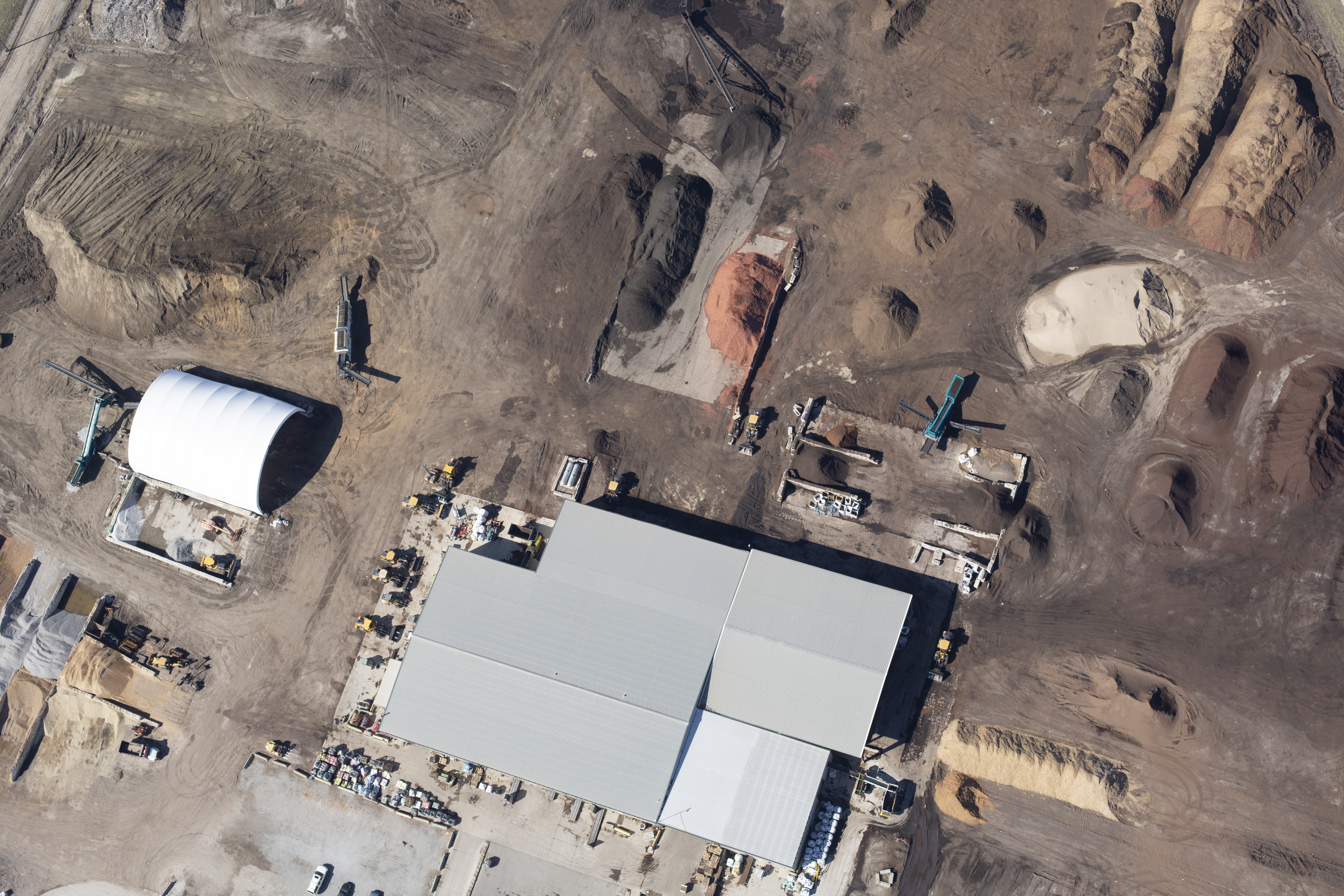
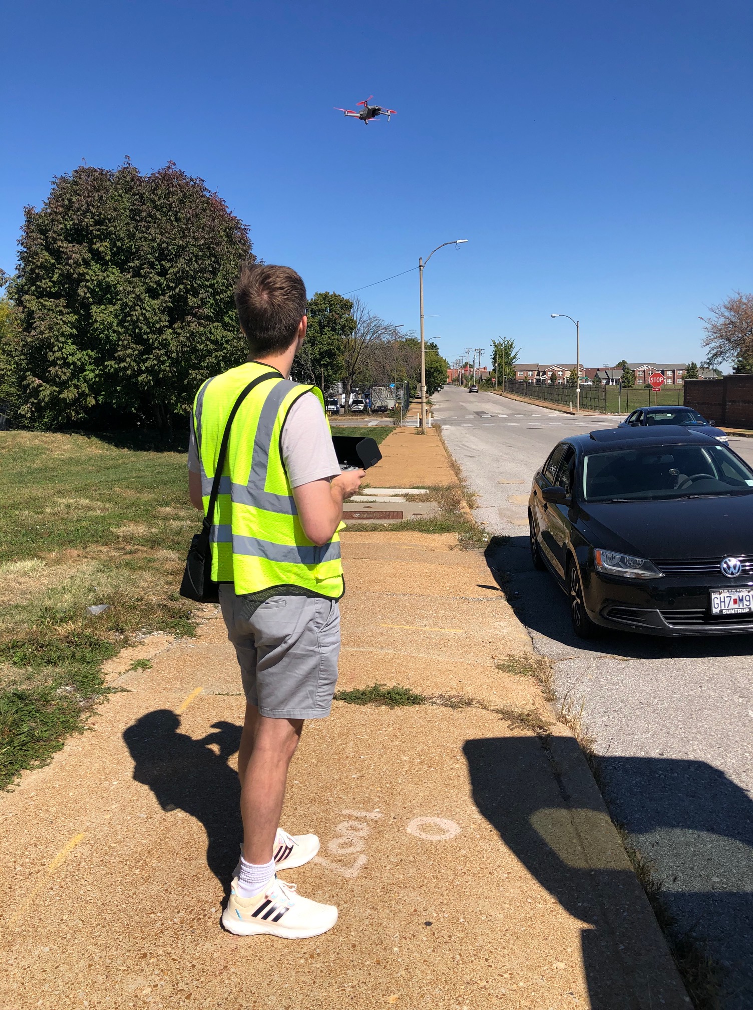
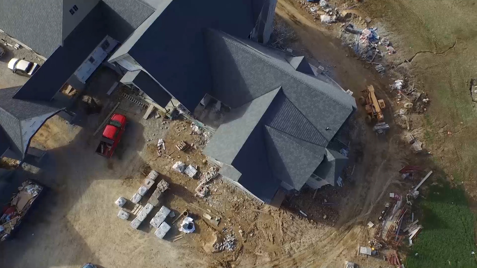
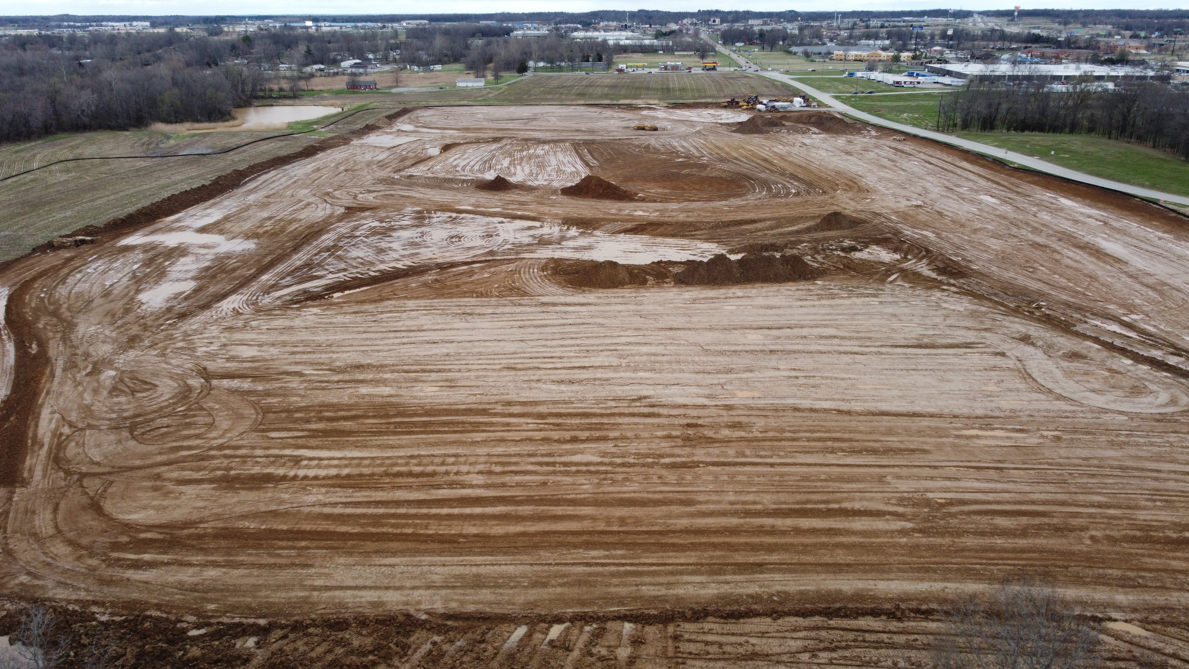
    Drones can survey large areas of land quickly and cost-effectively. With RTK-enabled drones and photogrammetry software, we can generate detailed, geo-referenced 2D and 3D models—often more accurately and faster than traditional surveying methods.
  • Progress Monitoring & Visual Reporting
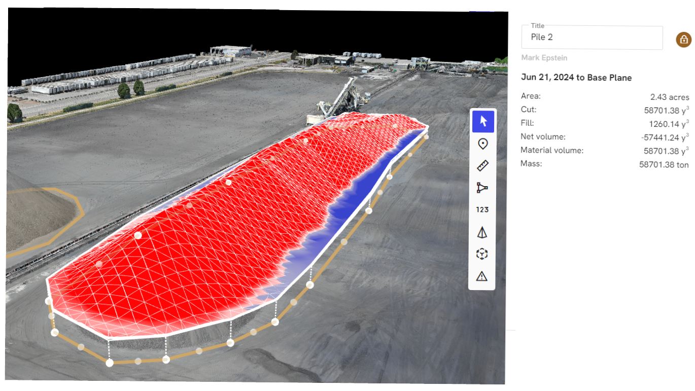
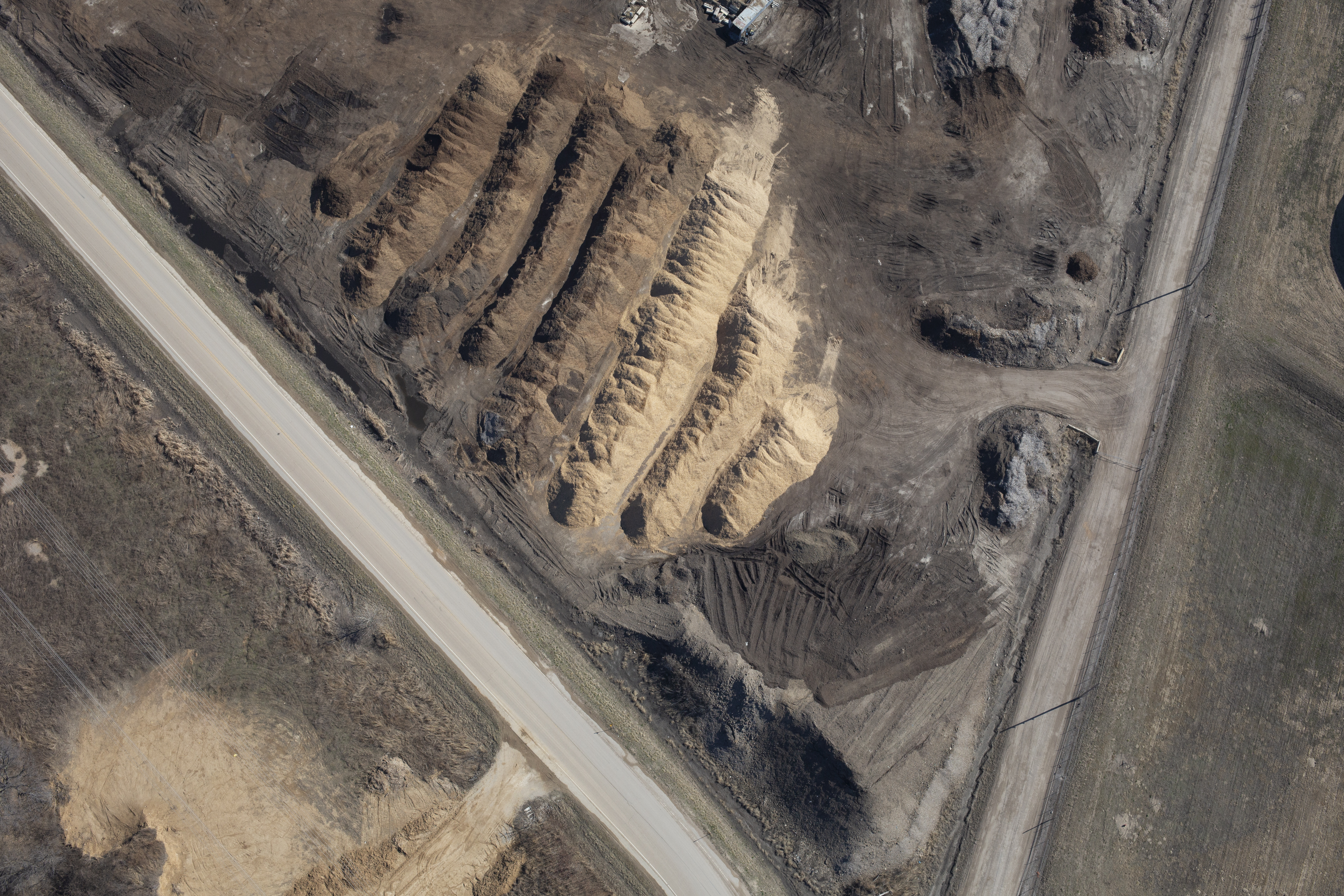
    Frequent drone flights provide stakeholders with up-to-date, high-resolution visuals, aiding in project tracking and client communications. These images and videos also serve as valuable documentation for compliance and insurance purposes.
  • Volumetric Analysis for Earthworks & Stockpiles
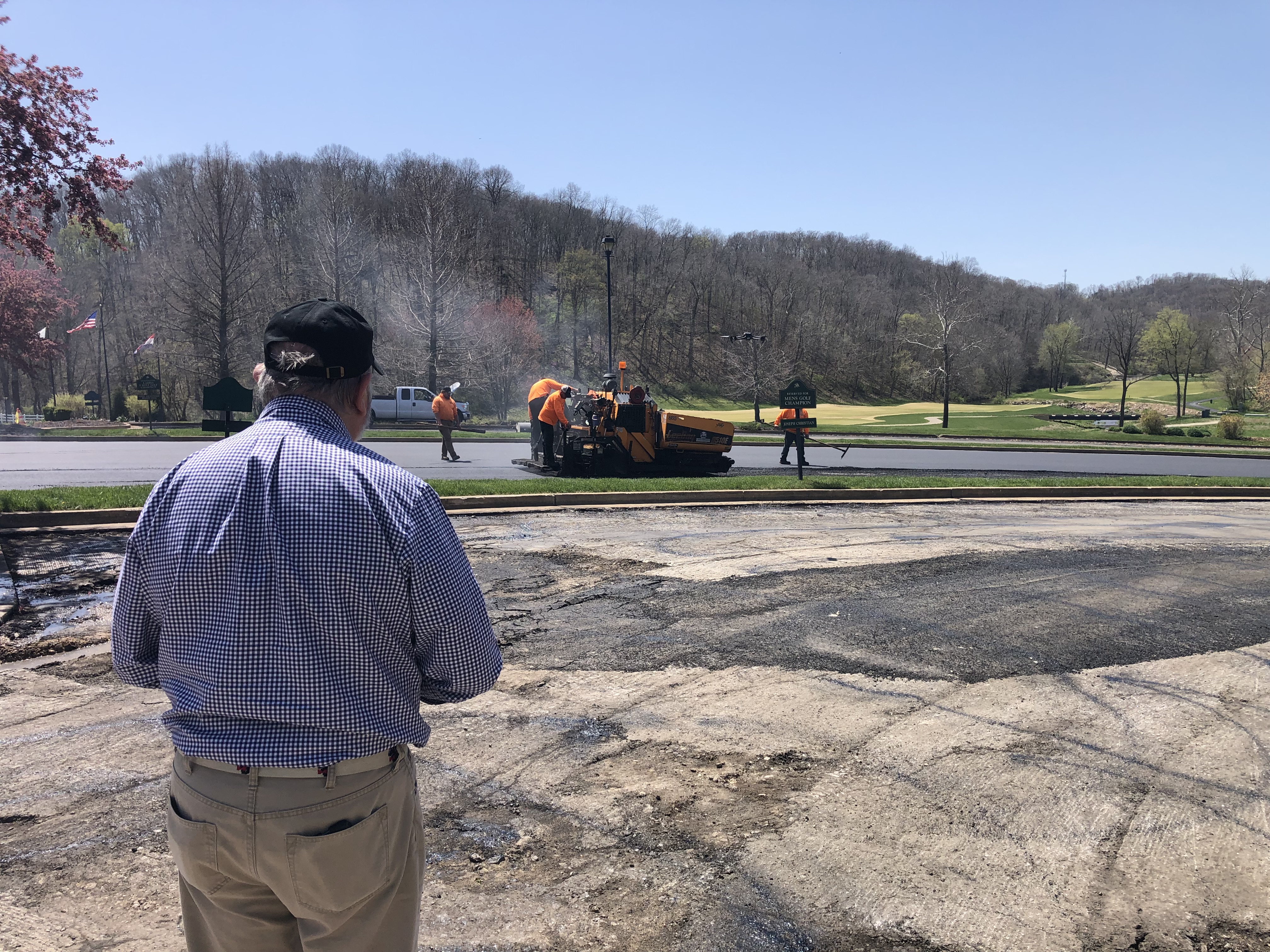
    Drone data enables accurate measurement of materials moved on-site. This is especially useful for grading, cut-and-fill planning, and confirming vendor material deliveries.
  • Site Inspections & Safety Assessments
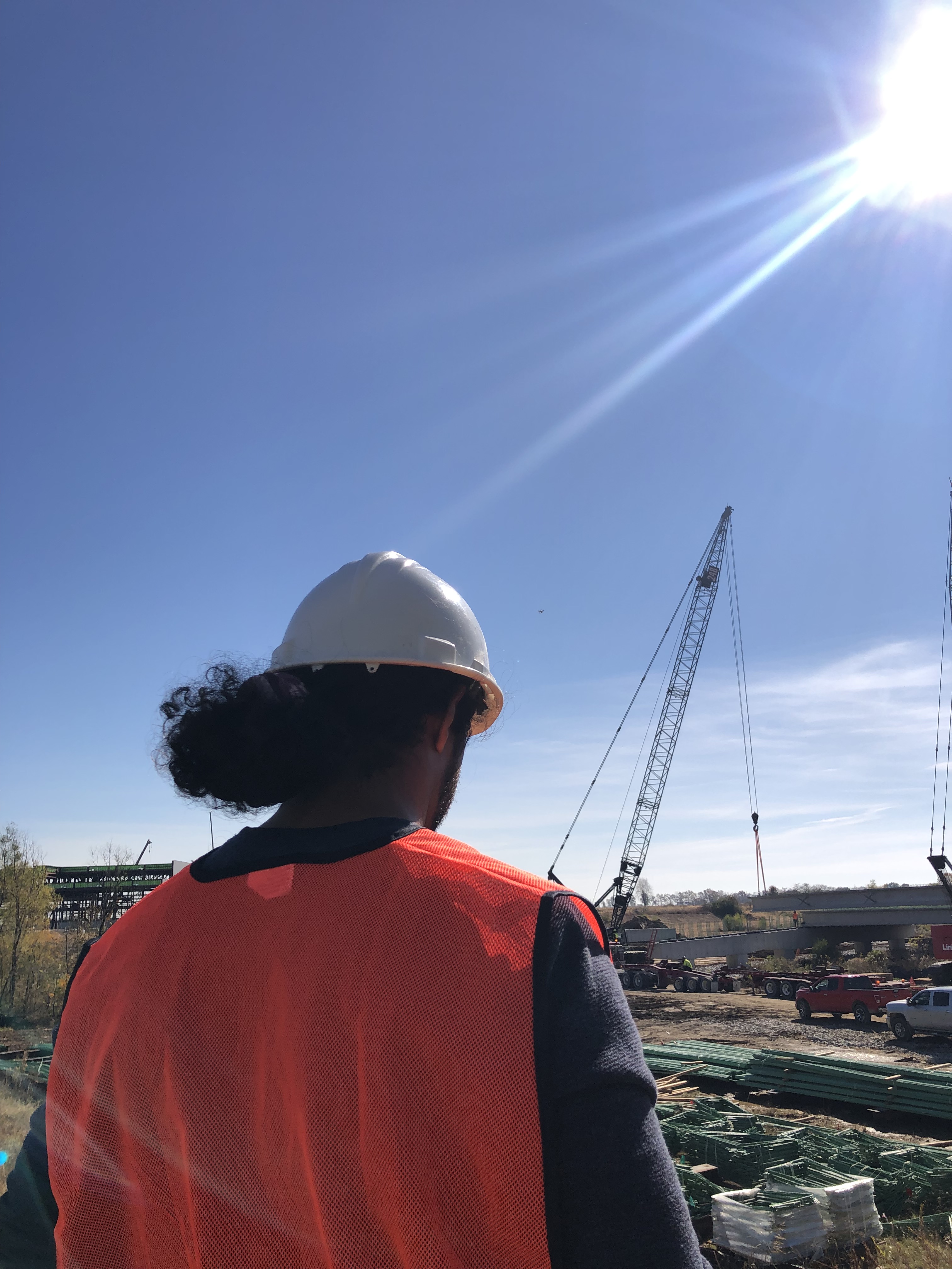
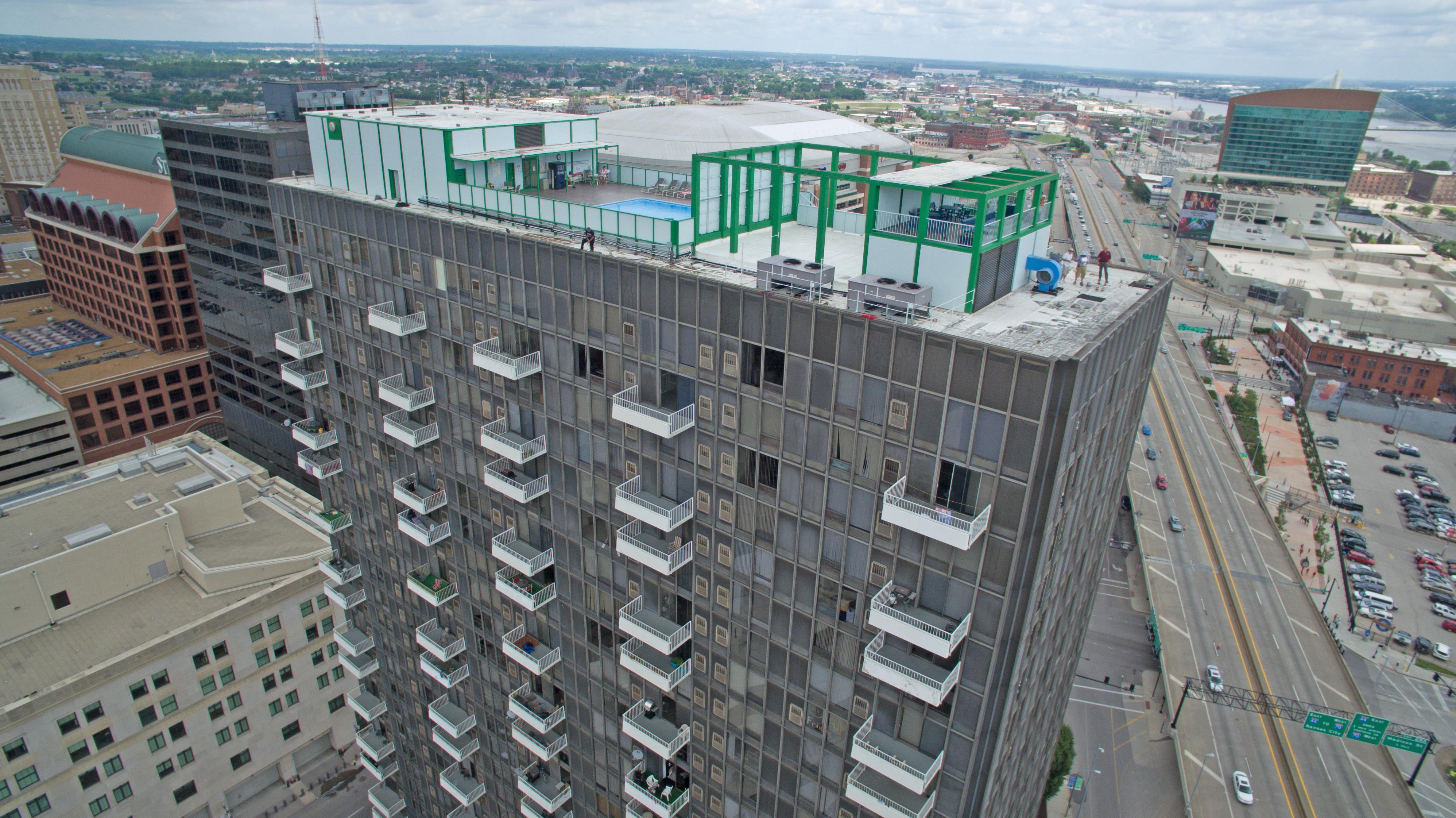
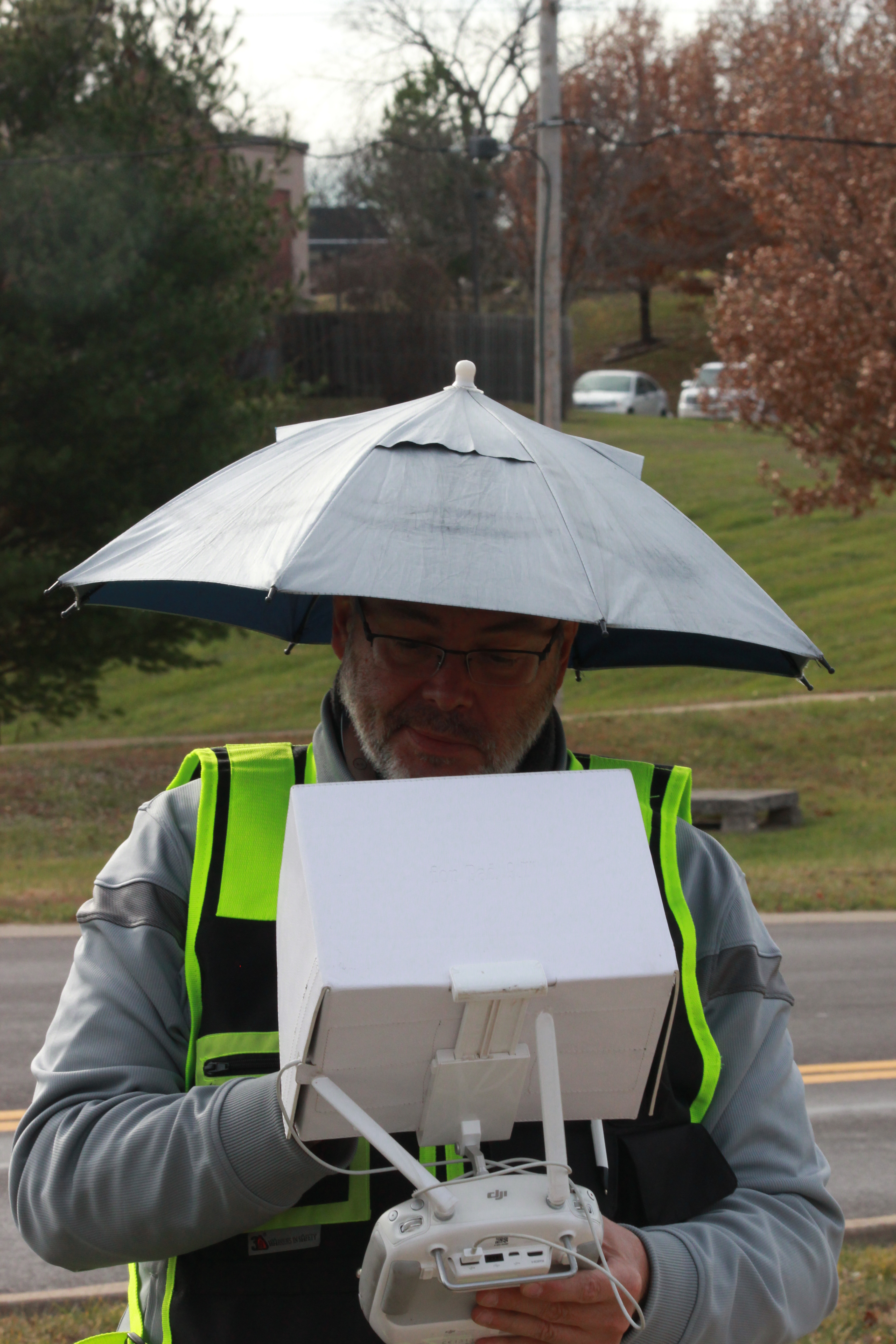
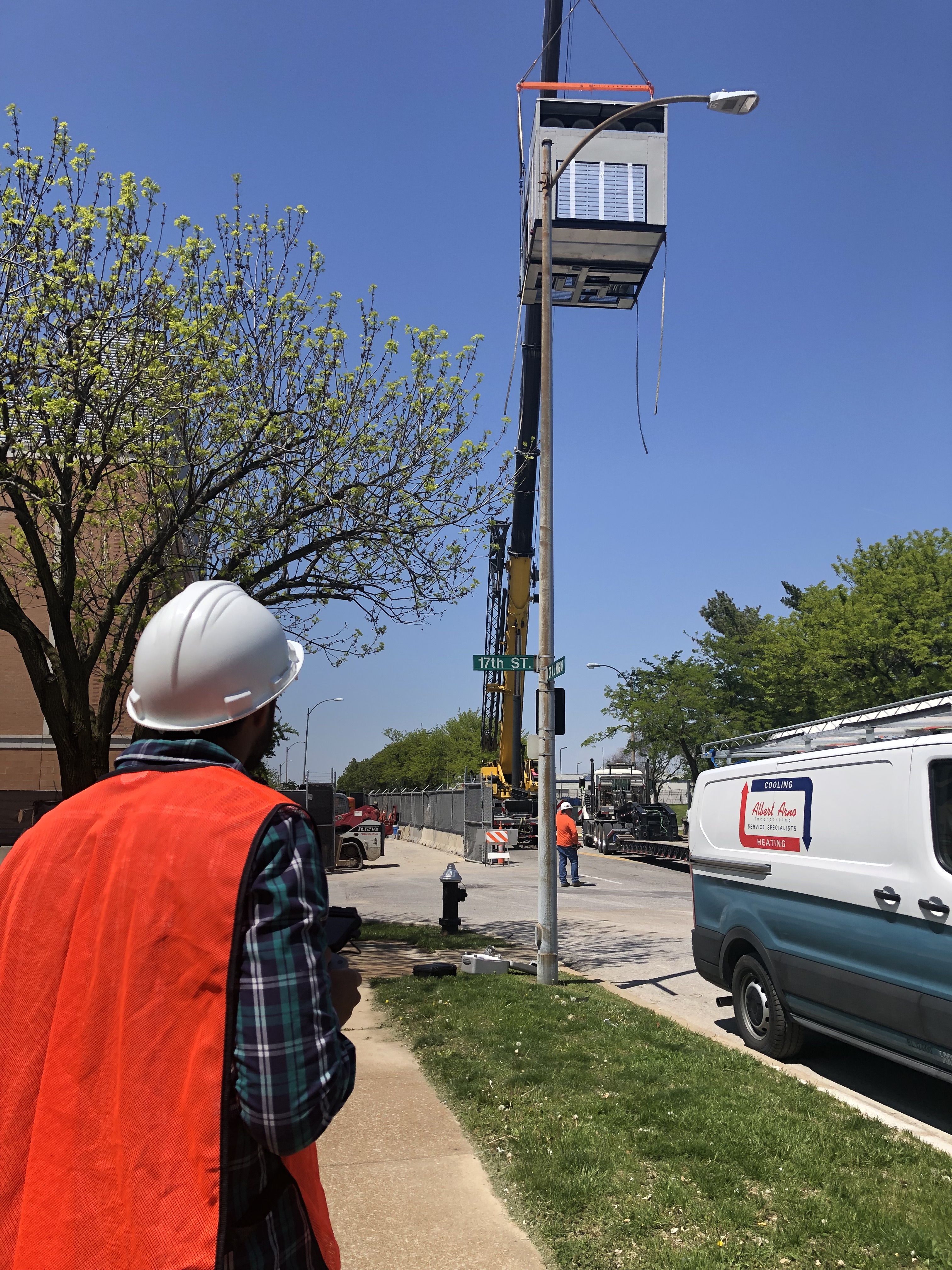
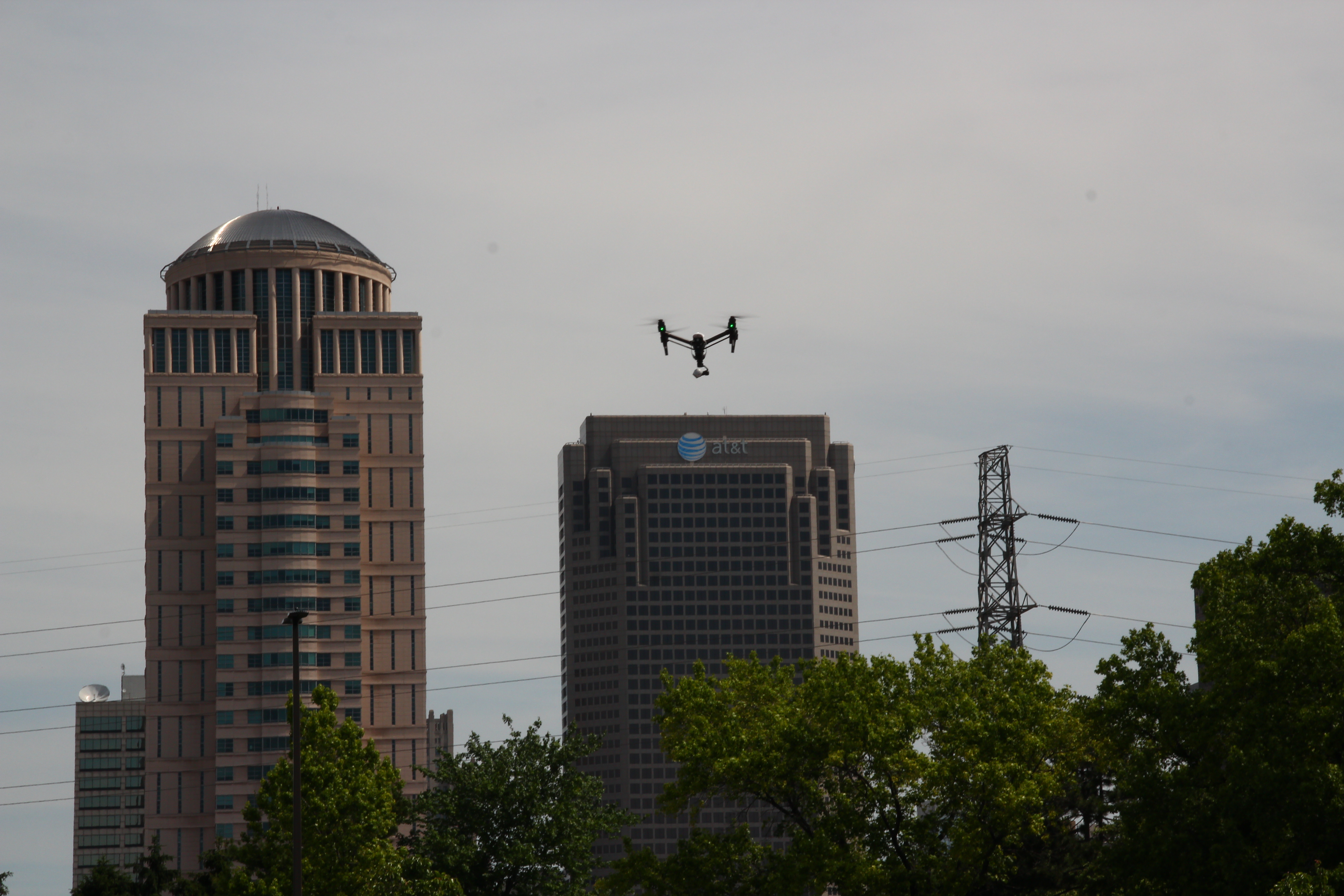
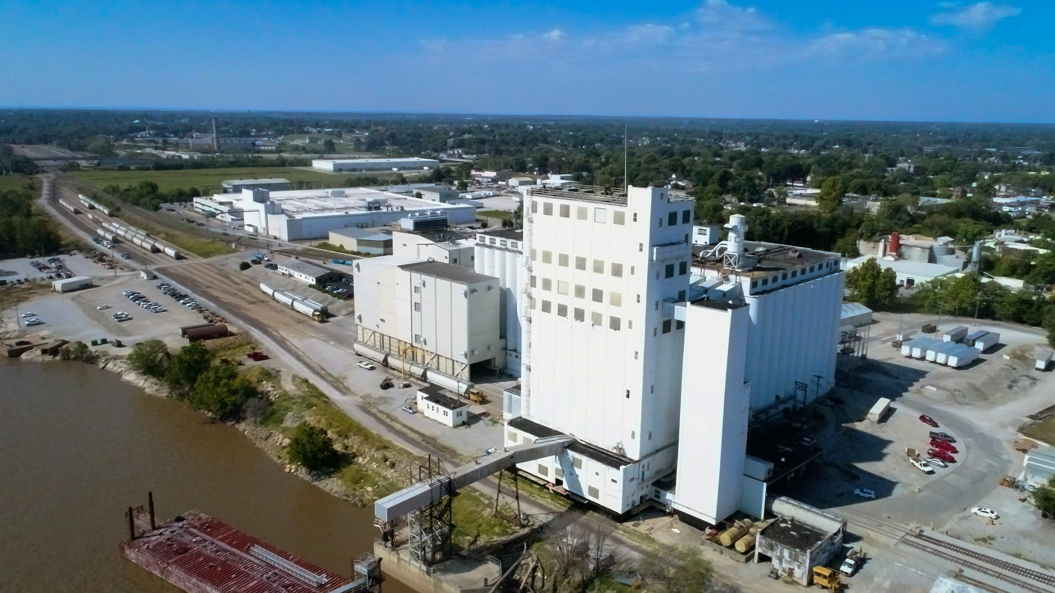
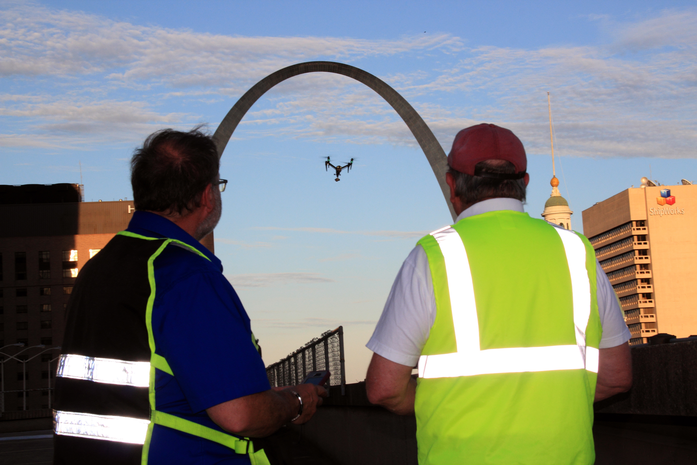
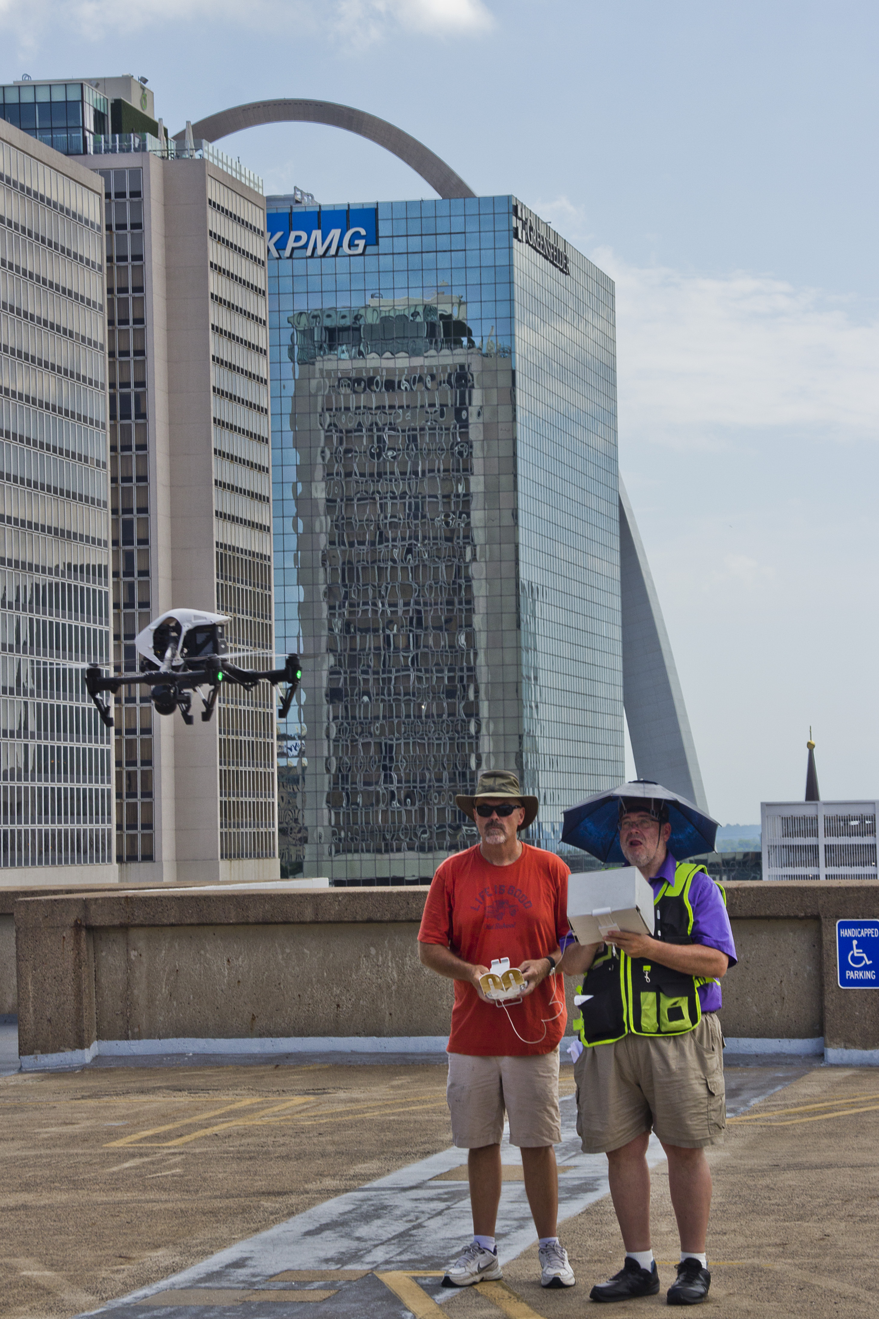
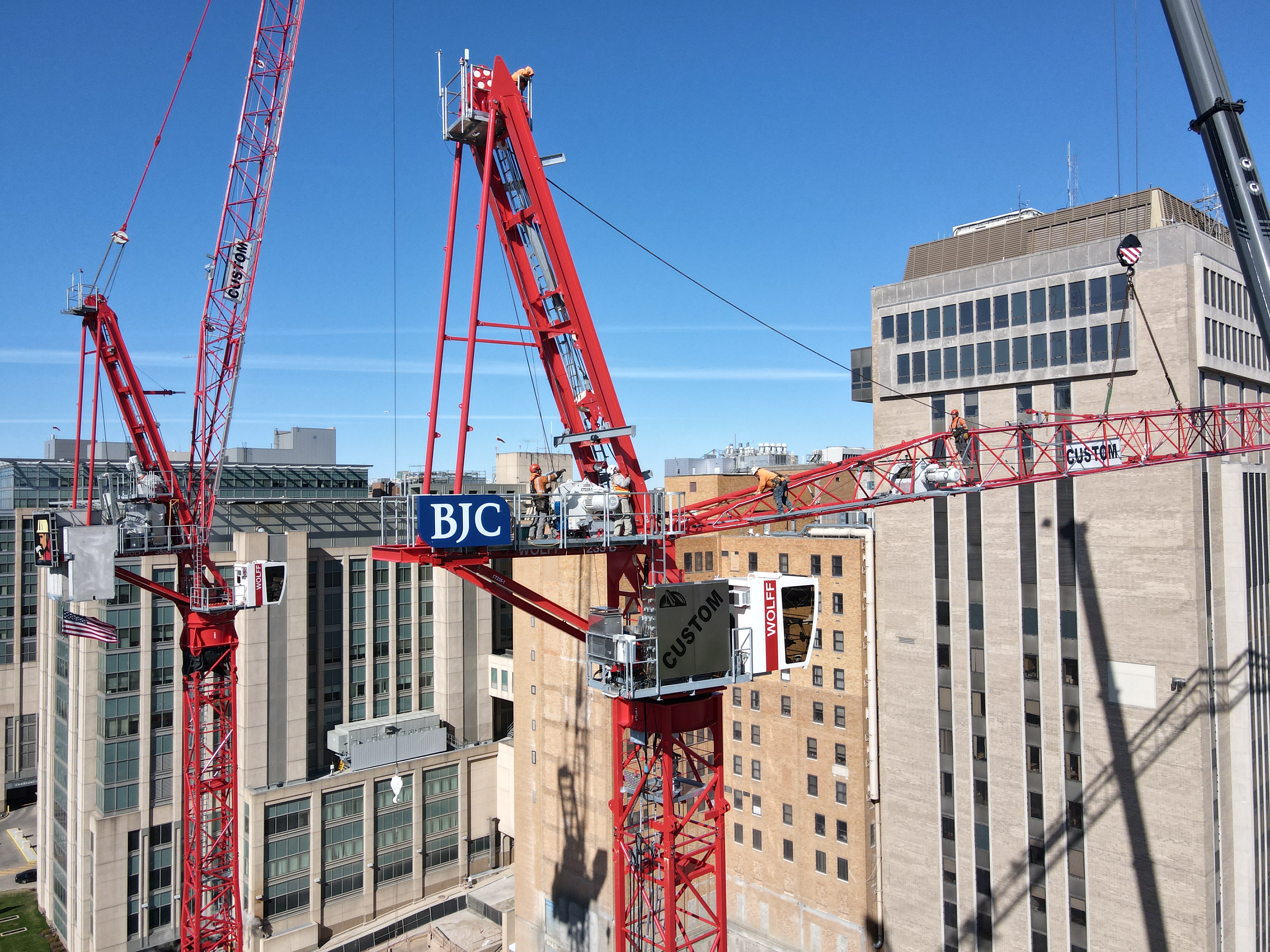
    Drones provide access to hard-to-reach or hazardous areas, keeping personnel safe while gathering critical visual information from roofs, towers, scaffolding, and other elevated zones.

What’s Next: The Future of Drones in Construction

As drone technology continues to mature, we anticipate several key developments that will further embed UAVs into construction workflows:

  • Autonomous Flight Plans & AI-Powered Analysis
    With AI-assisted flight planning and automated data processing, drones will not just capture images—they’ll interpret them. AI can identify changes in site conditions, detect potential safety hazards, and flag discrepancies between blueprints and actual builds.
  • Real-Time 3D Modeling & Digital Twins
    Construction firms will increasingly rely on real-time 3D reconstructions of job sites—so-called “digital twins”—to simulate progress, collaborate remotely, and prevent costly mistakes.
  • BIM Integration
    Drone data will be more tightly integrated with Building Information Modeling (BIM) systems. This convergence allows for seamless updates to planning documents and immediate insights into the build’s progress versus design.
  • Indoor Drone Flight for Facility Mapping
    With advanced obstacle avoidance and optical flow technology, drones can now navigate interior spaces for documentation, as-built verification, and post-construction inspection—ideal for warehouses, factories, and large commercial spaces.
  • Thermal Imaging & LiDAR Applications
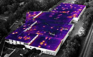
    Drones equipped with thermal cameras and LiDAR sensors will gain broader use in energy audits, underground infrastructure mapping, and monitoring of HVAC systems during facility upgrades or new construction.

Why It Matters: Competitive Advantages of Drone Integration

Construction firms that adopt aerial technology early stand to benefit from:

  • Faster data collection and turnaround
  • Reduced rework from improved quality control
  • Lower labor and insurance costs
  • Stronger documentation for stakeholder transparency
  • Enhanced reputation for innovation and safety

As the construction landscape becomes more competitive and technology-driven, drone services are no longer optional—they’re essential.


Why Choose St Louis Drone Services?

At St Louis Drone Services, we combine deep industry experience with cutting-edge technology to help your construction projects take flight—literally and figuratively.

We’re a full-service professional commercial photography and video production company, offering:

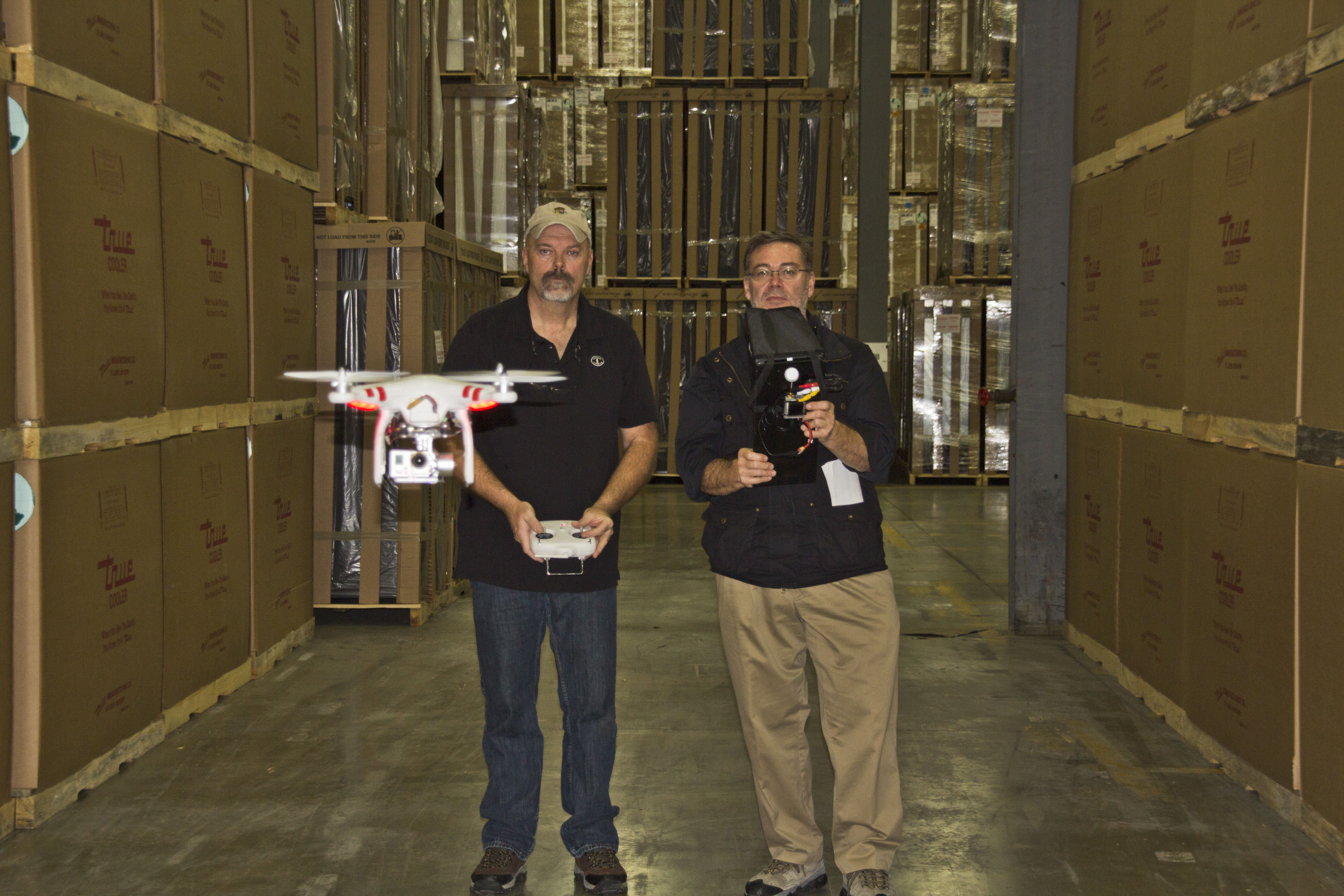
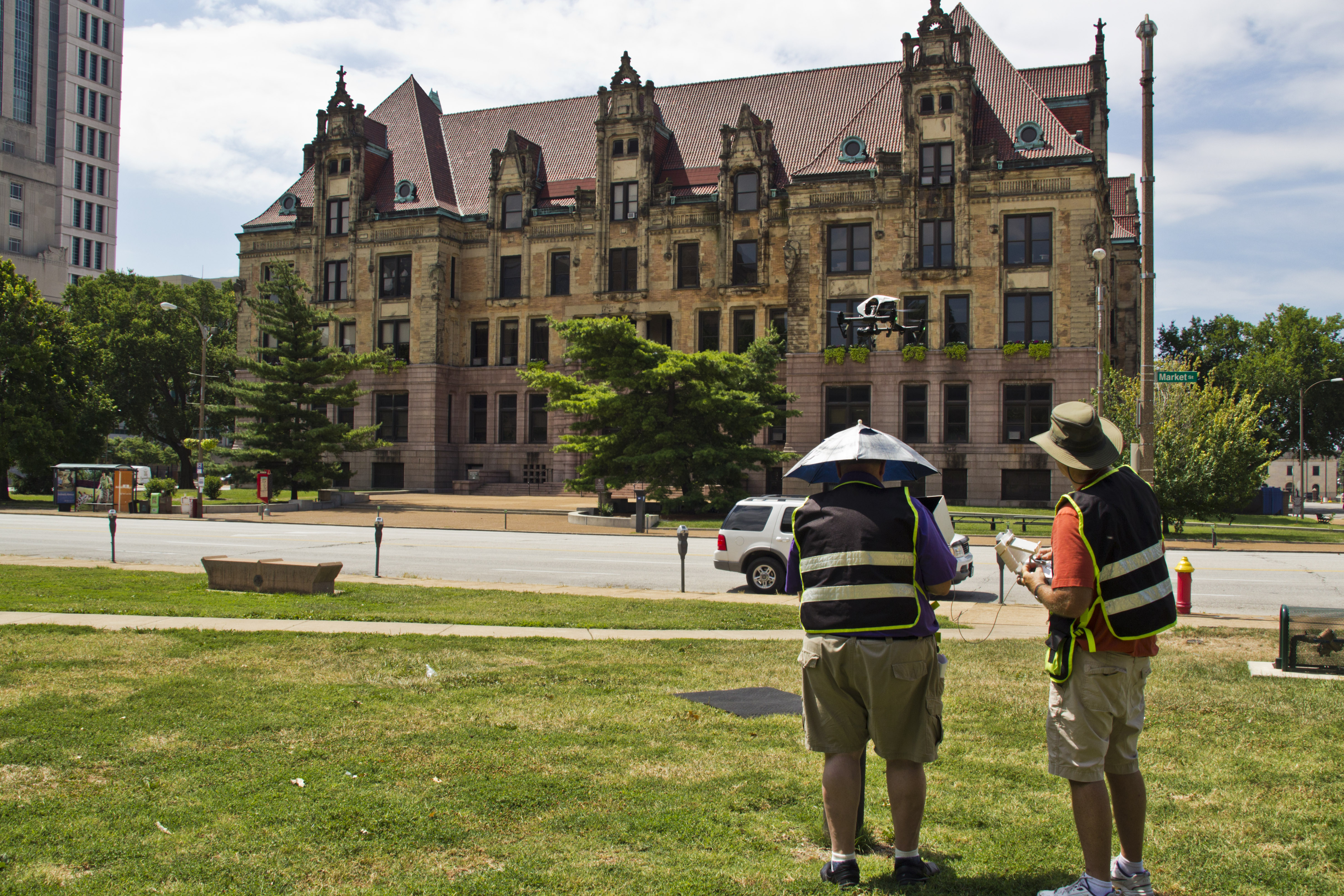
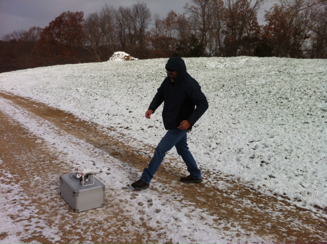
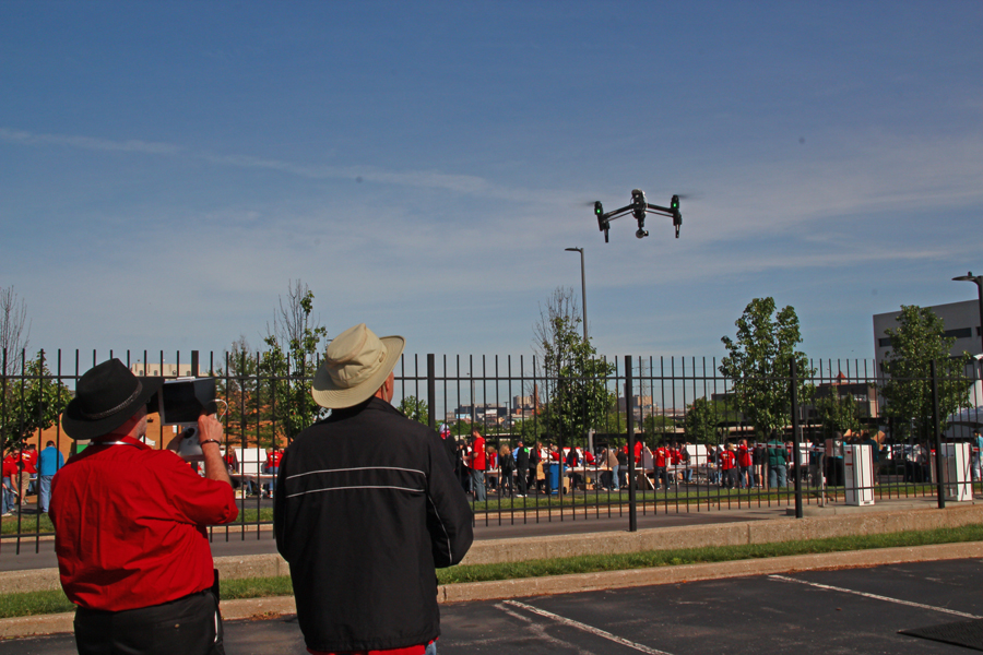
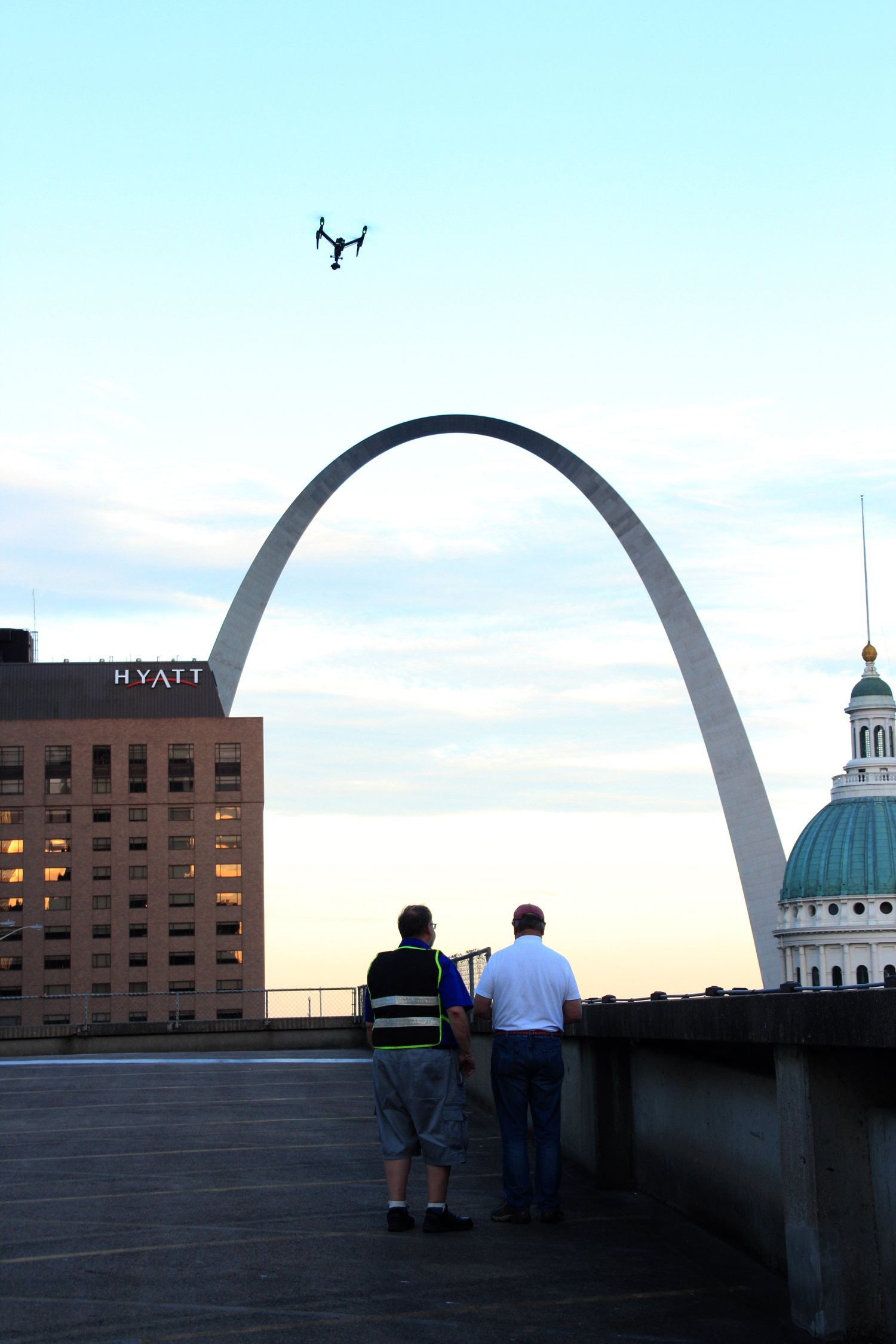
  • Licensed and insured drone pilots
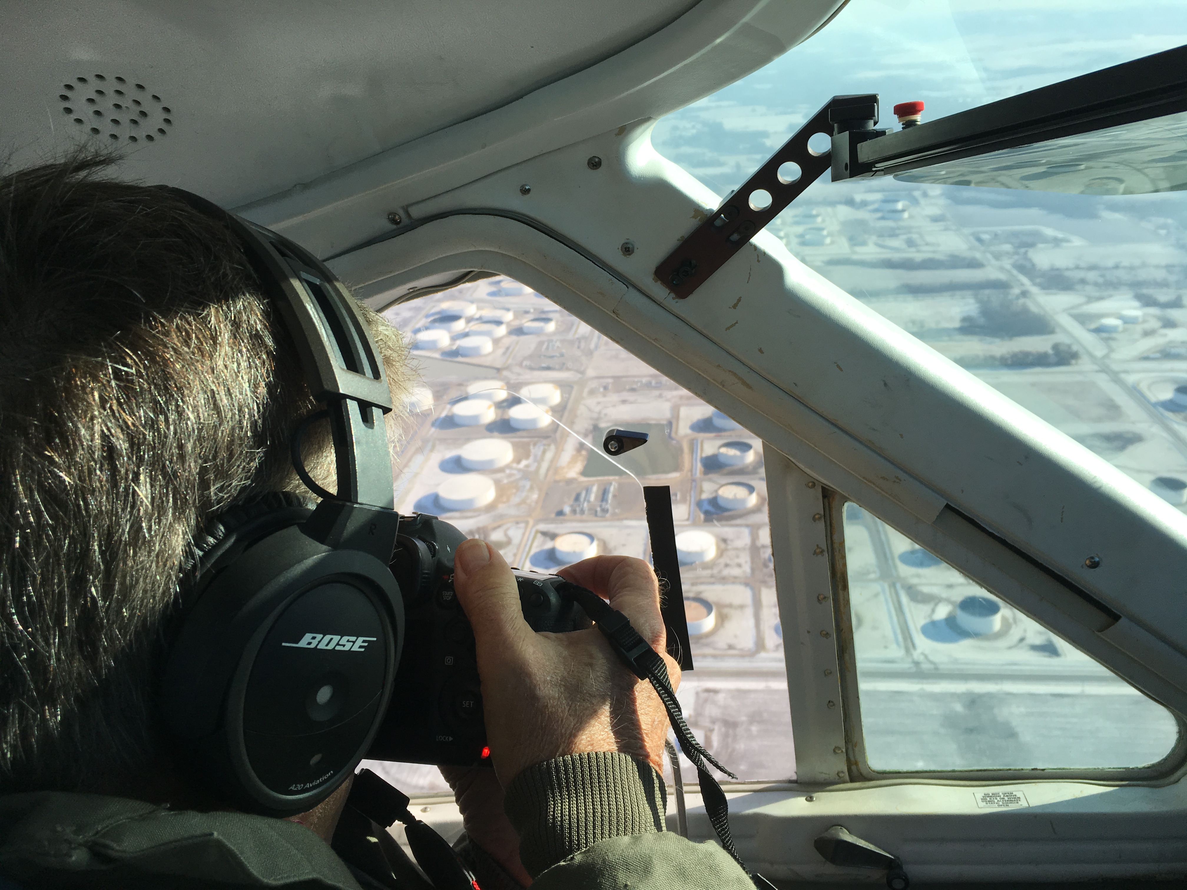
  • Aerial photography, video, and 3D imaging
  • Editing and post-production
  • Indoor and outdoor flight capabilities
  • AI-enhanced image analysis
  • Volumetric measurements and digital modeling
  • Private studio lighting and custom-built sets for visual presentations

Whether you’re tracking construction progress, inspecting infrastructure, or creating stakeholder presentations, we have the right equipment and creative crew to ensure successful image acquisition.

Since 1982, St Louis Drone Services has worked with businesses, marketing firms, and creative agencies throughout the St. Louis area. Our media team understands how to repurpose your photography and video branding to gain more traction—whether for project management, marketing, or internal documentation. We are well-versed in all media file types, styles, and accompanying software, delivering a seamless experience from planning to final delivery.

Let us elevate your next construction project—in the air and on the ground.

314-604-6544

stlouisdroneservices@gmail.com

Enhancing Solar Panel Layout Planning with Drones: The Future of Efficient Energy Solutions

With drones, solar companies can capture high-resolution aerial images, ensuring that all data is precise and reliable.

In the growing renewable energy industry, solar power remains one of the most promising solutions for sustainable energy. To maximize its potential, it’s crucial for businesses to optimize the design and placement of solar panels. One of the most effective tools for improving the planning and execution of solar panel layouts is drone technology. With their ability to capture detailed aerial views and data, drones are transforming how energy companies and businesses plan their solar installations.

The Role of Drones in Solar Panel Layout Design

Planning an efficient solar panel layout involves analyzing various factors, including terrain, sunlight exposure, and the layout of the land. Traditionally, this process required time-consuming ground surveys and measurements. However, drones have significantly streamlined this process, providing quicker, more accurate data.

Drones equipped with high-resolution cameras and mapping software can capture precise imagery of the site, even in challenging terrain or hard-to-reach locations. The data gathered from these aerial surveys can be used to generate 3D models, offering insights that help engineers optimize solar panel placement to achieve maximum sunlight exposure and energy efficiency.

Why Drones Are the Game-Changer for Solar Panel Layouts

  1. Speed and Efficiency: Drones can survey large areas in a fraction of the time it would take to conduct manual surveys, accelerating the planning process and enabling faster decision-making.
  2. Cost-Effective Technology: Drone services offer a more affordable alternative to traditional surveying methods, saving businesses money on labor and equipment costs. Additionally, drones reduce the need for specialized machinery, lowering the overall project cost.
  3. High-Precision Data: With drones, solar companies can capture high-resolution aerial images, ensuring that all data is precise and reliable. This data can then be used to create 3D models that enhance the accuracy of solar panel placement.
  4. Access to Difficult Terrain: Drones can easily navigate difficult or dangerous terrain, such as steep hills or densely vegetated areas, where traditional surveys might be impractical or unsafe.
  5. Real-Time Insights: Drones provide real-time data, allowing solar designers to make adjustments to the layout on the spot, improving the overall efficiency and accuracy of the design.

St. Louis Drone Services: Transforming Solar Panel Layout Planning

At St. Louis Drone Services, we specialize in providing advanced drone solutions for the renewable energy sector, including solar panel layout planning. Our expertise in commercial photography and video production, combined with our state-of-the-art drone technology, allows us to offer a comprehensive service that meets the unique needs of energy companies.

As a full-service provider, St. Louis Drone Services offers everything from aerial photography and video to 3D mapping and modeling, delivering the precise data you need to plan your solar installations effectively. Our licensed drone pilots have extensive experience and can even fly specialized drones indoors for projects that require a controlled environment.

We also offer a range of additional services to support your production needs. Whether it’s creating a custom interview studio setup, providing sound and camera operators, or offering expert editing and post-production, St. Louis Drone Services has everything needed for a seamless video production experience.

Since 1982, we have been serving businesses, marketing firms, and agencies in the St. Louis area, providing them with the tools and expertise to achieve their goals. Our private studio offers a perfect space for small productions and interviews, while our larger setups are ideal for more complex shoots involving props and elaborate sets.

At St. Louis Drone Services, we pride ourselves on our ability to customize every project to your specific needs. Whether you’re looking to optimize solar panel layouts or need help with repurposing video and photography for marketing, we have the right equipment and creative team to bring your vision to life.

Let us help you take your solar panel layout planning to the next level. With our expert drone services, we ensure that your project is as efficient and effective as possible.

314-604-6544

stlouisdroneservices@gmail.com

How to Use Drones to Measure Stockpiles and Track Volumes More Accurately

In the mining, construction, and aggregates industries, precise stockpile measurement is essential for effective inventory management and operational efficiency. Traditional methods can be time-consuming, labor-intensive, and often less accurate. However, with the advent of drone technology, measuring stockpiles has become significantly more efficient and accurate. This guide explores how drones are transforming stockpile measurement and how your organization can benefit from this innovative approach.

The Advantages of Using Drones for Stockpile Measurement

Typically, a drone survey can be completed in a few hours, including flight time and initial data processing.

Accurate and Efficient Data Collection

Drones enable quick and precise data collection by capturing geo-referenced images from above your worksite. Using photogrammetry, these images can be transformed into detailed 3D maps. Drone survey visualization software ensures high data accuracy, allowing for precise stockpile volume measurements.

Track Progress and Compare Surveys

Drone technology simplifies the process of comparing current stockpile volumes to previous surveys, helping you effectively track site progress. You can also compare drone surveys to final grade design files to determine how much material needs to be added or removed, ensuring your project stays on target.

Comprehensive 3D Mapping

Drones create detailed 3D maps of your site, providing both a visual representation and actionable data, including stockpile volume calculations. This level of detail and accuracy is invaluable for informed decision-making in inventory management and site planning.

Improved Safety

Traditional stockpile measurement methods often require personnel to climb stockpiles, posing safety risks. Drones eliminate this hazard by collecting data remotely, ensuring the safety of your workforce. At St Louis Drone Services, safety is our top priority. Our licensed pilots are FAA 107 compliant and Safe-To-Fly certified, meeting the highest safety standards.

Speed and Cost-Effectiveness

Drone surveys are faster than traditional methods, allowing for more frequent data collection and quicker turnaround times. This efficiency can lead to significant cost savings by reducing the time and labor needed for stockpile measurement while maintaining high accuracy.

Applications of Drone Surveying in Various Industries

Mining and Aggregates

For professionals in the mining and aggregates industries, stockpile inventory management is a key application of drone surveying. Accurate volume measurements are critical for managing inventory, planning operations, and meeting regulatory requirements. Drones provide a reliable and efficient means to collect this essential data.

Construction

Construction sites benefit greatly from drone surveying. Quick site surveys and detailed 3D maps help project managers track progress, manage resources, and ensure projects stay on schedule and within budget. The actionable data collected from drone flights supports informed decision-making and enhances overall project efficiency.

Frequently Asked Questions About Drones and Volumetric Measuring

1. How accurate are drone surveys for volumetric measurements?

Drone surveys are highly accurate for volumetric measurements, often achieving accuracy within 1-2% of traditional ground survey methods. Accuracy depends on factors such as the drone’s camera quality, flight plan, and processing software used for generating 3D models and measurements.

2. What equipment is needed for drone volumetric measurements?

To conduct volumetric measurements using drones, you need:

  • A high-quality drone equipped with GPS and a high-resolution camera.
  • Photogrammetry software for processing images and generating 3D models.
  • Ground control points (GCPs) to enhance survey accuracy.
  • A computer capable of handling the processing software and large datasets.

3. How long does it take to complete a drone survey?

The time required for a drone survey depends on the site’s size and terrain complexity. Typically, a drone survey can be completed in a few hours, including flight time and initial data processing. Larger or more complex sites may take longer.

4. What are ground control points (GCPs) and why are they important?

Ground control points (GCPs) are physical markers placed on the ground at known coordinates. They improve the accuracy of the drone survey by providing reference points for the photogrammetry software, ensuring that the generated 3D models and measurements are correctly scaled and geo-referenced.

5. Can drones be used to measure stockpiles indoors?

Yes, drones can measure stockpiles indoors using specialized drones equipped with sensors that navigate in GPS-denied environments. While indoor measurements can be more challenging due to limited space and potential obstacles, accurate measurements can be achieved with the right equipment and expertise.

6. What types of materials can be measured using drones?

Drones can measure various materials, including aggregates like rock and gravel, coal, sand, soil, and more. As long as the stockpiles are accessible and visible to the drone’s camera, volumetric measurements can be accurately obtained.

7. How are the volumetric measurements calculated from drone data?

Volumetric measurements are calculated using photogrammetry software that processes the images captured by the drone. The software generates a 3D model of the site and calculates the volume of the stockpiles by analyzing differences in elevation and surface area.

8. What are the benefits of using drones for volumetric measurements compared to traditional methods?

The benefits of using drones for volumetric measurements include:

  • Increased safety by eliminating the need for personnel to climb stockpiles.
  • Faster data collection and processing times.
  • High accuracy and detailed 3D models.
  • Cost savings due to reduced labor and time requirements.
  • The ability to frequently update measurements for better inventory management.

9. Are there any regulatory requirements for using drones in volumetric measurements?

Yes, there are regulatory requirements for using drones, including:

  • Obtaining a Remote Pilot Certificate from the FAA for commercial drone operations.
  • Adhering to FAA Part 107 regulations, which cover operational limitations, airspace restrictions, and safety guidelines.
  • Ensuring the drone and pilot comply with local regulations and any additional permits required for specific areas.

10. How can St Louis Drone Services help with drone volumetric measurements?

At St Louis Drone Services, we provide comprehensive drone surveying services, including volumetric measurements. Our team of licensed and experienced pilots, equipped with the latest technology, ensures accurate data collection and processing. We prioritize safety and compliance with FAA regulations, offering customized solutions to meet your specific needs. Whether you need regular inventory updates, detailed site surveys, or custom media production, we have the expertise and equipment to deliver exceptional results.

Why Choose St Louis Drone Services

At St Louis Drone Services, we are a full-service professional commercial photography and video production company with extensive experience in drone surveying for stockpile inventory management. Our team of licensed drone pilots is equipped with the latest technology to provide accurate and reliable data acquisition. Here’s what sets us apart:

  • Expertise and Equipment: We have the right equipment and creative crew to handle all aspects of your project, from data acquisition to post-production.
  • Comprehensive Services: We offer full-service studio and location video and photography, as well as editing, post-production, and licensed drone pilots. Whether you need custom video productions, sound and camera operators, or specialized drone flights, we have you covered.
  • Customization: We can tailor our services to meet diverse media requirements, ensuring that your content is optimized for maximum impact.
  • Safety and Compliance: Our operations are FAA approved, and all our pilots are FAA 107 compliant. We prioritize safety and adhere to the highest standards in the industry.
  • Experience: We have worked with numerous businesses to gather data and measure stockpiles accurately, helping them make informed decisions and improve operational efficiency.

By leveraging our expertise and state-of-the-art technology, St Louis Drone Services can help you achieve accurate stockpile measurements and optimize your inventory management processes. Contact us today to learn more about how we can support your business needs with our comprehensive drone surveying services.

314-604-6544

stlouisdroneservices@gmail.com

Indoor Drone Expert: Insider Tips and Tricks

Drones have revolutionized the way we capture images and videos from the sky, but what about indoors? While many people associate drones with outdoor aerial photography and videography, there is a growing demand for indoor drone services in various industries. As an experienced editor, photographer, and videographer at St Louis Drone Services, I’ve compiled a comprehensive guide to mastering indoor drone photography and videography.

Adjust your drone’s camera settings to accommodate different lighting scenarios and enhance the quality of your footage.

Understanding Indoor Drone Challenges

Indoor environments pose unique challenges for drone operation. Unlike outdoor spaces, indoor areas lack GPS signal, which drones rely on for navigation and stability. Additionally, confined spaces present obstacles such as walls, ceilings, and furniture, requiring careful maneuvering to avoid collisions.

Tips for Successful Indoor Drone Operation

1. Choose the Right Drone

Selecting the appropriate drone for indoor use is crucial. Opt for a compact and agile model with obstacle avoidance sensors to navigate tight spaces safely. DJI’s Mavic Mini or Mavic Air series are popular choices for indoor drone photography and videography.

2. Practice in Controlled Environments

Before tackling complex indoor shoots, practice flying your drone in controlled environments such as empty warehouses or spacious rooms. Familiarize yourself with the drone’s controls and responsiveness to gain confidence in maneuvering indoors.

3. Plan Your Shots

Careful planning is essential for indoor drone projects. Create a detailed flight plan, taking into account obstacles, lighting conditions, and desired angles. Visualize the shots you want to capture and strategize your flight path accordingly.

4. Utilize Indoor Lighting

Indoor spaces often have varying lighting conditions, from harsh fluorescent lights to natural sunlight streaming through windows. Adjust your drone’s camera settings to accommodate different lighting scenarios and enhance the quality of your footage.

5. Maintain Line of Sight

Maintaining visual line of sight with your drone is critical for safety and control, especially in indoor environments where obstacles are prevalent. Always keep the drone within your line of sight to avoid collisions and navigate effectively.

6. Edit and Enhance Post-Production

Post-production editing plays a significant role in refining indoor drone footage. Utilize editing software to stabilize shaky footage, adjust colors and exposure, and add special effects to enhance the final product.

Elevating Your Indoor Drone Productions with St Louis Drone Services

At St Louis Drone Services, we specialize in indoor drone photography and videography, offering unparalleled expertise and creativity for your projects. Our experienced team of editors, photographers, and videographers is equipped with state-of-the-art equipment and innovative techniques to capture stunning imagery in any indoor environment.

From corporate events and promotional videos to architectural surveys and real estate showcases, we tailor our services to meet your unique needs. With licensed drone pilots and extensive experience in indoor drone operations, St Louis Drone Services delivers exceptional results that exceed expectations.

Call to Action

As a full-service video and photography production company, St Louis Drone Services has partnered with numerous businesses, marketing firms, and agencies in the St. Louis area for their corporate photography and video needs. Contact us today to elevate your indoor drone productions and unlock the potential of aerial imagery for your business.

Remember, mastering indoor drone photography and videography takes practice, patience, and precision. With the right techniques and equipment, you can capture breathtaking footage that showcases the beauty and intricacies of indoor spaces like never before.


At St Louis Drone Services, we are committed to pushing the boundaries of creativity and innovation in aerial photography and videography. Contact us today to discover the endless possibilities of indoor drone imaging for your business or organization.

314-604-6544

stlouisdroneservices@gmail.com

Utilizing Drones for Infrared Imaging

In recent years, the field of infrared imaging has witnessed a revolution, thanks to advancements in drone technology. As an experienced drone pilot and infrared technician at St. Louis Drone Services, I am excited to delve into the fascinating world of utilizing drones for infrared imaging. In this comprehensive article, we will explore the applications, benefits, equipment, and techniques involved in this cutting-edge field.

The heart of any infrared drone setup is the thermal camera. These specialized cameras can detect heat emissions and convert them into visible images or data.

Introduction to Infrared Imaging

Infrared imaging, also known as thermography, is a technology that enables us to capture images based on the heat radiated by objects and surfaces. Unlike visible light, infrared radiation is invisible to the human eye, making it a valuable tool for various industries, including:

  • Building Inspection: Identifying heat leaks, electrical issues, and insulation problems.
  • Agriculture: Monitoring crop health and detecting irrigation problems.
  • Search and Rescue: Locating individuals in low-light or obscured environments.
  • Wildlife Conservation: Studying animal behavior and habitat analysis.
  • Industrial Applications: Predictive maintenance, quality control, and process monitoring.

However, traditional methods of acquiring infrared data often involved ground-based equipment or manned aircraft, which could be costly, time-consuming, and limited in accessibility. This is where drones have stepped in to revolutionize the field.

Advantages of Infrared Drones

1. Cost-Effective

Traditional infrared inspections often require scaffolding, lifts, or helicopter rentals, driving up costs significantly. In contrast, drones are a cost-effective solution. They are less expensive to operate and can access hard-to-reach areas without the need for additional infrastructure.

2. Safety

Performing inspections in dangerous or high-risk environments can put human lives at stake. Drones eliminate this risk by allowing technicians to remotely access hazardous areas, ensuring their safety while collecting crucial data.

3. Efficiency and Speed

Drones equipped with thermal cameras can swiftly cover large areas, reducing the time required for inspections. This efficiency can be especially critical in time-sensitive situations, such as disaster response or equipment failures.

4. Data Accuracy

Infrared drones provide highly accurate thermal data, enabling precise analysis and decision-making. The images they capture are detailed and can reveal temperature variations as subtle as a few tenths of a degree Celsius.

5. Accessibility

Drones can access areas that are difficult or impossible to reach by traditional means, such as the undersides of bridges, the tops of tall buildings, or remote wilderness locations.

Equipment and Technology

To harness the full potential of infrared imaging with drones, it’s essential to have the right equipment and technology at your disposal. At St. Louis Drone Services, we take pride in using cutting-edge tools to deliver top-notch results.

1. Thermal Cameras

The heart of any infrared drone setup is the thermal camera. These specialized cameras can detect heat emissions and convert them into visible images or data. Some popular brands in the industry include FLIR, DJI, and Seek Thermal.

2. High-Resolution Drones

Pairing the right drone with a thermal camera is crucial. High-resolution drones with stable flight capabilities, like the DJI Matrice series, provide a stable platform for capturing detailed infrared images.

3. Software and Data Analysis

Software plays a crucial role in the post-processing of thermal data. Tools like FLIR Tools or specialized drone thermal analysis software can help interpret and analyze the captured imagery.

Techniques for Infrared Imaging with Drones

Now that we have covered the advantages and essential equipment, let’s delve into some techniques that are employed when utilizing drones for infrared imaging.

1. Altitude and Angle Control

Maintaining the right altitude and camera angle is essential for accurate data collection. Drones must fly at an optimal height and angle to capture thermal data effectively.

2. Overlap in Image Capture

To ensure comprehensive coverage and avoid missing critical details, thermal images should have a degree of overlap. This ensures that no areas are left uninspected.

3. Stabilization and Calibration

Stabilization systems on drones are crucial for eliminating image distortion caused by drone movement. Calibrating the thermal camera is also vital to ensure accurate temperature readings.

4. Data Annotation

After capturing thermal images, it’s essential to annotate and categorize the data for analysis. This process helps identify anomalies and temperature variations effectively.

5. Integration with Other Sensors

For a holistic inspection, drones can be equipped with other sensors, such as LiDAR or multispectral cameras. Combining data from multiple sources can provide a more comprehensive view of the inspected area.

Applications of Infrared Imaging with Drones

The versatility of infrared imaging with drones opens up a wide range of applications across various industries. Let’s explore some of these applications in detail.

Building Inspection and Maintenance

One of the most common applications is building inspection and maintenance. Infrared drones can identify issues such as water leaks, insulation problems, and electrical faults in commercial and residential structures. This is particularly valuable for predictive maintenance and energy efficiency improvements.

Agriculture

In agriculture, drones equipped with thermal cameras can monitor crop health, detect irrigation problems, and assess soil conditions. Farmers can make data-driven decisions to optimize crop yields and reduce water usage.

Public Safety and Search and Rescue

Drones have proven invaluable in search and rescue operations. Thermal imaging can help locate missing persons, even in low-light or challenging environments. Drones equipped with thermal cameras are used by first responders to save lives.

Wildlife Conservation

Infrared drones have made significant contributions to wildlife conservation efforts. Researchers can monitor animal behavior, track poachers, and study ecosystems from the air without disturbing the natural environment.

Industrial Applications

Industries rely on thermal imaging drones for predictive maintenance, quality control, and process monitoring. Identifying equipment failures before they occur can save companies substantial amounts of money and prevent downtime.

Post-Production and Data Analysis

Collecting infrared data with drones is only the beginning of the process. The real value lies in post-production and data analysis. At St. Louis Drone Services, we excel in this crucial aspect of infrared imaging.

1. Data Interpretation

Our team of experienced technicians and analysts is well-versed in interpreting thermal data. We can identify anomalies, temperature variations, and potential issues, providing our clients with actionable insights.

2. Reporting

We take pride in delivering comprehensive and easy-to-understand reports to our clients. These reports include detailed findings, annotated images, and recommendations for any necessary actions.

3. Customization

St. Louis Drone Services understands that each client’s needs are unique. We offer customization options to tailor our services to your specific requirements, ensuring that you get the most out of your thermal imaging data.

4. Repurposing and Traction

We recognize the importance of repurposing your thermal imaging data to gain more traction and value. Whether it’s for marketing purposes or further analysis, we can help you leverage your data effectively.

Conclusion

In conclusion, the utilization of drones for infrared imaging has transformed the way we approach various industries and applications. At St. Louis Drone Services, we are proud to be at the forefront of this technology, offering full-service infrared drone production and post-production services.

As a full-service video creation company, St. Louis Drone Services has worked with many commercial businesses in the St. Louis area to create their building infrared reports. We have experienced drone videographers and producers to create insightful, accurate reporting. Whether it’s building inspections, agricultural assessments, public safety, wildlife conservation, or industrial applications, our team is equipped with the right equipment and creative crew service experience for accurate reporting.

If you are looking to harness the power of infrared imaging with drones for your specific needs, don’t hesitate to reach out to us. We are well-versed in all file types and styles of infrared media reporting and can tailor our services to meet your unique requirements. Contact St. Louis Drone Services today and let us help you unlock the potential of thermal imaging with drones.

Contact St. Louis Drone Services to discuss your infrared imaging needs and experience the difference that expertise and cutting-edge technology can make.

314-604-6544

stlouisdroneservices@gmail.com

How Drone Services are Revolutionizing Construction Site Monitoring

Introduction

The construction industry is no stranger to embracing innovative technologies that enhance efficiency, safety, and project management. One such technological advancement that has transformed the way construction sites are monitored and managed is the utilization of drone services. Drones, equipped with high-resolution cameras and advanced sensors, have become an invaluable tool for construction professionals. In this article, we will explore the numerous ways in which drone services are revolutionizing construction site monitoring, and how St. Louis Drone Services, a full-service video and photography production company based in St. Louis, can help ensure construction site safety and efficiency through their expertise in drone imagery.

Drones can capture images and videos of the site at various stages, providing an accurate record of progress.

The Evolution of Construction Site Monitoring

Traditionally, monitoring a construction site was a labor-intensive process that involved manual inspections and sometimes even climbing tall structures for a closer look. This not only posed safety risks but was also time-consuming. With the advent of drone technology, the game changed dramatically.

1. Aerial Surveying

Drones, with their ability to capture high-definition aerial images and videos, offer a bird’s-eye view of construction sites. This enables project managers, engineers, and stakeholders to have a comprehensive and real-time overview of the entire site. Aerial surveys can be conducted regularly, allowing for the tracking of progress and the identification of potential issues early in the construction process.

2. Safety Inspections

Safety is paramount on construction sites, and drones have proven to be an essential tool for enhancing safety measures. Drones can be equipped with thermal cameras and other specialized sensors to detect safety hazards, such as heat leaks, gas leaks, and electrical issues. Moreover, they can monitor worker compliance with safety protocols and ensure that no one is in harm’s way.

3. Progress Tracking

Tracking the progress of a construction project is crucial for staying on schedule and within budget. Drones can capture images and videos of the site at various stages, providing an accurate record of progress. This can be particularly useful for comparing the actual work done with the project timeline, identifying delays, and making necessary adjustments.

4. Site Security

Construction sites are often vulnerable to theft, vandalism, and trespassing. Drones can act as a security asset by patrolling the area and providing real-time alerts if any unauthorized activity is detected. They can be programmed to fly surveillance routes and record any suspicious activity, thereby deterring potential threats.

How Drones Benefit Construction Site Monitoring

The adoption of drone services in construction offers several notable advantages:

1. Time and Cost Efficiency

Drones significantly reduce the time and labor required for site inspections. Traditional methods may take days or even weeks to complete, while drones can provide data within hours. This time efficiency translates to cost savings, as fewer man-hours are needed for monitoring and inspections.

2. Safety

By minimizing the need for manual inspections and climbing structures, drones contribute to a safer working environment. The ability to conduct safety inspections with specialized sensors also enhances on-site safety measures.

3. Accurate Data

Drones capture high-quality images and videos, providing a level of detail that is hard to achieve with the naked eye. This accuracy is essential for making informed decisions and ensuring that the construction process is on track.

4. Real-time Monitoring

Drones offer real-time data and can be programmed to provide alerts if any anomalies or safety hazards are detected. This enables quick responses to emerging issues, preventing potential delays and costly rework.

5. Improved Communication

Drones provide a common platform for sharing visual data with all stakeholders, including architects, engineers, project managers, and investors. This enhances communication and collaboration throughout the project.

St. Louis Drone Services: Your Partner in Construction Site Safety

St. Louis Drone Services is a leading full-service video and photography production company based in St. Louis, specializing in providing comprehensive drone services for construction site monitoring. With a team of experienced and certified drone pilots, we are well-versed in all aspects of shooting and editing videos for construction job sites.

Our services include:

  • Aerial Surveying: We capture high-resolution aerial images and videos to provide an in-depth view of your construction site. Our drones are equipped with cutting-edge cameras and sensors to ensure precise and detailed data.
  • Safety Inspections: Safety is a top priority in the construction industry. Our drones are equipped with thermal cameras and other specialized sensors to identify safety hazards and compliance issues, ensuring that your construction site is a secure and accident-free environment.
  • Progress Tracking: We offer comprehensive progress tracking services, allowing you to monitor the development of your construction project. With regular updates, you can make informed decisions to keep your project on track.
  • Site Security: St. Louis Drone Services provides site security solutions to protect your construction site from theft, vandalism, and trespassing. Our drones can patrol the area and alert you to any unauthorized activity.

Case Study: How We Improved Construction Site Monitoring

Let’s take a look at a real-world example of how St. Louis Drone Services helped a construction company enhance its monitoring and safety measures.

Project Overview

Our client, a large construction firm, was working on a complex project involving the construction of a multi-story building in a densely populated urban area. Safety and progress tracking were major concerns due to the challenging nature of the project.

Our Solution

  1. Regular Aerial Surveys: We conducted weekly aerial surveys to track the progress of the construction. This allowed our client to detect any deviations from the project schedule and address them promptly.
  2. Safety Inspections: Our drones were equipped with thermal cameras, which were used to identify heat leaks and electrical issues. This proactive approach to safety inspections led to the early detection and resolution of potential hazards.
  3. Site Security: Our drones patrolled the construction site during non-working hours, providing an extra layer of security. Any unauthorized activity was quickly identified and reported.

Results

  • The construction project was completed on schedule, thanks to our regular progress tracking.
  • Safety incidents were minimized due to the early detection of safety hazards.
  • Site security was enhanced, and incidents of theft and vandalism were reduced to zero.

Conclusion

The utilization of drone services in construction site monitoring is undoubtedly revolutionizing the industry. From enhanced safety measures to efficient progress tracking, drones are proving to be a game-changer. St. Louis Drone Services, as a full-service drone imagery company, is here to partner with construction businesses of all types and sizes in the St. Louis area.

We understand the unique needs of the construction industry and have the expertise to provide comprehensive drone services that can significantly improve construction site safety, efficiency, and project management. As experts in shooting drone video for commercial construction sites, we are committed to helping our clients achieve their goals.

Contact St. Louis Drone Services today to learn more about how our drone services can benefit your construction project and improve safety. Let us be your trusted partner in construction site monitoring.

314-604-6544

stlouisdroneservices@gmail.com

Drone Media St. Louis | Professional Pilots

Our FAA certification assures that our pilots are knowledgeable regarding all FAA rules and regulations regarding unmanned aerial vehicle drone operation and safety practices.

We provide professional aerial photography and cinematography services for marketing and advertising companies as well as directly for the end client for leisure destinations and multimedia communications. This includes Golf Courses & Resorts, Local Tourism Promotion, and other Landmark and Destination Advertising. Use of drone photography and video can help provide a new, exciting perspective that attracts more visitors and customers.

We specialize in aerial and ground based video production in addition to providing in-house post-production services. Our expertise in video editing, sound design, and animation bring a unique component to each project and enables us to produce amazing content for our clients and partners.

Robert Haller

314-604-6544

stlouisdroneservices@gmail.com

St Louis Drone Video and Photography Services

Drones are now synonymous with aerial photography and aerial videography. They are powerful tools that provide incredible aerial images and videos in a safe and efficient manner. Drones are most useful for commercial real estate aerial photography, residential real estate aerial photography and other situations where low altitude detailed shots are preferred and the 400′ altitude limitations are not a factor.

We are a visual production company, specializing in aerial drone videography and photography; driven by passion, quality, safety, and client satisfaction.

Each of our expert pilots hold industry standard UAS qualifications from AMA. They then undergo further in-house training to hone their skills to ensure a safe and efficient flight every single time they take off to undertake aerial photography.

Our expertise extends past our drone and into our editing work. With industry defining software, we can edit and manipulate your video or photos to create the the perfect end product. Other drone service companies may be able to fly a drone but they can’t compete with our editors and graphic artists.

Robert Haller
314-604-6544
stlouisdroneservices@gmail.com

St Louis Arch Aerial Photography and Video Production

We fly with the Inspire Cinematography platform and camera.

The Inspire has a curved lens design which eliminates distortion, and the 20mm focal length opens up your shots to a remarkably wide angle without that fish-eye look.  The camera shoots video at 4K, 4096 x 2150 High Definition.

Inspire 5Z camera

The 3-axis gimbal constantly draws on data fed by the intelligent flight controller, so it knows the aircraft’s flight parameters and computes the proper motion correction every millisecond.  Such precision is only possible because of the ultra-fast, custom-made processor that is unique to the Inspire gimbal. Operating at speeds that allow the drone to compensate for motion and tilt in real-time, this processor controls motors on all three axes: yaw, tilt, and roll.  All resulting in very smooth and completely stable shots.

Robert Haller
314-604-6544
stlouisdroneservices@gmail.com

St Louis Drone Video by Drone Professionals | FAA Safety Approved

We have the creative, pilot and camera operator expertise to prevent all the headaches and avoid all the typical problems that can come with inexperienced aerial drone operations.  Our expert team can handle it all for you.  We are experienced, licensed, insured and talented.

We are a full-service production company that produces cinematic professional quality videos for business commercials, commercial real estate, luxury homes and high rises, music videos, live events and a wide range of other applications. We also work as a gun for hire for studios, production companies, and photographers, real estate marketing and corporate clients in need of high quality Aerial Drone Video capabilities / low altitude UAS video services for their productions, websites and publications.

We are a fully insured aerial cinematography company offering professional photography and video for the St Louis and Midwest region.  Our drones use the latest safety and technology in aerial cinematography.

Drone Services strive on safely capturing aerial footage that will highlight your unique vision and produce stunning visuals from a diverse perspective. We offer cost efficient drone packages that enable our clients to obtain aerial footage where it once would have been too expensive.

Safety is always our first priority. Our drones are operated by experienced pilots and camera operators. For safety and quality, we shoot with a two-man crew, and we are fully insured.

Robert Haller
314-604-6544
stlouisdroneservices@gmail.com