Tag Archives: artificial-intelligence

LiDAR Drones are Redefining Accuracy in Stockpile Reporting

If your organization tracks bulk materials—aggregate, coal, salt, scrap, mulch, grain, or recycled product—your stockpile numbers aren’t just “operations data.” They’re financial data. They affect inventory valuation, purchasing, production schedules, customer commitments, and (in many cases) audit readiness.

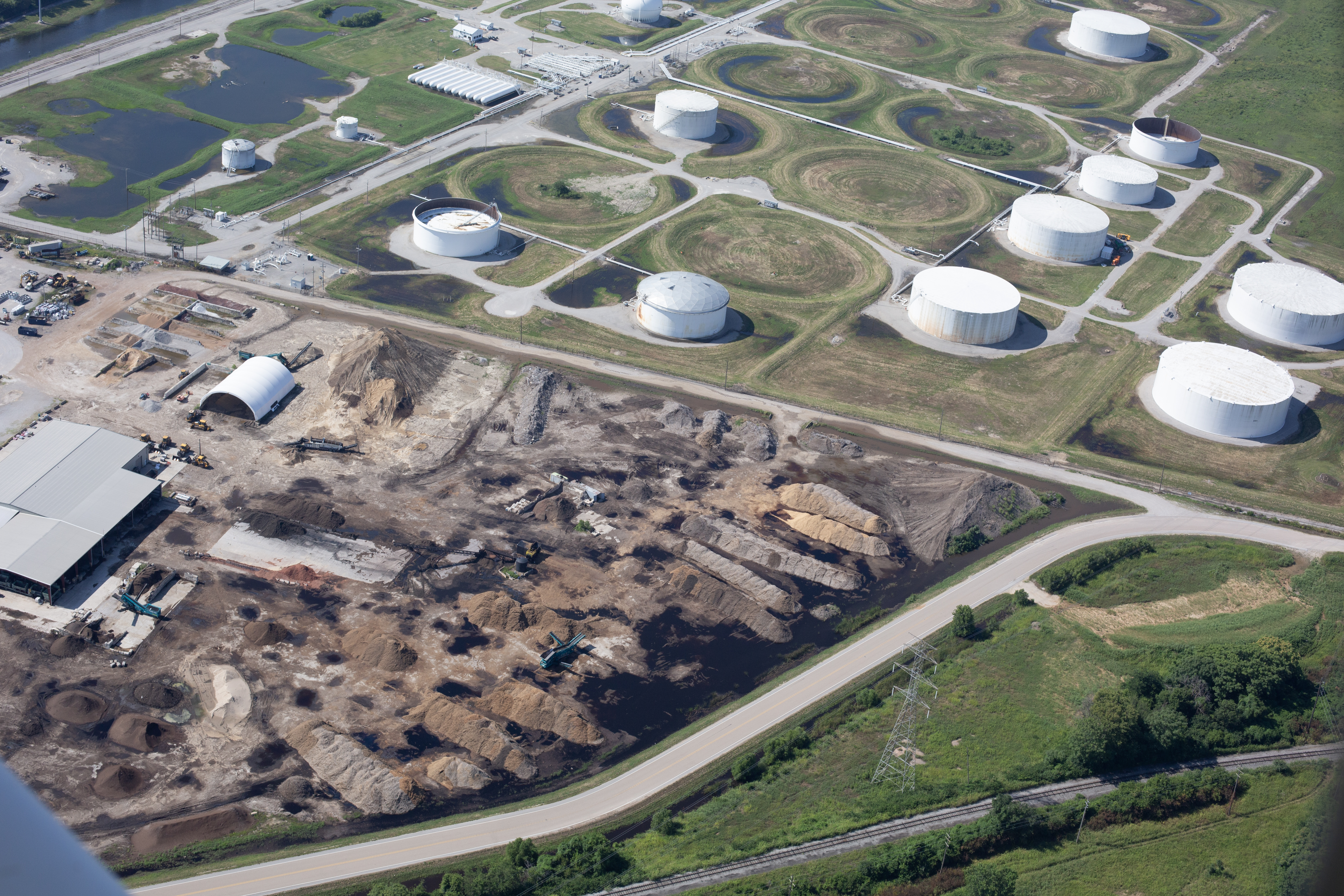
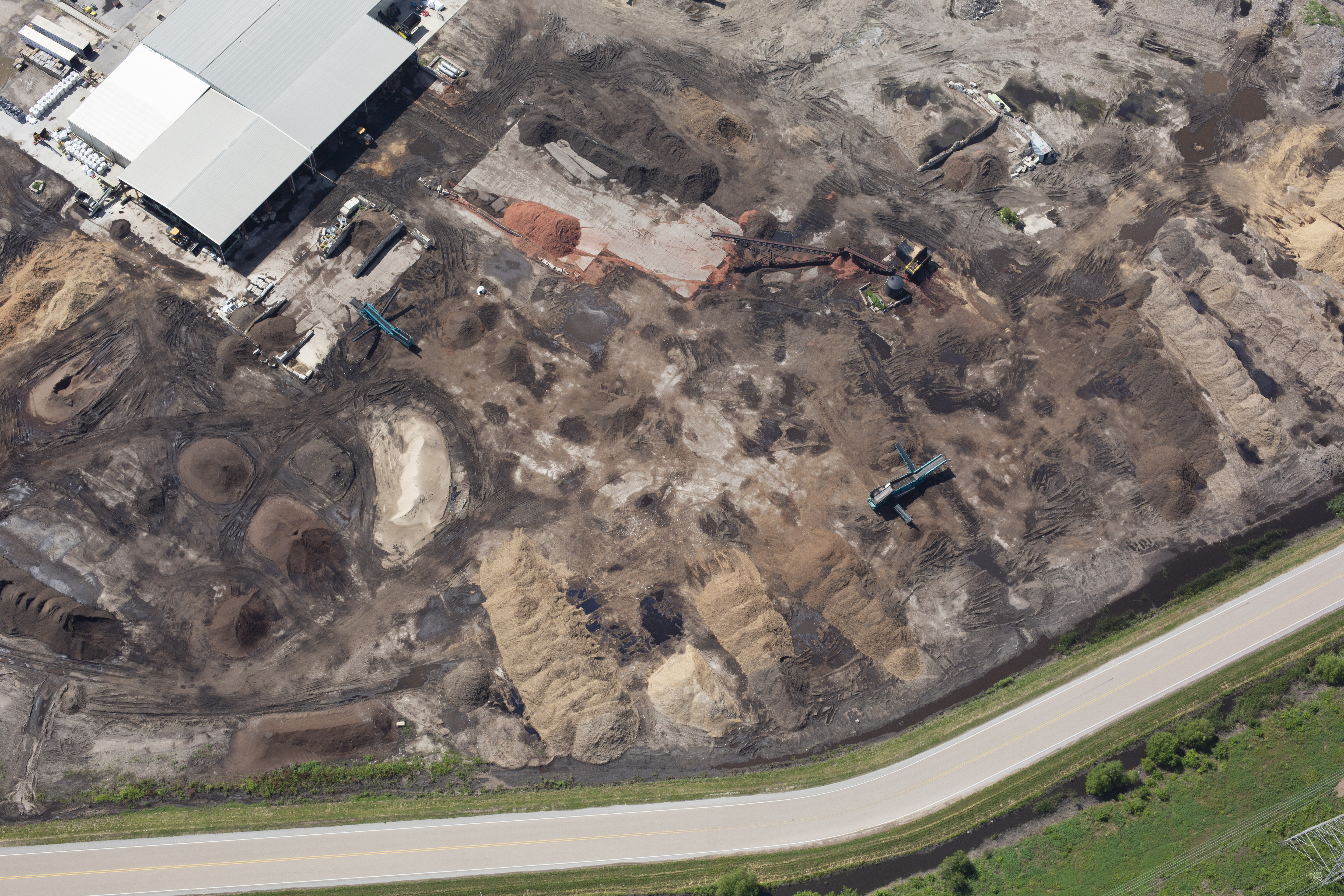
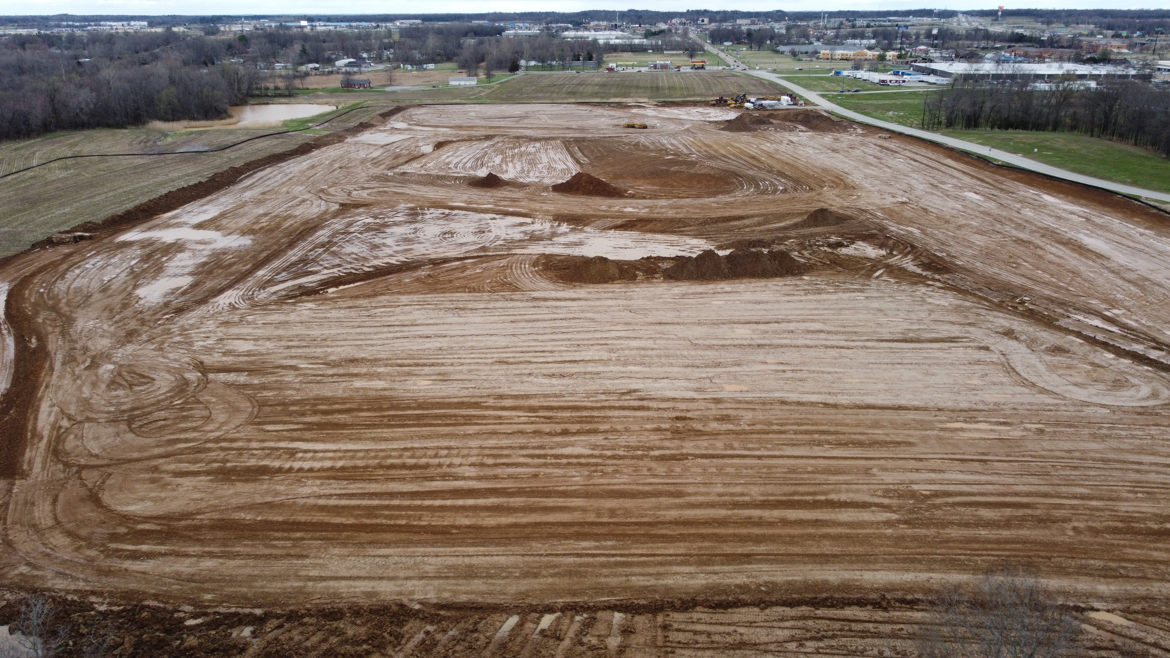
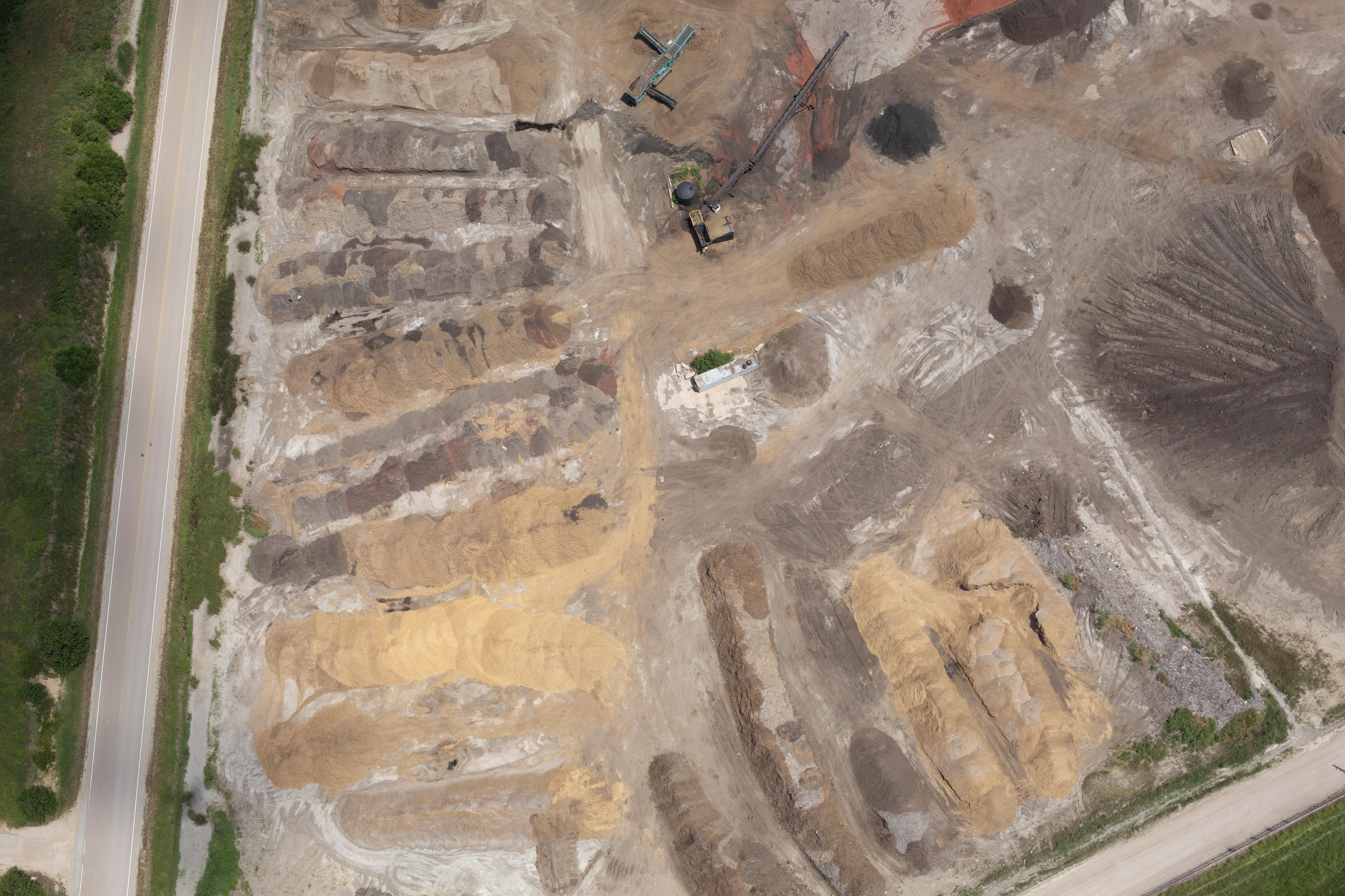
The challenge is that stockpiles are a moving target. They change daily, they’re rarely tidy shapes, and the environments around them—conveyors, berms, walls, dust, shadows, traffic—make measurement difficult.

That’s exactly why LiDAR drones have become the measurement tool of choice for many sites that need accuracy and repeatability. This article explains what LiDAR is, why it often outperforms image-based methods in real industrial conditions, how a professional LiDAR reporting workflow works end-to-end, and what decision makers should demand in deliverables.


Why Stockpile Measurement Fails in the Real World

Traditional approaches each have a weak point:

  • Loader bucket counts: Fast, but heavily assumption-driven and inconsistent across operators, material, moisture, and loading method.
  • Tape/rod/hand measurement: Slow, risky, and often too coarse for large or complex piles.
  • Occasional survey crew work: Accurate when done right—but expensive, disruptive, and hard to schedule at the pace inventory changes.
  • Photogrammetry (image-based 3D): Can be excellent, but can also struggle when surfaces are uniform, reflective, dusty, shadowed, or low-texture.

Stockpiles punish inconsistency. If you change method, change operators, or change assumptions month-to-month, your trend line becomes questionable—even if each individual measurement looks plausible.

For decision makers, the real goal is defensible consistency:

  • Can we reproduce this result?
  • Can we explain it to finance or leadership?
  • Can we audit the workflow?
  • Can we compare month-to-month without “method noise” drowning out real change?

What LiDAR Is (and Why It’s Different)

LiDAR (Light Detection and Ranging) measures distance using laser pulses. A LiDAR sensor emits pulses, measures the return time, and produces a dense 3D point cloud—a direct measurement of physical surfaces.

Instead of reconstructing surfaces from pixels (which depends on lighting and texture), LiDAR measures geometry.

For stockpile reporting, this matters because industrial yards are rarely “camera-friendly.” LiDAR is typically more resilient to:

  • Low-texture materials (dark coal, uniform sand, wet piles)
  • Harsh shadows from structures or high walls
  • Reflective or shimmering surfaces (certain aggregates/salt)
  • Busy backgrounds with equipment, rails, or clutter
  • Sites where the pile-to-ground boundary is hard to see in photos

LiDAR doesn’t eliminate the need for professional workflow, but it often reduces failure modes that cause re-flights, re-processing, and “we don’t trust the number” conversations.


Where LiDAR Drones Improve Accuracy Most

1) Better Surface Definition on Difficult Materials

Image-based modeling can struggle when a pile looks “flat” to a camera—uniform color, minimal texture, or poor contrast. LiDAR doesn’t need texture to measure.

2) Cleaner Separation Between Pile and Ground

A big source of volume error is the base surface. If the “ground” under a pile is guessed wrong, the volume is wrong—even if the top surface looks perfect.

LiDAR workflows can produce more reliable terrain and pile models, especially when paired with solid georeferencing.

3) More Repeatable Results Month-to-Month

Accuracy isn’t only about closeness to “truth” today. It’s about whether your method produces stable, comparable results across seasons, crews, and site conditions.

Repeatability is where LiDAR often shines—because it depends less on lighting and imagery conditions that fluctuate across time.


What “Accurate” Actually Means: Precision, Verification, and Accountability

A key point many vendors avoid: accuracy depends on the whole system, not just the sensor.

A professional LiDAR stockpile program is built on:

  • Georeferencing (RTK/PPK and/or ground control)
  • Checkpoints (independent verification points)
  • Consistent boundary definitions
  • Consistent base surface methodology
  • Quality assurance documentation
  • Versioned deliverables (so “what number did we use last month?” is easy to answer)

If you want confidence from leadership and finance, demand a workflow that includes verification—not just a volume number.


The Professional LiDAR Stockpile Workflow (What You Should Expect)

Step 1: Define the Reporting Rules (Before the First Flight)

Agree on:

  • Which piles are in scope
  • How piles are named/identified
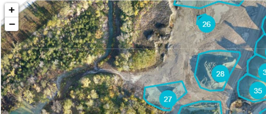
  • How boundaries are drawn (polygons, breaklines, site plan overlays)
  • What constitutes the base surface (pad model, terrain model, reference survey)
  • Units, rounding rules, and reporting cadence (weekly, monthly, quarterly)

This step prevents downstream disputes.

Step 2: Flight Planning That Reduces Occlusions

Industrial sites have shadows and blockages—conveyors, hoppers, walls, stacked materials. A LiDAR flight should be planned to minimize “blind spots” and maintain safe separation from operations.

Step 3: Capture with Positioning That Supports Accuracy

Depending on requirements, workflows may use:

  • RTK/PPK positioning
  • Ground control points (GCPs)
  • Checkpoints for accuracy verification

A serious provider will tell you what they used and why, and what error tolerance they expect.

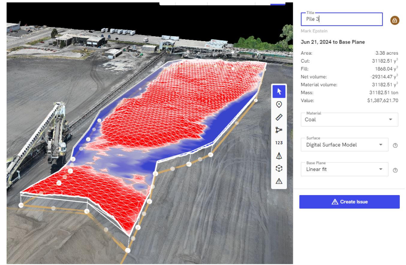
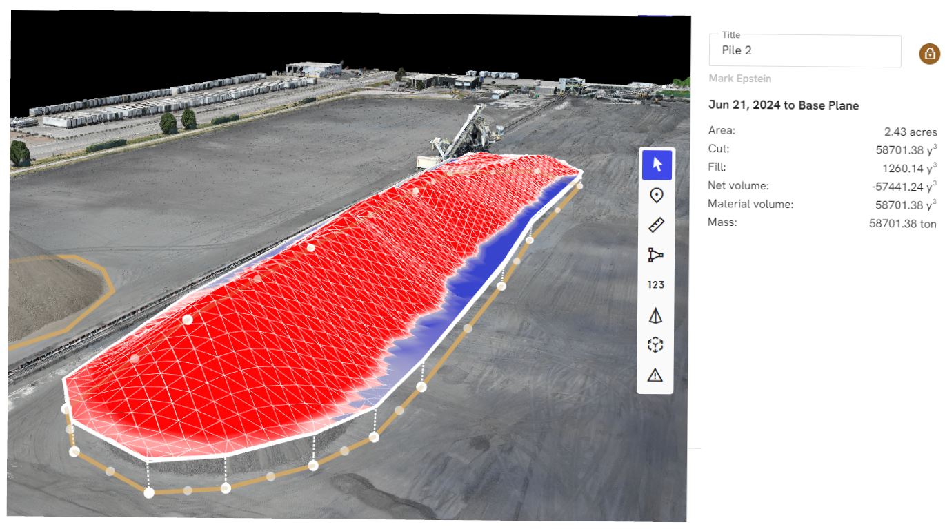
Step 4: Processing Into Decision-Ready Models

Processing typically yields:

  • Classified point cloud (ground vs non-ground)
  • Digital terrain model (DTM) and digital surface model (DSM)
  • Pile surfaces and segmented volumes

Step 5: Reporting That Finance Can Use

Deliverables should be both readable and auditable. Common outputs include:

  • PDF summary report with map views and pile boundaries
  • Spreadsheet (CSV/XLSX) listing pile IDs and volumes
  • Change tracking vs prior periods (optional but valuable)
  • CAD-ready surfaces or contours (when needed for engineering)

Turning Stockpile Reporting Into a Business Process (Not a One-Off Project)

The biggest ROI shows up when you treat LiDAR reporting as a recurring operational discipline:

  • Month-end inventory support for accounting close
  • Vendor/customer dispute resolution (documented, timestamped, mapped)
  • Shrink/loss monitoring over time
  • Site planning with 3D yard models
  • Operational optimization (flow, layout, safety zones)

A mature program doesn’t just measure. It improves decisions.


The Decision-Maker Checklist: What to Ask Before You Hire a LiDAR Drone Provider

  1. How do you verify accuracy?
    Look for checkpoints, QA notes, and a method you can explain internally.
  2. How do you define pile boundaries and base surfaces?
    If boundaries change every time, your comparisons are meaningless.
  3. What exactly do you deliver—and in what formats?
    PDF + spreadsheet is a baseline. CAD and GIS outputs may matter depending on teams.
  4. Can you show a sample report from a similar site?
    Not just a screenshot—an example with pile IDs, maps, and methodology notes.
  5. How do you work around active operations safely?
    A professional crew coordinates; they don’t disrupt.

Why St. Louis Drone Services Is Built for High-Stakes Reporting and Marketing-Grade Visuals

At St. Louis Drone Services, we bring the discipline of full-scale production to industrial measurement and business storytelling—because accurate data and compelling visuals both depend on planning, consistency, and professional execution.

We’re a full-service professional commercial photography and video production company with the right equipment and creative crew service experience for successful image acquisition. We offer full-service studio and location video and photography, plus editing and post-production, and our work is supported by licensed drone professionals. St. Louis Drone Services can customize your productions for diverse media requirements, and repurposing your photography and video branding to gain more traction is another specialty.

We’re well-versed in all file types, media styles, and the software ecosystems used by businesses and agencies. We also use the latest Artificial Intelligence across our media services—helping streamline workflows, improve deliverables, and accelerate production without sacrificing quality.

Our private studio lighting and visual setup is ideal for small productions and interview scenes, and our studio space is large enough to incorporate props to round out your set. We support every aspect of your production—from setting up a private, custom interview studio to supplying professional sound and camera operators, as well as providing the right equipment—ensuring your next project is seamless and successful. And when environments demand it, we can fly specialized drones indoors.

As a full-service video and photography production corporation since 1982, St. Louis Drone Services has worked with many businesses, marketing firms, and creative agencies in the St. Louis area for marketing photography and video—bringing decades of experience to every project, whether the goal is a defensible stockpile report, a 3D site model, or content that sells your capabilities with authority.

If you want stockpile reporting that’s more accurate, more repeatable, and easier to defend internally—LiDAR drones can change the conversation from “best guess” to “business confidence.”

314-604-6544

stlouisdroneservices@gmail.com

How to Get Accurate Stockpile Data With Drones: Aerial Solutions for Smarter Business Decisions


Accurate stockpile measurements are critical to inventory management, resource allocation, and financial reporting for industries such as construction, mining, aggregates, and manufacturing. Yet traditional methods—manual surveys, ground-based laser scans, or walking wheel measurements—are not only time-consuming and expensive, but often yield inconsistent or incomplete data. In today’s market, precision and efficiency are non-negotiable, which is why many companies are turning to drone-based aerial solutions.

At St Louis Drone Services, we use cutting-edge UAV (Unmanned Aerial Vehicle) technology to provide fast, accurate, and cost-effective stockpile volumetrics—empowering decision-makers with actionable intelligence while minimizing operational disruption.


Why Traditional Stockpile Measurement Falls Short

While tape measures and GPS rovers still have their place, they introduce several limitations:

  • Safety Risks: Climbing unstable piles or walking active work zones can expose crews to harm.
  • Time-Intensive: Ground surveys take hours or even days, especially over large or multiple sites.
  • Limited Access: Dense or irregular pile geometry and site obstructions hinder complete data collection.
  • Inaccuracy: Human error and inconsistent vantage points often result in flawed measurements.

These limitations not only delay reporting but can also lead to costly material discrepancies and logistical setbacks.


Drone Photogrammetry: How It Works

Using high-resolution aerial imagery and GPS-locked flight plans, drones fly over stockpiles and capture thousands of overlapping images from multiple angles. These images are processed using advanced photogrammetry software to create:

  • 3D point clouds
  • Digital surface models (DSM)
  • Orthomosaic maps
  • Volumetric calculations

Once the data is processed, precise volume calculations can be generated in a fraction of the time traditional surveying requires, often with accuracy margins under 3%.


Benefits of Using Drones for Stockpile Management

1. Increased Accuracy

Aerial data offers a comprehensive top-down view with centimeter-level precision, reducing error and improving confidence in reporting.

2. Faster Turnaround

What used to take days now takes hours. Flights typically last under 30 minutes, with deliverables ready in 24–48 hours depending on project complexity.

3. Improved Safety

Crews stay out of dangerous areas. Everything is captured from the air with zero contact, significantly lowering liability.

4. Cost Efficiency

Drones eliminate the need for expensive ground survey crews or manned aircraft, dramatically reducing labor and overhead.

5. Consistent Historical Tracking

Routine drone surveys allow for easy benchmarking and change detection over time, which is ideal for auditing, forecasting, and operational planning.


Applications Across Industries

Drone-based stockpile measurements are used in:

  • Construction Sites – Tracking fill, excavation, and material delivery.
  • Quarries & Mines – Inventorying gravel, sand, and raw materials.
  • Landscaping Suppliers – Managing bulk mulch, rock, and soil stockpiles.
  • Waste Management – Monitoring volume growth for landfills or recycling centers.

Whether you’re reporting to stakeholders or planning next steps in a project, having accurate, timely volume data is essential to staying ahead.


How St Louis Drone Services Delivers

At St Louis Drone Services, we bring decades of experience in professional photography, video production, and licensed drone operations to the table. Our drone pilots are FAA-certified and skilled in flying both outdoor and indoor environments—including tight warehouse spaces and enclosed facilities where specialized GPS-free drones are required.

We offer:

  • Customized flight planning for multi-site or recurring stockpile measurements
  • Accurate 2D and 3D maps in formats compatible with your CAD, GIS, or modeling platforms
  • Repurposable media—video and imagery captured during surveys can also be used in marketing, training, and reporting
  • Full-service editing and post-production, using the latest AI-assisted software for maximum clarity and precision

Our team doesn’t just deliver raw data—we help interpret it and integrate it into your business workflow. Whether you need a single snapshot or ongoing documentation, we scale our services to your needs.


Why Choose St Louis Drone Services

Since 1982, St Louis Drone Services has been the trusted partner for businesses, marketing firms, and creative agencies throughout the St. Louis region. We are a full-service commercial photography and video production company, offering both studio and on-location capabilities. From data-rich drone flights to polished post-production, our experienced crew ensures every aspect of your project is executed flawlessly.

We provide:

  • FAA-licensed pilots
  • Custom indoor drone solutions
  • Expert photo and video editing
  • AI-enhanced media processing
  • Complete support for multi-format deliverables

Whether you’re in construction, manufacturing, logistics, or aggregate sales, St Louis Drone Services has the tools, talent, and experience to deliver accurate, efficient, and professional stockpile measurement solutions. And if your team needs help transforming that footage into compelling marketing visuals? We’ve got you covered there, too.

Contact us today to schedule your aerial assessment—and take your inventory management to new heights.

314-604-6544

stlouisdroneservices@gmail.com

What’s Next for Drones in Construction? How Aerial Imaging Is Shaping the Future of Job Site Management.

Introduction: Elevating Construction with Aerial Innovation

In the fast-paced world of construction, precision, efficiency, and real-time information are critical. As the industry evolves, so too does the technology supporting it—none more transformative than the rise of drone services. Once used primarily for overhead photography, drones now play an integral role in modern construction workflows. From pre-construction planning to post-project evaluation, drones are revolutionizing how teams visualize, measure, and manage job sites.

At St Louis Drone Services, we’ve seen firsthand how aerial solutions can boost productivity, enhance safety, and reduce costs. But what’s next? Let’s take a closer look at where drone technology is heading in the construction industry—and how businesses can leverage it to gain a competitive edge.


Current Use Cases: Where Drones Already Excel on Construction Sites

Today’s construction teams are turning to drones for a wide range of high-impact tasks:

  • Topographic Mapping & Land Surveys
    Drones can survey large areas of land quickly and cost-effectively. With RTK-enabled drones and photogrammetry software, we can generate detailed, geo-referenced 2D and 3D models—often more accurately and faster than traditional surveying methods.
  • Progress Monitoring & Visual Reporting
    Frequent drone flights provide stakeholders with up-to-date, high-resolution visuals, aiding in project tracking and client communications. These images and videos also serve as valuable documentation for compliance and insurance purposes.
  • Volumetric Analysis for Earthworks & Stockpiles
    Drone data enables accurate measurement of materials moved on-site. This is especially useful for grading, cut-and-fill planning, and confirming vendor material deliveries.
  • Site Inspections & Safety Assessments
    Drones provide access to hard-to-reach or hazardous areas, keeping personnel safe while gathering critical visual information from roofs, towers, scaffolding, and other elevated zones.

What’s Next: The Future of Drones in Construction

As drone technology continues to mature, we anticipate several key developments that will further embed UAVs into construction workflows:

  • Autonomous Flight Plans & AI-Powered Analysis
    With AI-assisted flight planning and automated data processing, drones will not just capture images—they’ll interpret them. AI can identify changes in site conditions, detect potential safety hazards, and flag discrepancies between blueprints and actual builds.
  • Real-Time 3D Modeling & Digital Twins
    Construction firms will increasingly rely on real-time 3D reconstructions of job sites—so-called “digital twins”—to simulate progress, collaborate remotely, and prevent costly mistakes.
  • BIM Integration
    Drone data will be more tightly integrated with Building Information Modeling (BIM) systems. This convergence allows for seamless updates to planning documents and immediate insights into the build’s progress versus design.
  • Indoor Drone Flight for Facility Mapping
    With advanced obstacle avoidance and optical flow technology, drones can now navigate interior spaces for documentation, as-built verification, and post-construction inspection—ideal for warehouses, factories, and large commercial spaces.
  • Thermal Imaging & LiDAR Applications
    Drones equipped with thermal cameras and LiDAR sensors will gain broader use in energy audits, underground infrastructure mapping, and monitoring of HVAC systems during facility upgrades or new construction.

Why It Matters: Competitive Advantages of Drone Integration

Construction firms that adopt aerial technology early stand to benefit from:

  • Faster data collection and turnaround
  • Reduced rework from improved quality control
  • Lower labor and insurance costs
  • Stronger documentation for stakeholder transparency
  • Enhanced reputation for innovation and safety

As the construction landscape becomes more competitive and technology-driven, drone services are no longer optional—they’re essential.


Why Choose St Louis Drone Services?

At St Louis Drone Services, we combine deep industry experience with cutting-edge technology to help your construction projects take flight—literally and figuratively.

We’re a full-service professional commercial photography and video production company, offering:

  • Licensed and insured drone pilots
  • Aerial photography, video, and 3D imaging
  • Editing and post-production
  • Indoor and outdoor flight capabilities
  • AI-enhanced image analysis
  • Volumetric measurements and digital modeling
  • Private studio lighting and custom-built sets for visual presentations

Whether you’re tracking construction progress, inspecting infrastructure, or creating stakeholder presentations, we have the right equipment and creative crew to ensure successful image acquisition.

Since 1982, St Louis Drone Services has worked with businesses, marketing firms, and creative agencies throughout the St. Louis area. Our media team understands how to repurpose your photography and video branding to gain more traction—whether for project management, marketing, or internal documentation. We are well-versed in all media file types, styles, and accompanying software, delivering a seamless experience from planning to final delivery.

Let us elevate your next construction project—in the air and on the ground.

314-604-6544

stlouisdroneservices@gmail.com