Tag Archives: technology

How Drone Technology is Revolutionizing Inspections for Commercial Buildings

In the ever-evolving landscape of commercial building inspections, drone technology has emerged as a game-changer. Gone are the days of traditional, time-consuming methods that involve scaffolding, ladders, or even risky manual inspections. With the advent of drones, businesses and organizations now have access to faster, safer, and more efficient inspection processes.

The Rise of Drone Inspections

Drone technology has opened up a new realm of possibilities in the realm of commercial building inspections. By utilizing unmanned aerial vehicles equipped with high-resolution cameras and sensors, inspectors can now capture detailed imagery and data from vantage points that were previously inaccessible or hazardous. This not only streamlines the inspection process but also enhances the overall accuracy and comprehensiveness of the assessment.

Advantages of Drone Inspections

1. Safety

One of the most significant advantages of drone inspections is their ability to mitigate safety risks associated with traditional methods. By eliminating the need for inspectors to physically access elevated or hazardous areas, drones minimize the likelihood of accidents and injuries, thus ensuring the well-being of both inspectors and building occupants.

2. Speed and Efficiency

Drone inspections offer unparalleled speed and efficiency compared to traditional methods. With the ability to cover large areas in a fraction of the time, drones enable inspectors to complete thorough assessments swiftly, minimizing downtime and disruption to business operations.

3. Access to Inaccessible Areas

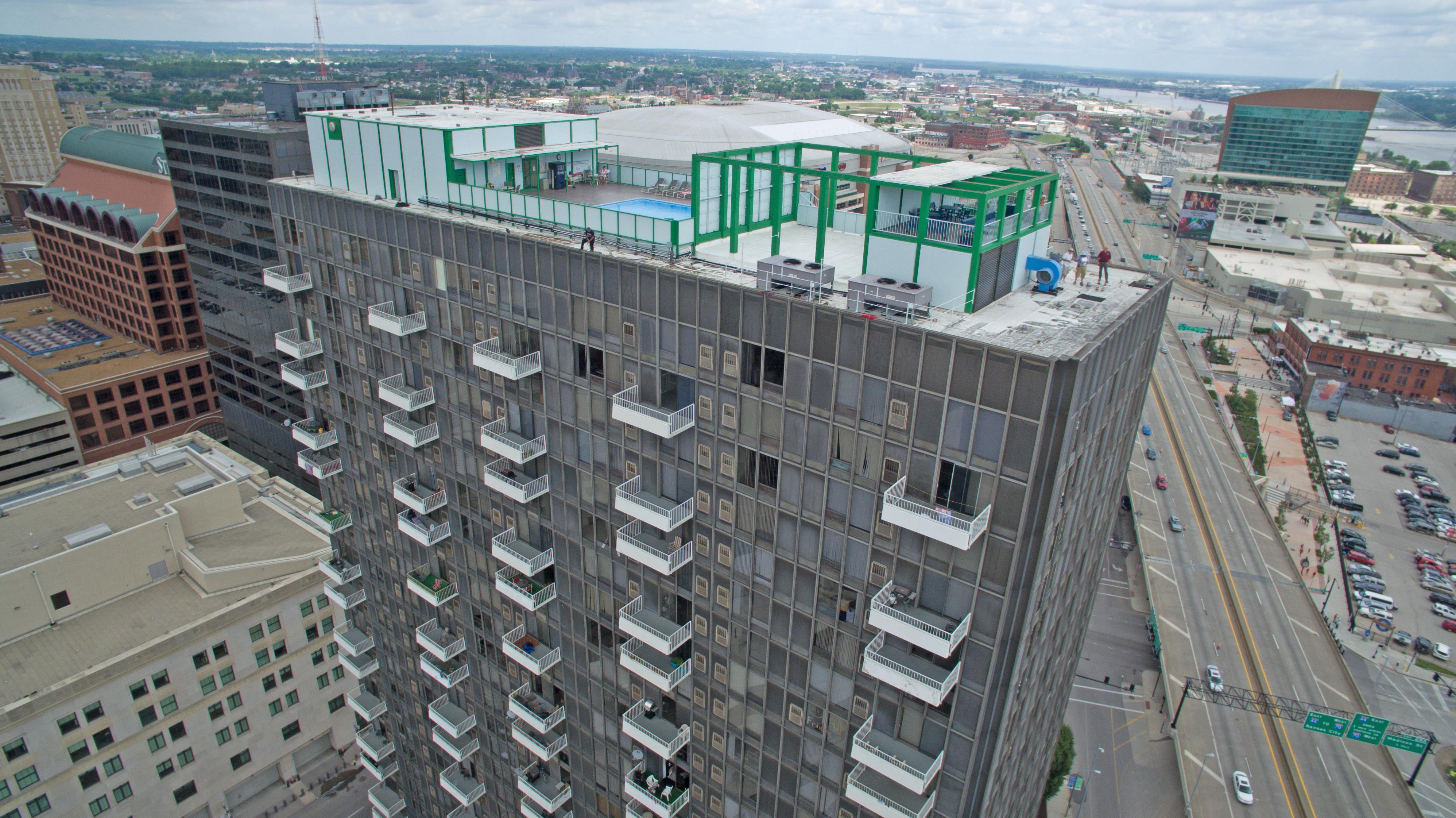
Certain parts of commercial buildings, such as rooftops, facades, and high-rise structures, can be challenging or dangerous to access manually. Drones provide a cost-effective solution to this problem by offering access to these otherwise inaccessible areas, allowing inspectors to capture detailed imagery and data with ease.

4. High-Quality Data Capture

Equipped with advanced cameras and sensors, drones are capable of capturing high-resolution imagery and precise data, enabling inspectors to detect even the smallest defects or anomalies. This level of detail ensures a comprehensive assessment of the building’s condition, facilitating informed decision-making and proactive maintenance strategies.

Applications of Drone Inspections

Drone inspections have a wide range of applications across various industries, including:

  • Construction: Monitoring construction progress, identifying structural issues, and ensuring compliance with building codes.
  • Real Estate: Conducting property inspections, creating immersive virtual tours, and showcasing properties from unique perspectives.
  • Infrastructure: Inspecting bridges, towers, and other infrastructure for signs of wear and damage.
  • Environmental: Monitoring environmental conditions, assessing vegetation growth, and detecting pollution or contamination.

St Louis Drone Services: Your Trusted Partner in Drone Inspections

At St Louis Drone Services, we understand the importance of leveraging cutting-edge technology to deliver exceptional results for our clients. As a full-service professional commercial photography and video production company, we specialize in utilizing drones for building inspections with precision and efficiency.

With our experienced team of licensed drone pilots and state-of-the-art equipment, we offer comprehensive inspection services tailored to meet the diverse needs of businesses and organizations. From capturing high-resolution imagery to analyzing data and generating actionable insights, we are committed to delivering superior results that exceed expectations.

In addition to drone inspections, we offer a range of services including full-service studio and location video and photography, editing, post-production, and more. Our private studio is equipped with advanced lighting and visual setups, perfect for small productions and interview scenes. We also have the capability to fly specialized drones indoors, allowing for seamless inspections in any environment.

Whether you’re in need of a custom interview studio setup, sound and camera operators, or equipment rental, St Louis Drone Services has you covered. With our expertise and dedication to excellence, we can help you achieve your vision and elevate your brand through compelling imagery and video content.

Contact us today to learn more about how St Louis Drone Services can revolutionize your commercial building inspections and take your projects to new heights.


By showcasing how drone technology is transforming commercial building inspections and highlighting the expertise and capabilities of St Louis Drone Services, this article aims to educate decision-makers on the benefits of leveraging drone technology for their photography and video production needs.

314-604-6544

stlouisdroneservices@gmail.com

Indoor Drone Expert: Insider Tips and Tricks

Drones have revolutionized the way we capture images and videos from the sky, but what about indoors? While many people associate drones with outdoor aerial photography and videography, there is a growing demand for indoor drone services in various industries. As an experienced editor, photographer, and videographer at St Louis Drone Services, I’ve compiled a comprehensive guide to mastering indoor drone photography and videography.

Adjust your drone’s camera settings to accommodate different lighting scenarios and enhance the quality of your footage.

Understanding Indoor Drone Challenges

Indoor environments pose unique challenges for drone operation. Unlike outdoor spaces, indoor areas lack GPS signal, which drones rely on for navigation and stability. Additionally, confined spaces present obstacles such as walls, ceilings, and furniture, requiring careful maneuvering to avoid collisions.

Tips for Successful Indoor Drone Operation

1. Choose the Right Drone

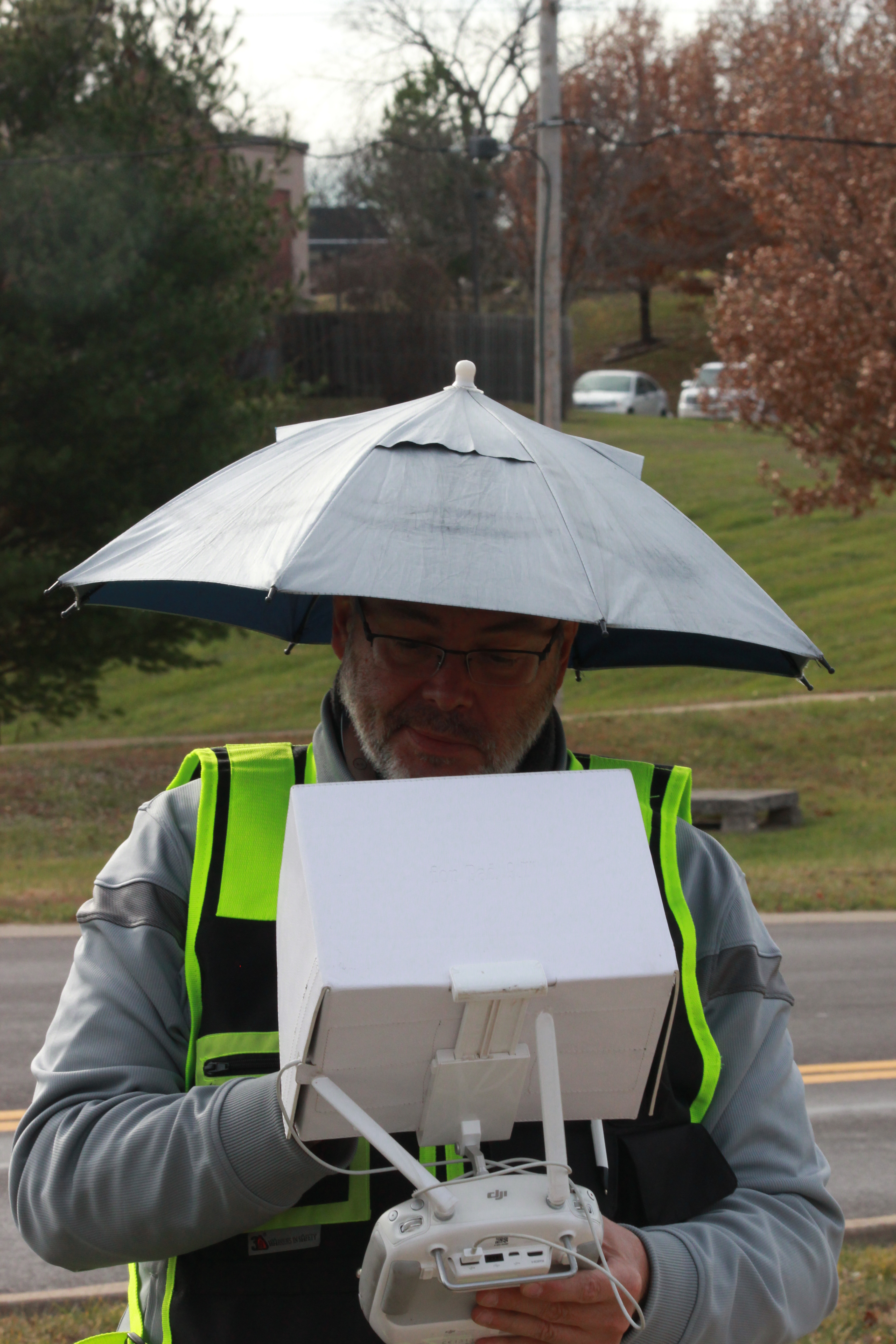
Selecting the appropriate drone for indoor use is crucial. Opt for a compact and agile model with obstacle avoidance sensors to navigate tight spaces safely. DJI’s Mavic Mini or Mavic Air series are popular choices for indoor drone photography and videography.

2. Practice in Controlled Environments

Before tackling complex indoor shoots, practice flying your drone in controlled environments such as empty warehouses or spacious rooms. Familiarize yourself with the drone’s controls and responsiveness to gain confidence in maneuvering indoors.

3. Plan Your Shots

Careful planning is essential for indoor drone projects. Create a detailed flight plan, taking into account obstacles, lighting conditions, and desired angles. Visualize the shots you want to capture and strategize your flight path accordingly.

4. Utilize Indoor Lighting

Indoor spaces often have varying lighting conditions, from harsh fluorescent lights to natural sunlight streaming through windows. Adjust your drone’s camera settings to accommodate different lighting scenarios and enhance the quality of your footage.

5. Maintain Line of Sight

Maintaining visual line of sight with your drone is critical for safety and control, especially in indoor environments where obstacles are prevalent. Always keep the drone within your line of sight to avoid collisions and navigate effectively.

6. Edit and Enhance Post-Production

Post-production editing plays a significant role in refining indoor drone footage. Utilize editing software to stabilize shaky footage, adjust colors and exposure, and add special effects to enhance the final product.

Elevating Your Indoor Drone Productions with St Louis Drone Services

At St Louis Drone Services, we specialize in indoor drone photography and videography, offering unparalleled expertise and creativity for your projects. Our experienced team of editors, photographers, and videographers is equipped with state-of-the-art equipment and innovative techniques to capture stunning imagery in any indoor environment.

From corporate events and promotional videos to architectural surveys and real estate showcases, we tailor our services to meet your unique needs. With licensed drone pilots and extensive experience in indoor drone operations, St Louis Drone Services delivers exceptional results that exceed expectations.

Call to Action

As a full-service video and photography production company, St Louis Drone Services has partnered with numerous businesses, marketing firms, and agencies in the St. Louis area for their corporate photography and video needs. Contact us today to elevate your indoor drone productions and unlock the potential of aerial imagery for your business.

Remember, mastering indoor drone photography and videography takes practice, patience, and precision. With the right techniques and equipment, you can capture breathtaking footage that showcases the beauty and intricacies of indoor spaces like never before.


At St Louis Drone Services, we are committed to pushing the boundaries of creativity and innovation in aerial photography and videography. Contact us today to discover the endless possibilities of indoor drone imaging for your business or organization.

314-604-6544

stlouisdroneservices@gmail.com

Optimizing Stockpile Management with Drone Technology

In today’s fast-paced world, industries are constantly seeking innovative solutions to streamline their operations and improve efficiency. Stockpile management is no exception. Traditional methods of monitoring and managing stockpiles often involve manual labor, which can be time-consuming, labor-intensive, and prone to errors. However, with the advent of drone technology, stockpile management has taken a giant leap forward. In this comprehensive guide, we will explore how drones are revolutionizing stockpile management, the benefits they offer, and why St. Louis Drone Services is your trusted partner in this exciting journey.

This data provides accurate measurements, volume calculations, and condition assessments without the need for manual labor.

The Drone Revolution in Stockpile Management

What Are Stockpiles?

Before we delve into the role of drones in stockpile management, let’s understand what stockpiles are. Stockpiles are accumulations of materials or goods typically stored for future use. They can consist of various materials, including but not limited to:

  • Construction aggregates
  • Minerals and ores
  • Agricultural products
  • Waste and recycling materials
  • Bulk commodities

Effective management of these stockpiles is crucial for businesses to ensure smooth operations, reduce waste, and optimize resource allocation.

The Challenges of Traditional Stockpile Management

Traditionally, stockpile management involved manual methods such as:

  1. Visual Inspection: Workers physically measuring and visually inspecting the stockpiles, which is time-consuming and can lead to inaccuracies.
  2. Manual Surveys: Conducting manual surveys using measuring instruments, which are subject to human errors and can be hazardous in certain environments.
  3. Periodic Reporting: Generating reports at fixed intervals, which may not reflect real-time changes in stockpile conditions.

These traditional methods are not only inefficient but also limit the ability to make proactive decisions based on up-to-date data.

How Drones Are Transforming Stockpile Management

1. Aerial Surveys

Drones equipped with high-resolution cameras and LiDAR technology can capture precise aerial imagery and 3D models of stockpiles. This data provides accurate measurements, volume calculations, and condition assessments without the need for manual labor.

2. Real-Time Monitoring

Drones can be programmed to conduct regular flyovers, allowing for real-time monitoring of stockpile conditions. Any changes or discrepancies are immediately detected and reported, enabling prompt corrective actions.

3. Safety and Efficiency

Using drones eliminates the need for workers to climb stockpiles or enter hazardous areas, significantly improving safety. Moreover, it reduces labor costs and minimizes downtime, making operations more efficient.

4. Data Analytics

The data collected by drones can be processed using advanced analytics software. This allows for in-depth analysis of trends, predictive maintenance, and better decision-making.

Benefits of Using Drones in Stockpile Management

1. Accuracy

Drones provide highly accurate measurements, reducing the risk of errors associated with manual methods. This accuracy is crucial for inventory management and resource allocation.

2. Cost-Effective

While the initial investment in drone technology may seem substantial, the long-term cost savings in labor and operational efficiency make it a cost-effective solution.

3. Time Efficiency

Drones can survey large stockpiles in a fraction of the time it would take human workers. Real-time monitoring also ensures timely responses to issues.

4. Safety

By removing the need for workers to physically inspect stockpiles, drones contribute to a safer working environment.

5. Data-driven Decisions

The data collected by drones can be used to make informed decisions, optimize stockpile usage, and plan for future needs.

St. Louis Drone Services: Your Trusted Partner

As an experienced drone pilot and scriptwriter at St. Louis Drone Services, I can attest to the expertise and capabilities of our company. We are not just a drone service provider; we are a full-service drone production and post-production company. Our commitment to excellence, coupled with the right equipment and a creative crew with extensive service experience in creative cinematography, sets us apart in the industry.

Our Services

  • Studio and Location Video Recording: We offer full-service video recording capabilities both in-studio and on-location, ensuring that your stockpile management needs are met with the highest quality footage.
  • Editing and Photography: Our team is skilled in post-production editing and photography, providing you with a comprehensive solution for your media needs.
  • Customization: We understand that every client’s needs are unique. That’s why we customize video productions to suit diverse recording requirements.
  • Repurposing: Repurposing your video productions to gain more traction is another specialty of ours. We know how to maximize the value of your media assets.
  • Expertise: We are well-versed in all file types and styles of drone media software and editing, ensuring that your final product meets your exact specifications.

Our Experience

St. Louis Drone Services has a proven track record of working with numerous companies in the St. Louis area to create both ground and aerial videos for their communication needs. Our experienced drone videographers, producers, and editors are adept at creating insightful volumetric reporting that empowers your decision-making processes.

Conclusion

In conclusion, drone technology has ushered in a new era of efficiency and accuracy in stockpile management. The benefits of using drones in this field are undeniable, and St. Louis Drone Services stands as a testament to the capabilities of this transformative technology. As a full-service drone video creation company, we are committed to delivering top-notch solutions tailored to your specific needs. Let us help you optimize your stockpile management and elevate your operations to new heights.

If you’re ready to experience the advantages of drone technology for stockpile management, contact St. Louis Drone Services today. Our experienced team is here to guide you through the process and provide you with the best drone solutions for your business.

Contact us now to take your stockpile management to the next level with St. Louis Drone Services!

314-604-6544

stlouisdroneservices@gmail.com

Utilizing Drones for Infrared Imaging

In recent years, the field of infrared imaging has witnessed a revolution, thanks to advancements in drone technology. As an experienced drone pilot and infrared technician at St. Louis Drone Services, I am excited to delve into the fascinating world of utilizing drones for infrared imaging. In this comprehensive article, we will explore the applications, benefits, equipment, and techniques involved in this cutting-edge field.

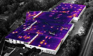
The heart of any infrared drone setup is the thermal camera. These specialized cameras can detect heat emissions and convert them into visible images or data.

Introduction to Infrared Imaging

Infrared imaging, also known as thermography, is a technology that enables us to capture images based on the heat radiated by objects and surfaces. Unlike visible light, infrared radiation is invisible to the human eye, making it a valuable tool for various industries, including:

  • Building Inspection: Identifying heat leaks, electrical issues, and insulation problems.
  • Agriculture: Monitoring crop health and detecting irrigation problems.
  • Search and Rescue: Locating individuals in low-light or obscured environments.
  • Wildlife Conservation: Studying animal behavior and habitat analysis.
  • Industrial Applications: Predictive maintenance, quality control, and process monitoring.

However, traditional methods of acquiring infrared data often involved ground-based equipment or manned aircraft, which could be costly, time-consuming, and limited in accessibility. This is where drones have stepped in to revolutionize the field.

Advantages of Infrared Drones

1. Cost-Effective

Traditional infrared inspections often require scaffolding, lifts, or helicopter rentals, driving up costs significantly. In contrast, drones are a cost-effective solution. They are less expensive to operate and can access hard-to-reach areas without the need for additional infrastructure.

2. Safety

Performing inspections in dangerous or high-risk environments can put human lives at stake. Drones eliminate this risk by allowing technicians to remotely access hazardous areas, ensuring their safety while collecting crucial data.

3. Efficiency and Speed

Drones equipped with thermal cameras can swiftly cover large areas, reducing the time required for inspections. This efficiency can be especially critical in time-sensitive situations, such as disaster response or equipment failures.

4. Data Accuracy

Infrared drones provide highly accurate thermal data, enabling precise analysis and decision-making. The images they capture are detailed and can reveal temperature variations as subtle as a few tenths of a degree Celsius.

5. Accessibility

Drones can access areas that are difficult or impossible to reach by traditional means, such as the undersides of bridges, the tops of tall buildings, or remote wilderness locations.

Equipment and Technology

To harness the full potential of infrared imaging with drones, it’s essential to have the right equipment and technology at your disposal. At St. Louis Drone Services, we take pride in using cutting-edge tools to deliver top-notch results.

1. Thermal Cameras

The heart of any infrared drone setup is the thermal camera. These specialized cameras can detect heat emissions and convert them into visible images or data. Some popular brands in the industry include FLIR, DJI, and Seek Thermal.

2. High-Resolution Drones

Pairing the right drone with a thermal camera is crucial. High-resolution drones with stable flight capabilities, like the DJI Matrice series, provide a stable platform for capturing detailed infrared images.

3. Software and Data Analysis

Software plays a crucial role in the post-processing of thermal data. Tools like FLIR Tools or specialized drone thermal analysis software can help interpret and analyze the captured imagery.

Techniques for Infrared Imaging with Drones

Now that we have covered the advantages and essential equipment, let’s delve into some techniques that are employed when utilizing drones for infrared imaging.

1. Altitude and Angle Control

Maintaining the right altitude and camera angle is essential for accurate data collection. Drones must fly at an optimal height and angle to capture thermal data effectively.

2. Overlap in Image Capture

To ensure comprehensive coverage and avoid missing critical details, thermal images should have a degree of overlap. This ensures that no areas are left uninspected.

3. Stabilization and Calibration

Stabilization systems on drones are crucial for eliminating image distortion caused by drone movement. Calibrating the thermal camera is also vital to ensure accurate temperature readings.

4. Data Annotation

After capturing thermal images, it’s essential to annotate and categorize the data for analysis. This process helps identify anomalies and temperature variations effectively.

5. Integration with Other Sensors

For a holistic inspection, drones can be equipped with other sensors, such as LiDAR or multispectral cameras. Combining data from multiple sources can provide a more comprehensive view of the inspected area.

Applications of Infrared Imaging with Drones

The versatility of infrared imaging with drones opens up a wide range of applications across various industries. Let’s explore some of these applications in detail.

Building Inspection and Maintenance

One of the most common applications is building inspection and maintenance. Infrared drones can identify issues such as water leaks, insulation problems, and electrical faults in commercial and residential structures. This is particularly valuable for predictive maintenance and energy efficiency improvements.

Agriculture

In agriculture, drones equipped with thermal cameras can monitor crop health, detect irrigation problems, and assess soil conditions. Farmers can make data-driven decisions to optimize crop yields and reduce water usage.

Public Safety and Search and Rescue

Drones have proven invaluable in search and rescue operations. Thermal imaging can help locate missing persons, even in low-light or challenging environments. Drones equipped with thermal cameras are used by first responders to save lives.

Wildlife Conservation

Infrared drones have made significant contributions to wildlife conservation efforts. Researchers can monitor animal behavior, track poachers, and study ecosystems from the air without disturbing the natural environment.

Industrial Applications

Industries rely on thermal imaging drones for predictive maintenance, quality control, and process monitoring. Identifying equipment failures before they occur can save companies substantial amounts of money and prevent downtime.

Post-Production and Data Analysis

Collecting infrared data with drones is only the beginning of the process. The real value lies in post-production and data analysis. At St. Louis Drone Services, we excel in this crucial aspect of infrared imaging.

1. Data Interpretation

Our team of experienced technicians and analysts is well-versed in interpreting thermal data. We can identify anomalies, temperature variations, and potential issues, providing our clients with actionable insights.

2. Reporting

We take pride in delivering comprehensive and easy-to-understand reports to our clients. These reports include detailed findings, annotated images, and recommendations for any necessary actions.

3. Customization

St. Louis Drone Services understands that each client’s needs are unique. We offer customization options to tailor our services to your specific requirements, ensuring that you get the most out of your thermal imaging data.

4. Repurposing and Traction

We recognize the importance of repurposing your thermal imaging data to gain more traction and value. Whether it’s for marketing purposes or further analysis, we can help you leverage your data effectively.

Conclusion

In conclusion, the utilization of drones for infrared imaging has transformed the way we approach various industries and applications. At St. Louis Drone Services, we are proud to be at the forefront of this technology, offering full-service infrared drone production and post-production services.

As a full-service video creation company, St. Louis Drone Services has worked with many commercial businesses in the St. Louis area to create their building infrared reports. We have experienced drone videographers and producers to create insightful, accurate reporting. Whether it’s building inspections, agricultural assessments, public safety, wildlife conservation, or industrial applications, our team is equipped with the right equipment and creative crew service experience for accurate reporting.

If you are looking to harness the power of infrared imaging with drones for your specific needs, don’t hesitate to reach out to us. We are well-versed in all file types and styles of infrared media reporting and can tailor our services to meet your unique requirements. Contact St. Louis Drone Services today and let us help you unlock the potential of thermal imaging with drones.

Contact St. Louis Drone Services to discuss your infrared imaging needs and experience the difference that expertise and cutting-edge technology can make.

314-604-6544

stlouisdroneservices@gmail.com