Tag Archives: technology

How to Get Accurate Stockpile Data With Drones: Aerial Solutions for Smarter Business Decisions


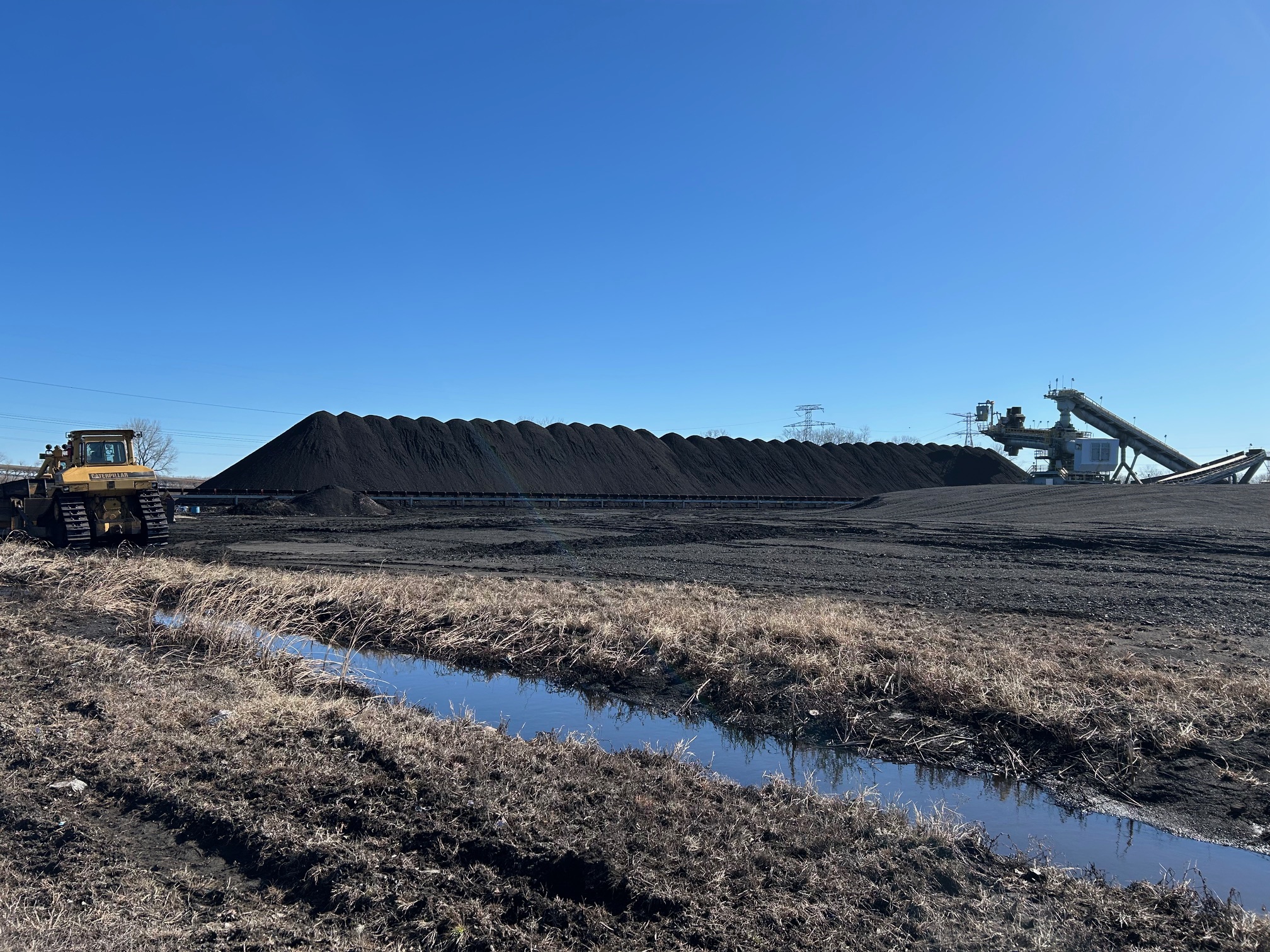
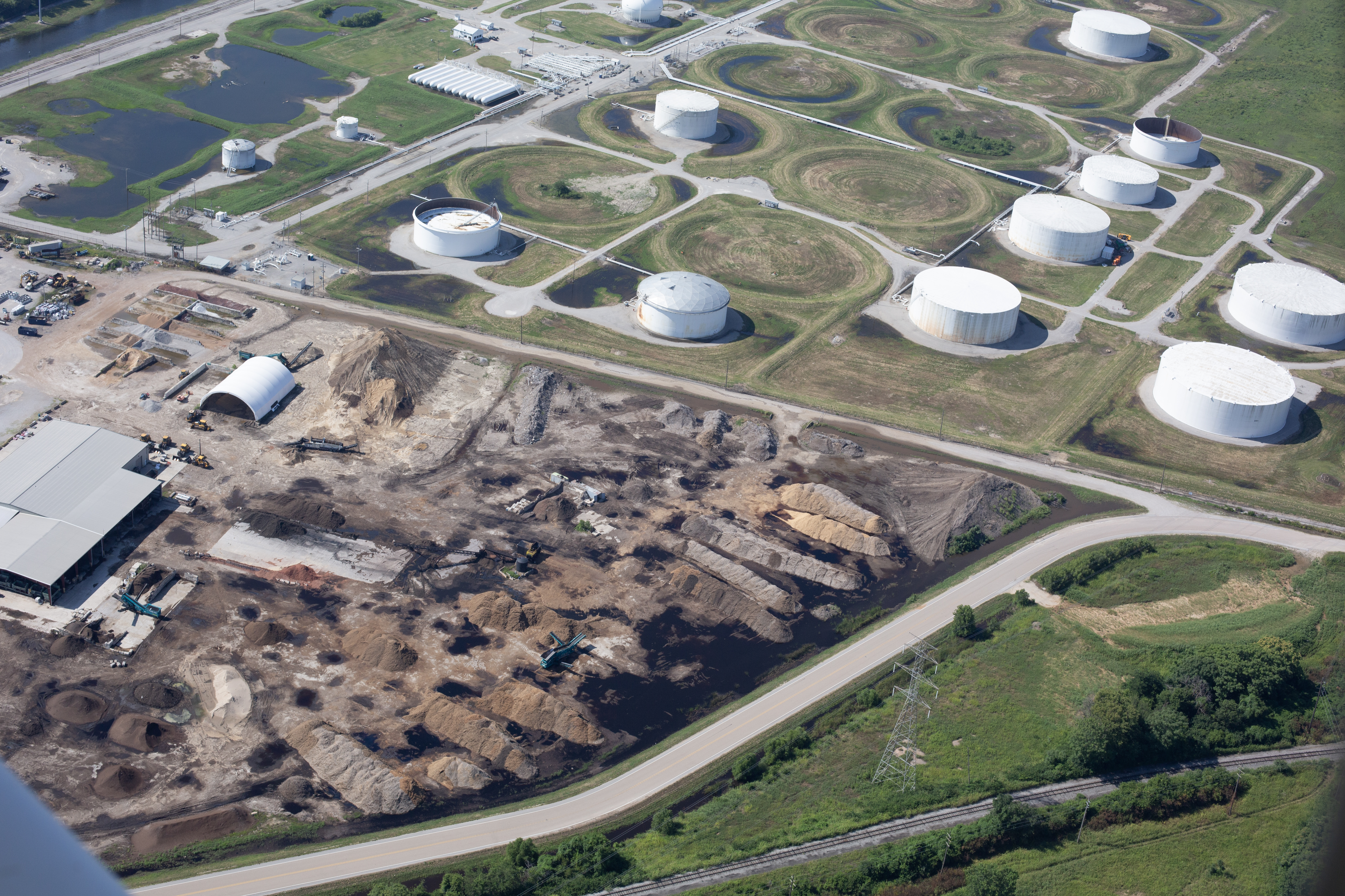
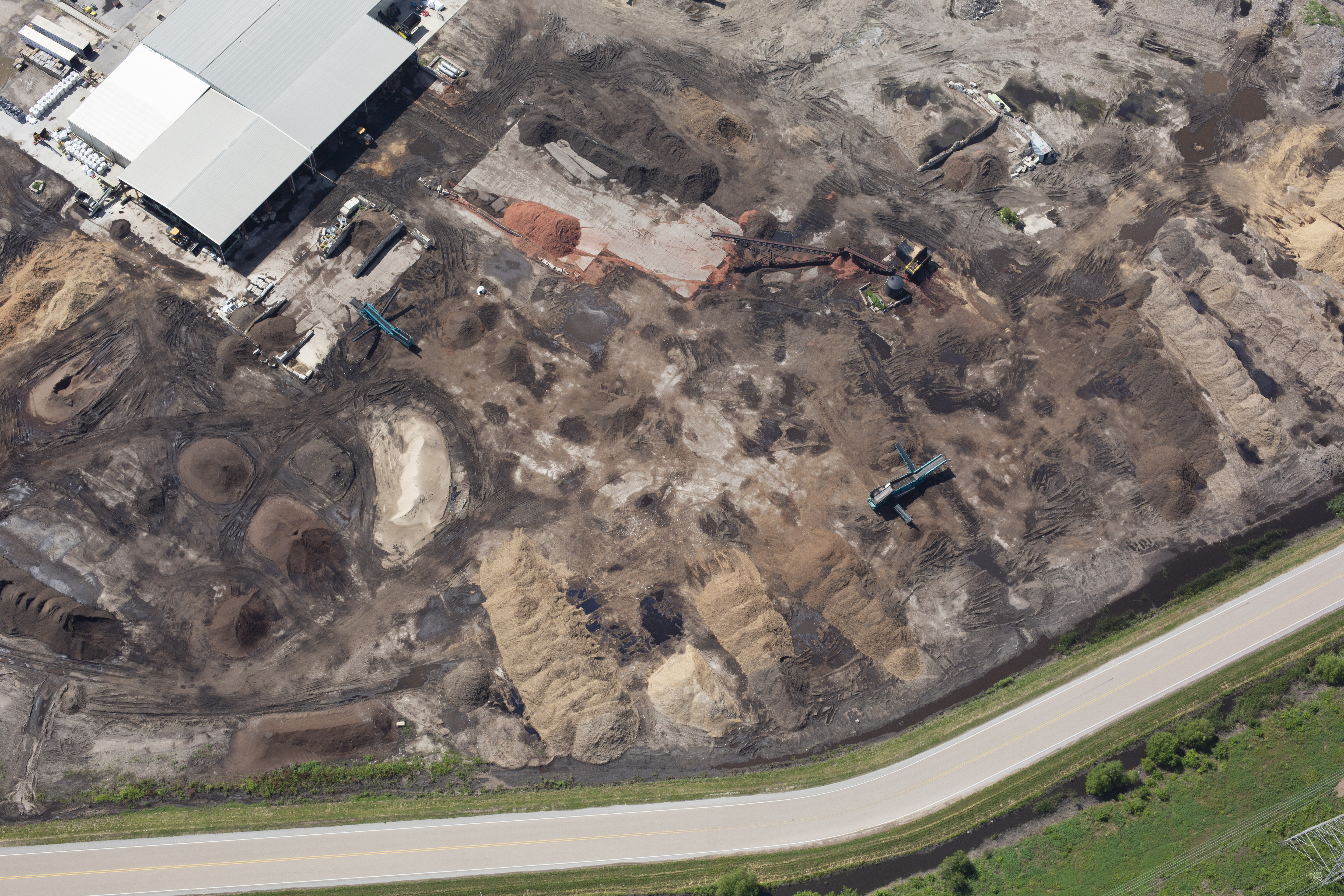
Accurate stockpile measurements are critical to inventory management, resource allocation, and financial reporting for industries such as construction, mining, aggregates, and manufacturing. Yet traditional methods—manual surveys, ground-based laser scans, or walking wheel measurements—are not only time-consuming and expensive, but often yield inconsistent or incomplete data. In today’s market, precision and efficiency are non-negotiable, which is why many companies are turning to drone-based aerial solutions.

At St Louis Drone Services, we use cutting-edge UAV (Unmanned Aerial Vehicle) technology to provide fast, accurate, and cost-effective stockpile volumetrics—empowering decision-makers with actionable intelligence while minimizing operational disruption.


Why Traditional Stockpile Measurement Falls Short

While tape measures and GPS rovers still have their place, they introduce several limitations:

  • Safety Risks: Climbing unstable piles or walking active work zones can expose crews to harm.
  • Time-Intensive: Ground surveys take hours or even days, especially over large or multiple sites.
  • Limited Access: Dense or irregular pile geometry and site obstructions hinder complete data collection.
  • Inaccuracy: Human error and inconsistent vantage points often result in flawed measurements.

These limitations not only delay reporting but can also lead to costly material discrepancies and logistical setbacks.


Drone Photogrammetry: How It Works

Using high-resolution aerial imagery and GPS-locked flight plans, drones fly over stockpiles and capture thousands of overlapping images from multiple angles. These images are processed using advanced photogrammetry software to create:

  • 3D point clouds
  • Digital surface models (DSM)
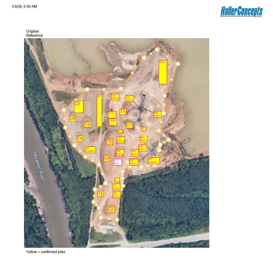
  • Orthomosaic maps
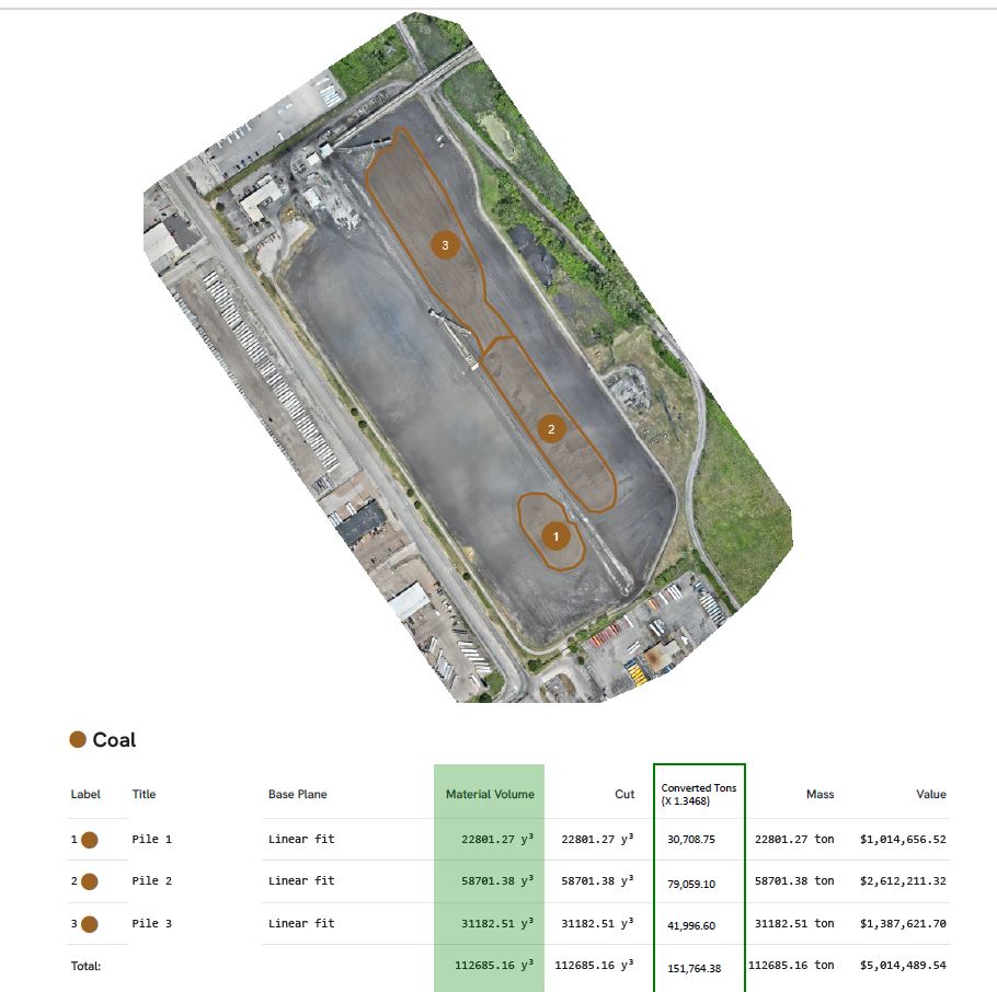
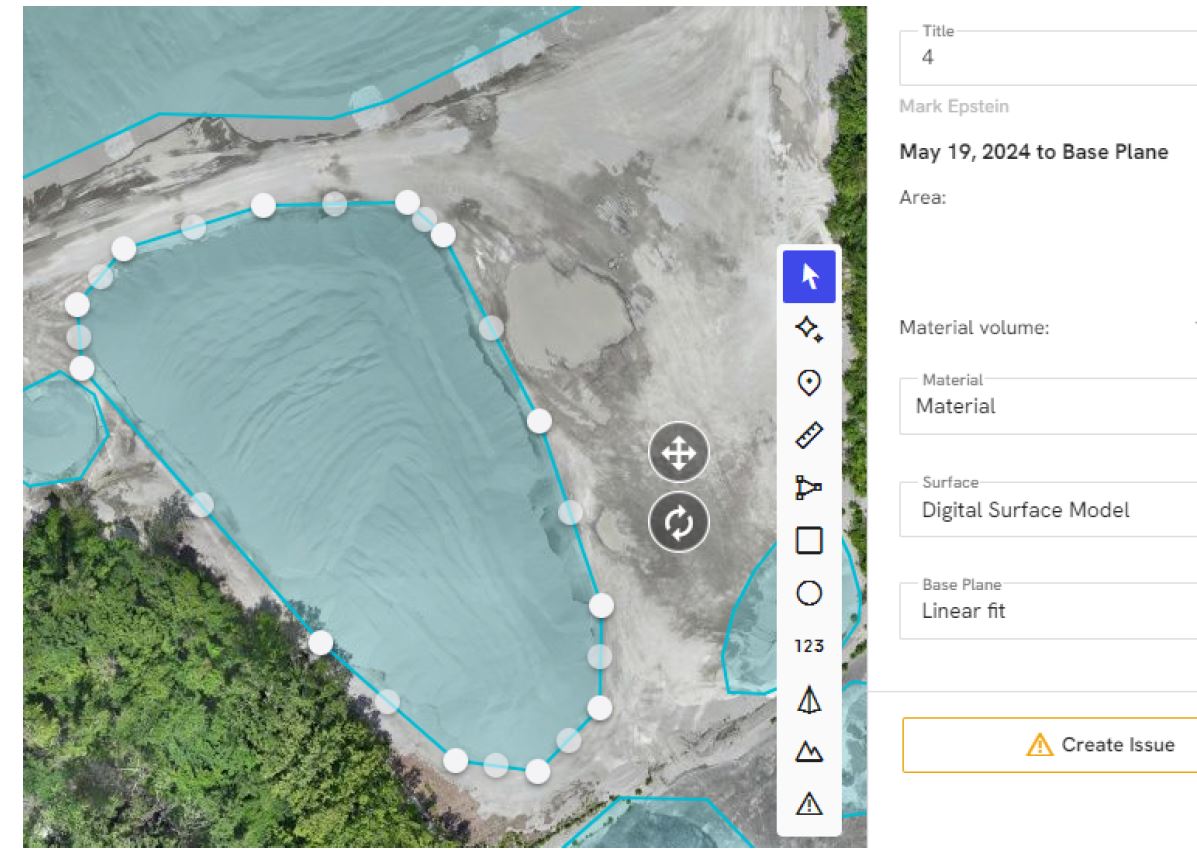
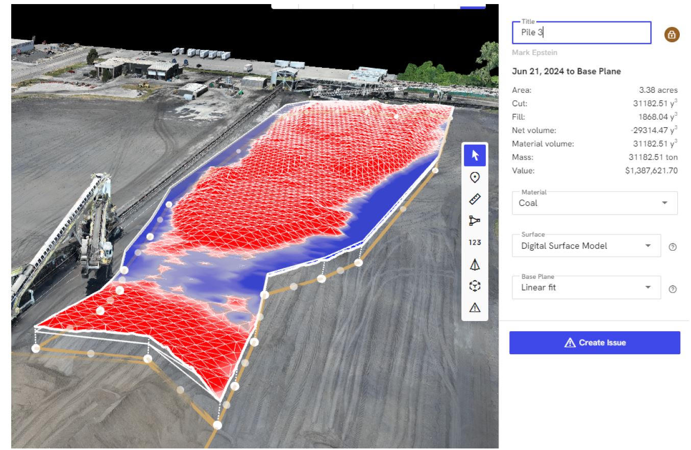
  • Volumetric calculations

Once the data is processed, precise volume calculations can be generated in a fraction of the time traditional surveying requires, often with accuracy margins under 3%.


Benefits of Using Drones for Stockpile Management

1. Increased Accuracy

Aerial data offers a comprehensive top-down view with centimeter-level precision, reducing error and improving confidence in reporting.

2. Faster Turnaround

What used to take days now takes hours. Flights typically last under 30 minutes, with deliverables ready in 24–48 hours depending on project complexity.

3. Improved Safety

Crews stay out of dangerous areas. Everything is captured from the air with zero contact, significantly lowering liability.

4. Cost Efficiency

Drones eliminate the need for expensive ground survey crews or manned aircraft, dramatically reducing labor and overhead.

5. Consistent Historical Tracking

Routine drone surveys allow for easy benchmarking and change detection over time, which is ideal for auditing, forecasting, and operational planning.


Applications Across Industries

Drone-based stockpile measurements are used in:

  • Construction Sites – Tracking fill, excavation, and material delivery.
  • Quarries & Mines – Inventorying gravel, sand, and raw materials.
  • Landscaping Suppliers – Managing bulk mulch, rock, and soil stockpiles.
  • Waste Management – Monitoring volume growth for landfills or recycling centers.

Whether you’re reporting to stakeholders or planning next steps in a project, having accurate, timely volume data is essential to staying ahead.


How St Louis Drone Services Delivers

At St Louis Drone Services, we bring decades of experience in professional photography, video production, and licensed drone operations to the table. Our drone pilots are FAA-certified and skilled in flying both outdoor and indoor environments—including tight warehouse spaces and enclosed facilities where specialized GPS-free drones are required.

We offer:

  • Customized flight planning for multi-site or recurring stockpile measurements
  • Accurate 2D and 3D maps in formats compatible with your CAD, GIS, or modeling platforms
  • Repurposable media—video and imagery captured during surveys can also be used in marketing, training, and reporting
  • Full-service editing and post-production, using the latest AI-assisted software for maximum clarity and precision

Our team doesn’t just deliver raw data—we help interpret it and integrate it into your business workflow. Whether you need a single snapshot or ongoing documentation, we scale our services to your needs.


Why Choose St Louis Drone Services

Since 1982, St Louis Drone Services has been the trusted partner for businesses, marketing firms, and creative agencies throughout the St. Louis region. We are a full-service commercial photography and video production company, offering both studio and on-location capabilities. From data-rich drone flights to polished post-production, our experienced crew ensures every aspect of your project is executed flawlessly.

We provide:

  • FAA-licensed pilots
  • Custom indoor drone solutions
  • Expert photo and video editing
  • AI-enhanced media processing
  • Complete support for multi-format deliverables

Whether you’re in construction, manufacturing, logistics, or aggregate sales, St Louis Drone Services has the tools, talent, and experience to deliver accurate, efficient, and professional stockpile measurement solutions. And if your team needs help transforming that footage into compelling marketing visuals? We’ve got you covered there, too.

Contact us today to schedule your aerial assessment—and take your inventory management to new heights.

314-604-6544

stlouisdroneservices@gmail.com

How to Plan Your Drone Shots for a Stronger Marketing Story

In an era when visual content determines audience engagement, storytelling through video must be more than just beautiful—it must be intentional. Drone footage has become a powerful tool in marketing, allowing businesses to add cinematic flair, showcase scale, and highlight unique perspectives. But like any visual asset, drone shots only truly shine when planned with strategy and narrative in mind.

At St Louis Drone Services, we don’t just fly drones—we help tell your brand story from above with purpose. Here’s how to effectively plan drone shots that enhance your next marketing campaign and leave a lasting impression.


1. Start with the Story, Not the Shot

Before thinking about flight paths or aerial angles, anchor your production with a strong message. Ask:

  • What are we trying to communicate?
  • What mood or emotion should the viewer feel?
  • How does the aerial perspective support or elevate the message?

For example, if you’re promoting a logistics company, you may want drone shots that communicate speed, coordination, and scale—such as smooth tracking over a fleet in motion or a wide reveal of a bustling shipping yard.


2. Location Scouting: Think Vertically and Spatially

Traditional location scouting is essential—but with drone productions, you must also consider airspace, obstructions, elevation, and regulations. Identify the most compelling visual elements and ensure they’re drone-accessible.

We recommend:

  • Conducting a pre-flight aerial assessment using maps or previous drone imagery
  • Considering sunrise/sunset for dramatic lighting
  • Reviewing FAA guidelines for the area (especially around restricted zones)

3. Map Out the Flight Plan to Match the Script

Treat drone footage as an integrated visual asset—not just a filler. If your marketing video has a script or narrative arc, align drone movement with key beats.

Example flight plan:

  • Opening shot: A reveal of your facility with a rising vertical movement to establish context
  • Middle sequence: Lateral tracking over operations to show workflow or human engagement
  • Final shot: A pull-away aerial to leave a sense of scale or progress

With professional crews like ours, we storyboard your drone sequences alongside the rest of the production plan for seamless integration.


4. Choose the Right Movement for the Mood

Drone maneuvers communicate mood just like music and pacing. Fast or aggressive flight may create excitement or urgency; slow, smooth glides convey trust and stability. Use this to your advantage.

Tips:

  • Orbiting shots can convey unity or innovation
  • Crane-style vertical rises are great for product reveals or dramatic intros
  • Tracking movement can enhance narrative flow or direct viewer attention

5. Balance Wide Aerials with Intimate Moments

While drone shots are naturally expansive, you don’t want them to feel disconnected from your ground-level story. Use them to transition between scenes, highlight scale, or contrast with close-up details.

Pro tip: Mix indoor drone fly-throughs with ground-level footage to keep viewers engaged and fully immersed in your brand environment.


6. Don’t Forget Post-Production Planning

Great drone content depends just as much on how it’s captured as how it’s cut, colored, and contextualized. Know your target platforms—horizontal for YouTube, vertical for Instagram Reels, square for LinkedIn. Planning with editing in mind ensures your shots are framed correctly and usable across campaigns.

At St Louis Drone Services, we tailor all drone footage for multi-platform flexibility and consistent brand integration.


Why Choose St Louis Drone Services?

At St Louis Drone Services, we bring decades of commercial video production experience together with the most advanced drone technology available today. Since 1982, we’ve worked with businesses, marketing firms, and creative agencies across the St. Louis region to deliver powerful aerial imagery that tells a story.

We offer:

  • Licensed and insured drone pilots trained in outdoor and indoor aerial capture
  • Custom studio setups for interview-driven or mixed-format content
  • Full-service editing, post-production, and AI-enhanced workflow for fast, high-quality results
  • Creative crew support including producers, camera ops, and location scouts
  • Expert repurposing strategies to stretch your investment across digital, broadcast, and social campaigns
  • In-depth experience with all major file formats and production styles

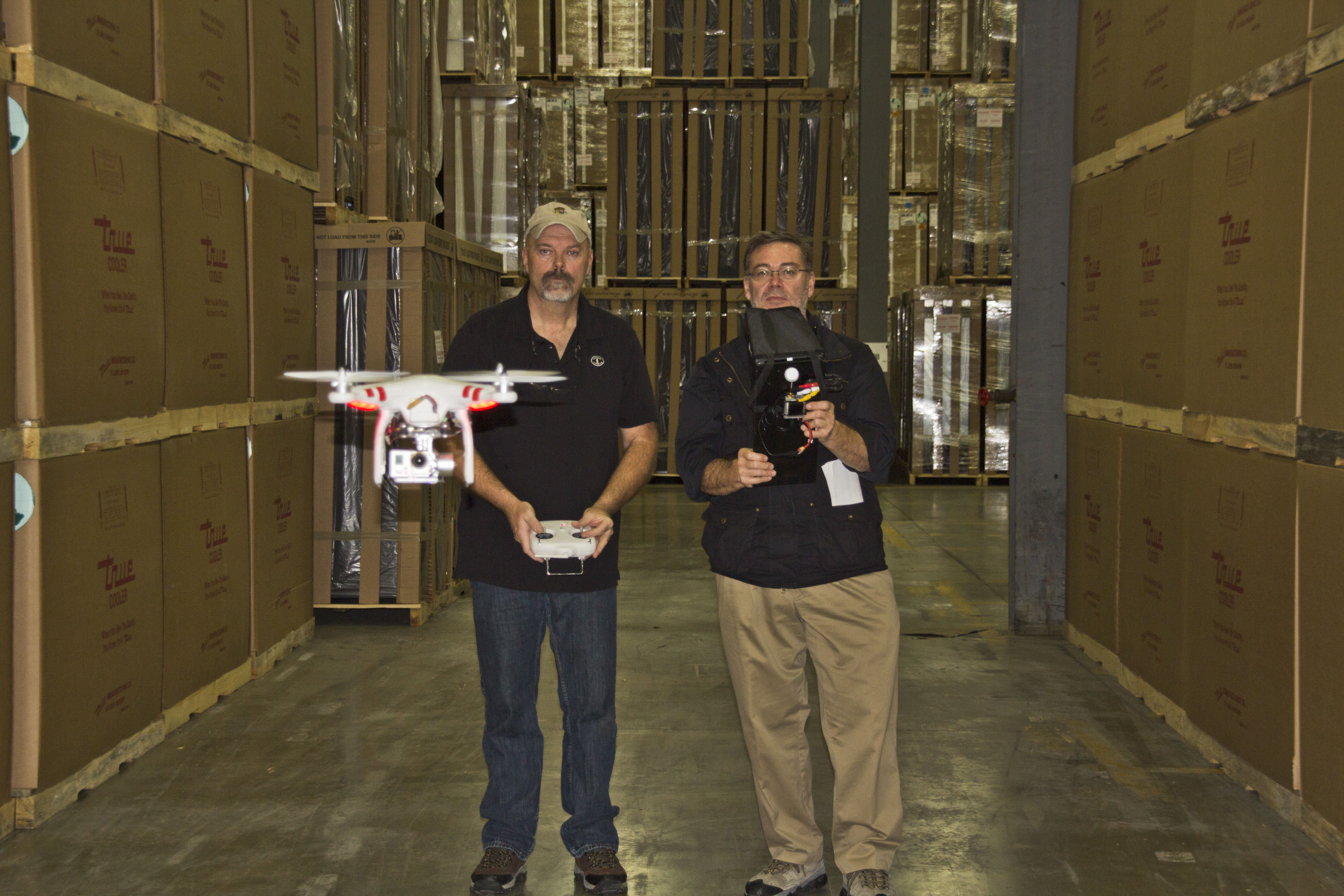
We even fly our specialized drones indoors, making your warehouse, showroom, or facility tour possible in a single, cinematic sequence.

No matter your industry—real estate, manufacturing, logistics, healthcare, or tourism—St Louis Drone Services has the tools, talent, and track record to help you plan and execute drone footage that delivers results.
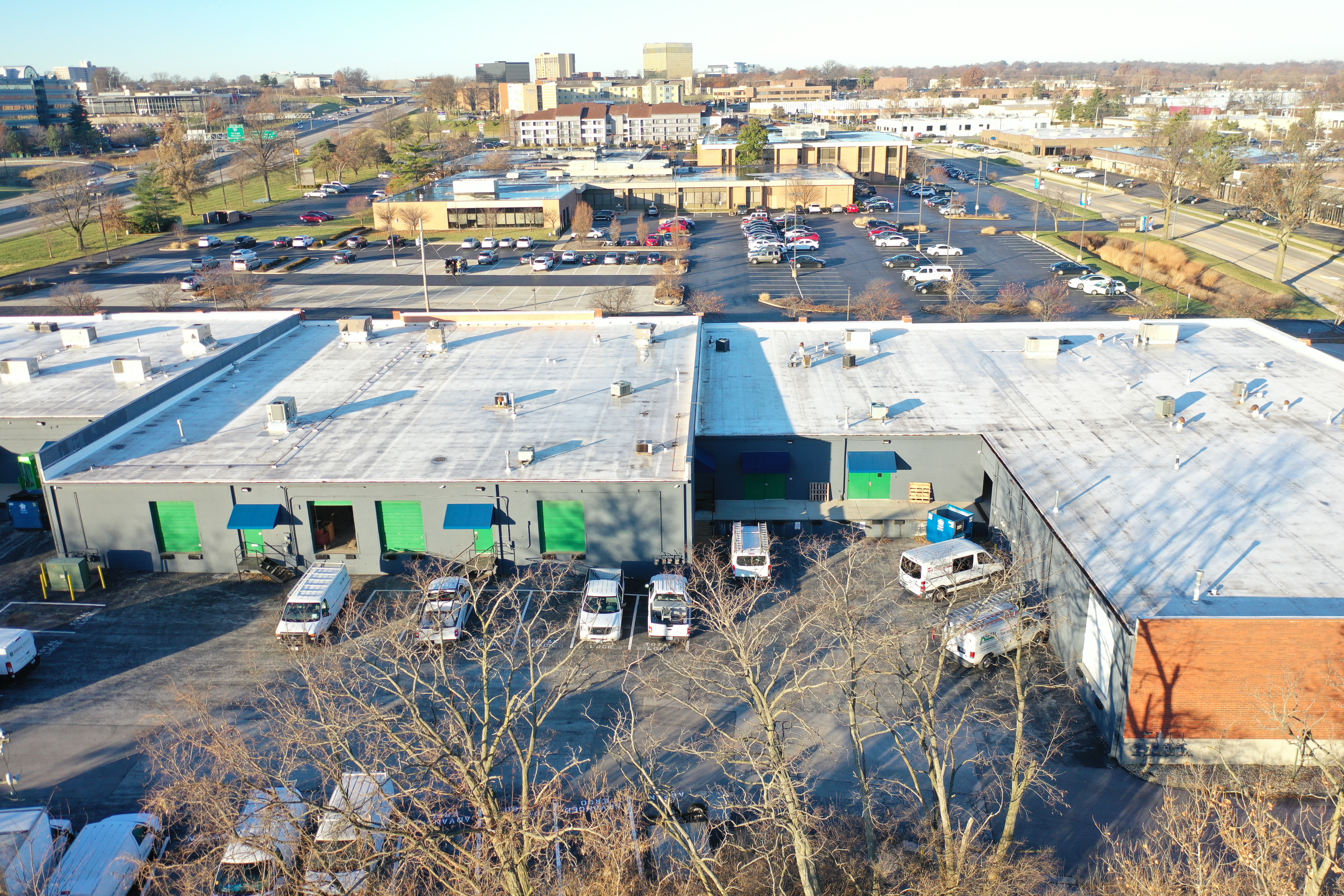
Let’s fly with purpose. Let’s tell your story from above.

314-604-6544

stlouisdroneservices@gmail.com

What’s Next for Drones in Construction? How Aerial Imaging Is Shaping the Future of Job Site Management.

Introduction: Elevating Construction with Aerial Innovation

In the fast-paced world of construction, precision, efficiency, and real-time information are critical. As the industry evolves, so too does the technology supporting it—none more transformative than the rise of drone services. Once used primarily for overhead photography, drones now play an integral role in modern construction workflows. From pre-construction planning to post-project evaluation, drones are revolutionizing how teams visualize, measure, and manage job sites.

At St Louis Drone Services, we’ve seen firsthand how aerial solutions can boost productivity, enhance safety, and reduce costs. But what’s next? Let’s take a closer look at where drone technology is heading in the construction industry—and how businesses can leverage it to gain a competitive edge.


Current Use Cases: Where Drones Already Excel on Construction Sites

Today’s construction teams are turning to drones for a wide range of high-impact tasks:

  • Topographic Mapping & Land Surveys
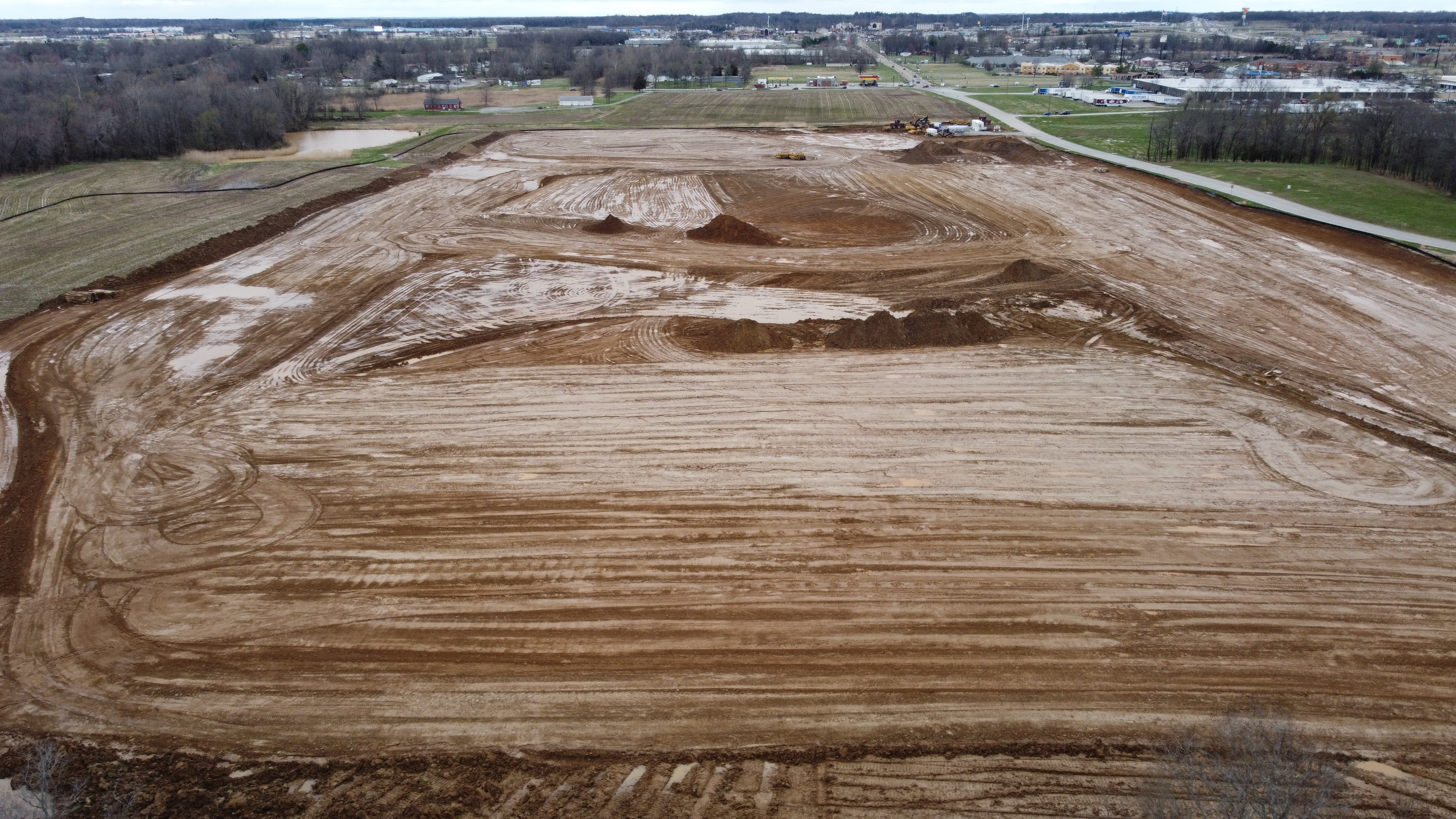
    Drones can survey large areas of land quickly and cost-effectively. With RTK-enabled drones and photogrammetry software, we can generate detailed, geo-referenced 2D and 3D models—often more accurately and faster than traditional surveying methods.
  • Progress Monitoring & Visual Reporting
    Frequent drone flights provide stakeholders with up-to-date, high-resolution visuals, aiding in project tracking and client communications. These images and videos also serve as valuable documentation for compliance and insurance purposes.
  • Volumetric Analysis for Earthworks & Stockpiles
    Drone data enables accurate measurement of materials moved on-site. This is especially useful for grading, cut-and-fill planning, and confirming vendor material deliveries.
  • Site Inspections & Safety Assessments
    Drones provide access to hard-to-reach or hazardous areas, keeping personnel safe while gathering critical visual information from roofs, towers, scaffolding, and other elevated zones.

What’s Next: The Future of Drones in Construction

As drone technology continues to mature, we anticipate several key developments that will further embed UAVs into construction workflows:

  • Autonomous Flight Plans & AI-Powered Analysis
    With AI-assisted flight planning and automated data processing, drones will not just capture images—they’ll interpret them. AI can identify changes in site conditions, detect potential safety hazards, and flag discrepancies between blueprints and actual builds.
  • Real-Time 3D Modeling & Digital Twins
    Construction firms will increasingly rely on real-time 3D reconstructions of job sites—so-called “digital twins”—to simulate progress, collaborate remotely, and prevent costly mistakes.
  • BIM Integration
    Drone data will be more tightly integrated with Building Information Modeling (BIM) systems. This convergence allows for seamless updates to planning documents and immediate insights into the build’s progress versus design.
  • Indoor Drone Flight for Facility Mapping
    With advanced obstacle avoidance and optical flow technology, drones can now navigate interior spaces for documentation, as-built verification, and post-construction inspection—ideal for warehouses, factories, and large commercial spaces.
  • Thermal Imaging & LiDAR Applications
    Drones equipped with thermal cameras and LiDAR sensors will gain broader use in energy audits, underground infrastructure mapping, and monitoring of HVAC systems during facility upgrades or new construction.

Why It Matters: Competitive Advantages of Drone Integration

Construction firms that adopt aerial technology early stand to benefit from:

  • Faster data collection and turnaround
  • Reduced rework from improved quality control
  • Lower labor and insurance costs
  • Stronger documentation for stakeholder transparency
  • Enhanced reputation for innovation and safety

As the construction landscape becomes more competitive and technology-driven, drone services are no longer optional—they’re essential.


Why Choose St Louis Drone Services?

At St Louis Drone Services, we combine deep industry experience with cutting-edge technology to help your construction projects take flight—literally and figuratively.

We’re a full-service professional commercial photography and video production company, offering:

  • Licensed and insured drone pilots
  • Aerial photography, video, and 3D imaging
  • Editing and post-production
  • Indoor and outdoor flight capabilities
  • AI-enhanced image analysis
  • Volumetric measurements and digital modeling
  • Private studio lighting and custom-built sets for visual presentations

Whether you’re tracking construction progress, inspecting infrastructure, or creating stakeholder presentations, we have the right equipment and creative crew to ensure successful image acquisition.

Since 1982, St Louis Drone Services has worked with businesses, marketing firms, and creative agencies throughout the St. Louis area. Our media team understands how to repurpose your photography and video branding to gain more traction—whether for project management, marketing, or internal documentation. We are well-versed in all media file types, styles, and accompanying software, delivering a seamless experience from planning to final delivery.

Let us elevate your next construction project—in the air and on the ground.

314-604-6544

stlouisdroneservices@gmail.com

Can Drones Handle Big Solar Farms? The Answer May Surprise You

As renewable energy continues to expand, large-scale solar farms are becoming a dominant force in power generation. These sprawling fields of solar panels require regular inspection, maintenance, and performance monitoring to maximize efficiency. Traditionally, these tasks have been labor-intensive, requiring teams of technicians to physically navigate the sites. However, with advancements in drone technology, aerial solutions are transforming the way solar farms are managed.

The Challenge of Managing Large Solar Farms

Solar farms can cover hundreds or even thousands of acres, making manual inspections time-consuming and inefficient. Even with ground-based monitoring systems, pinpointing underperforming panels or identifying damage from debris, weather, or wildlife is a logistical challenge. Additionally, traditional inspection methods often involve shutting down sections of a farm, leading to downtime and reduced energy output.

How Drones Are Revolutionizing Solar Farm Inspections

Drone technology offers a game-changing solution for the renewable energy sector. Equipped with high-resolution cameras, thermal imaging, and real-time data transmission capabilities, drones provide faster, more efficient, and more accurate solar panel inspections. Here’s how they are making a difference:

1. Speed and Efficiency

Drones can scan entire solar farms in a fraction of the time it would take a ground crew. By automating the inspection process, drones reduce labor costs and eliminate the need for technicians to traverse potentially hazardous areas.

2. Thermal Imaging for Performance Monitoring

Infrared-equipped drones can detect temperature variations across solar panels, pinpointing hotspots that indicate faulty or underperforming cells. This allows technicians to quickly address issues before they escalate into significant problems.

3. Minimizing Downtime and Energy Loss

With drone inspections, solar farms don’t need to halt operations for extended periods. The ability to survey an entire facility while panels continue generating power ensures that maintenance teams can act promptly without disrupting energy production.

4. Enhanced Data Collection and Reporting

Drones not only capture high-quality imagery but also generate detailed reports that integrate with AI-powered analysis tools. This data helps solar farm operators make informed decisions about maintenance schedules, panel replacements, and overall system performance improvements.

5. Safety Benefits

Inspecting solar farms often involves working at heights or in remote areas. By deploying drones, businesses can reduce the risks associated with manual inspections and keep personnel safe.

Beyond Inspections: Drones in Solar Farm Planning and Construction

Drones aren’t just useful for ongoing maintenance; they play a vital role in the planning and construction of solar farms. Using aerial mapping, drones help survey land, assess topography, and determine the optimal panel layout for maximum sunlight exposure. This technology aids developers in making data-driven decisions that enhance overall efficiency and long-term viability.

Why St. Louis Drone Services is the Right Partner for Your Solar Energy Projects

At St. Louis Drone Services, we specialize in commercial drone photography and video production, providing businesses and organizations with high-quality imagery and data to optimize their operations. Our experienced and licensed drone pilots utilize state-of-the-art equipment to conduct precision aerial inspections, making us the ideal partner for solar farm maintenance, monitoring, and marketing efforts.

As a full-service professional commercial photography and video production company, we offer:

  • Studio and location video and photography
  • Expert editing and post-production services
  • Specialized drone operations for both indoor and outdoor environments
  • Custom productions tailored to diverse media requirements
  • Repurposing photography and video branding to maximize market impact
  • Private studio setups with customizable lighting and visuals

With over 40 years of experience serving businesses, marketing firms, and agencies in the St. Louis area, we understand the unique needs of the energy sector. Whether you need high-resolution aerial inspections, promotional video content, or detailed performance analytics for your solar farm, our team is equipped to deliver exceptional results.
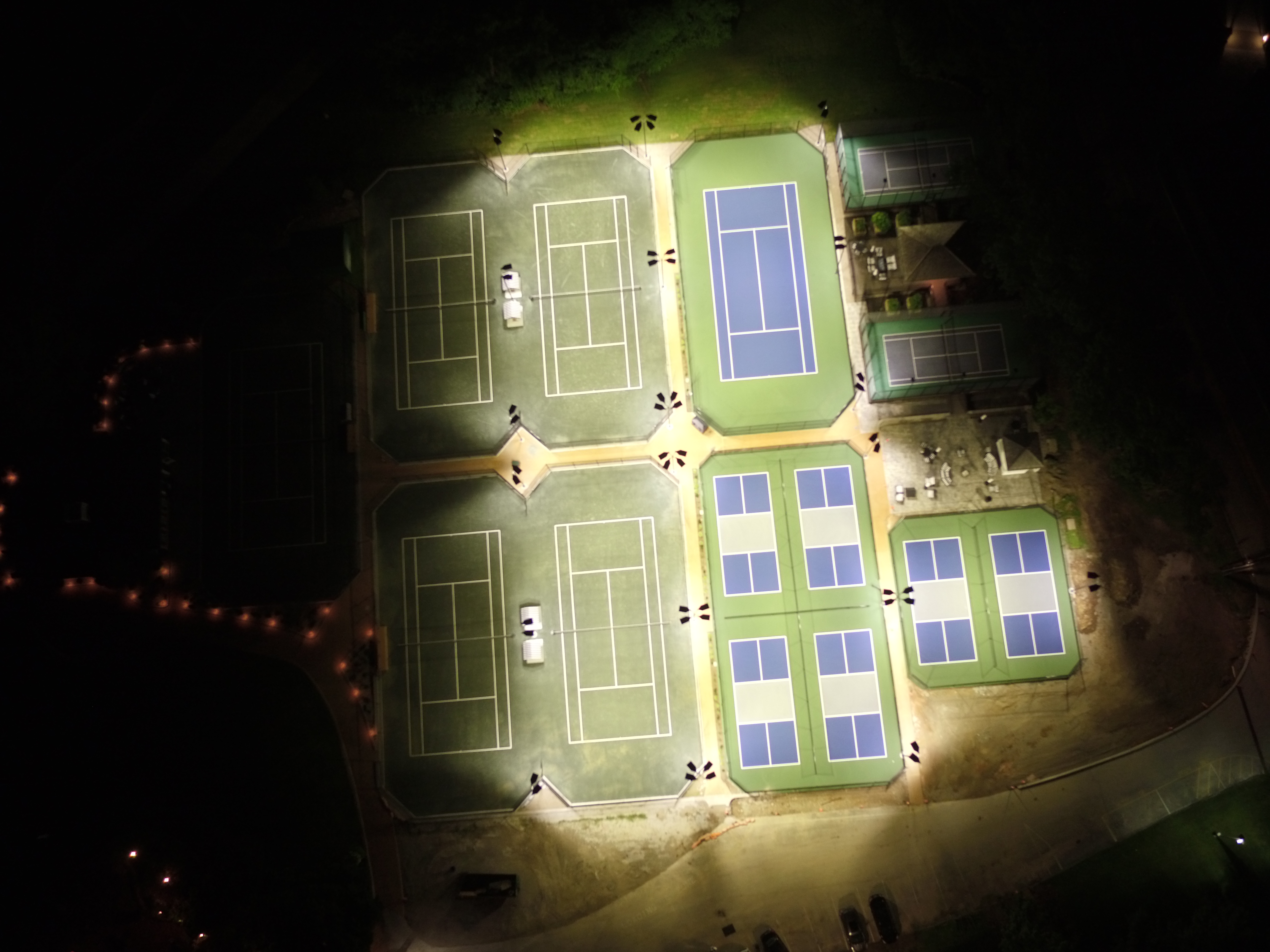
To learn more about how St. Louis Drone Services can enhance your solar farm operations through cutting-edge drone technology, contact us today. Let’s take your solar energy projects to new heights!

314-604-6544

stlouisdroneservices@gmail.com

How to Plan Drone Shots for Your Next Video

Incorporating drone shots into your video production can elevate your project by adding dramatic perspectives, dynamic motion, and cinematic appeal. However, successful drone shots require more than just a drone and a camera—they require thoughtful planning, expert coordination, and a clear vision of how these shots will contribute to your overall story. For businesses, marketing firms, and organizations looking to integrate drones into their video production, understanding how to effectively plan drone shots is crucial to achieving the desired outcome.

The best drone shots often take place during the golden hours—shortly after sunrise or just before sunset—when the light is soft and dramatic.

Here’s a guide to help you plan the perfect drone shots for your next video production:

1. Identify the Purpose of the Drone Shot

Before you even think about equipment or technical details, it’s important to identify what you want the drone shots to achieve. Ask yourself the following questions:

  • What mood or emotion do I want to convey? A sweeping aerial view can create a sense of grandeur or serenity, while a dynamic, fast-moving shot can evoke excitement or urgency.
  • What aspect of the scene or location should the drone highlight? Are you showcasing a vast landscape, a bustling city, or a close-up of a building or event? Drone shots are perfect for capturing the larger context and providing scale.
  • How will the drone shot fit into the narrative? Consider how the drone shot will move the story forward. Is it an establishing shot to set the scene, an action shot to follow a subject, or a cutaway to provide visual variety?

Once you have a clear purpose for your drone shots, you can tailor your planning accordingly.

2. Choose the Right Locations for Drone Shots

Drone shots are especially effective in open spaces, but they can also be used creatively in more confined settings. When scouting locations for your video, think about:

  • Wide open spaces: Drone shots are ideal for capturing outdoor environments like parks, construction sites, industrial facilities, cityscapes, or even natural landscapes.
  • Crowded or complex environments: Drones can also be used in busy or complex environments, such as office buildings, event spaces, or manufacturing facilities. However, you may need to consider specific logistics, such as obstacles or permission requirements.
  • Indoor shooting: Specialized drones can be flown indoors to capture detailed shots in locations like studios, warehouses, or office spaces. These shots provide a unique perspective, especially in environments that traditional cameras may struggle to capture.

Proper location scouting is key to ensuring that your drone shots serve both the narrative and the visual aesthetic of the project.

3. Consider the Weather and Lighting Conditions

Drone shots are highly sensitive to weather and lighting, so planning these factors is essential to achieving optimal results:

  • Weather conditions: Strong winds, rain, or low visibility can impede drone flight and affect shot quality. Ensure that you monitor weather forecasts in advance and plan your drone shots around the best conditions.
  • Lighting: The best drone shots often take place during the golden hours—shortly after sunrise or just before sunset—when the light is soft and dramatic. However, depending on the look you’re aiming for, you may choose to shoot in other lighting conditions, such as bright midday sunlight or even during night shoots with artificial lighting.

4. Work with Experienced Pilots and Operators

Flying drones isn’t as simple as pushing a button—it requires skill, precision, and coordination with other members of your production crew. This is where experienced drone operators and videographers come into play.

At St. Louis Drone Services, we have licensed drone pilots who are experts in navigating various environments, whether that means flying over a busy city, around tall buildings, or inside a tight space. The proficiency of your drone operator will directly affect the smoothness and safety of the shot, as well as its quality.

Ensure that your drone operators are experienced enough to handle the specific challenges of your shoot, and have them coordinate with other crew members to align with your overall production plan.

5. Create a Detailed Flight Plan

Drone flights should be carefully mapped out to avoid obstacles, ensure safe flying, and optimize shot quality. A detailed flight plan should include:

  • Flight path: Plot the trajectory of the drone, including takeoff and landing points, direction of flight, altitude, and speed. This ensures that the drone stays within the designated area and avoids obstacles.
  • Shot list: Create a list of specific shots you want the drone to capture, including angles, elevations, and transitions. This ensures that all key moments are covered and that your team stays on track.
  • Timing: Plan how long each drone shot will take, factoring in time for adjustments, repositioning, and retakes. If you have multiple drone shots planned, make sure there’s ample time for each segment of the shoot.

6. Understand the Legal and Safety Requirements

Drone operations are subject to specific regulations and laws, particularly when flying in urban areas or around private property. Ensure that you are familiar with the necessary permits, airspace restrictions, and any other legal considerations before your shoot.

In many cases, you’ll need to obtain permission to fly in certain areas or locations. It’s also important to prioritize safety and communicate with your team to ensure that everyone is aware of potential hazards.

7. Incorporate Drone Shots into the Post-Production Process

Once you’ve captured your drone shots, it’s important to integrate them seamlessly into your final video. Drone shots often require post-production work, such as stabilizing footage, color correction, and sound editing.

At St. Louis Drone Services, we offer full-service editing and post-production services, ensuring that your drone footage is polished and ready to make an impact. Whether you need a smooth aerial transition, seamless integration with other camera angles, or visual effects, our expert editing team will help bring your drone shots to life.

St. Louis Drone Services: Your Trusted Partner for Expert Drone Photography and Video Production

At St. Louis Drone Services, we are experts in planning and executing drone shots that will elevate your video production to new heights. Our full-service team is equipped with the right tools and experience to help you achieve your vision. From studio and location video to editing, post-production, and licensed drone pilots, we offer everything you need for a successful production.

We specialize in customizing your production to meet diverse media requirements, ensuring that your videos stand out and leave a lasting impression. Our extensive experience with all types of media and software ensures that we deliver high-quality, optimized footage that is perfect for your digital platforms.

With our private studio setup, sound and camera operators, and ability to fly specialized drones indoors, we’re equipped to handle every aspect of your production—from interviews to dynamic aerial shots. Since 1982, St. Louis Drone Services has been a trusted partner for businesses, marketing firms, and agencies in the St. Louis area, offering top-notch photography and video services that create lasting results.

Let us help you plan and execute the perfect drone shots for your next video production. Contact St. Louis Drone Services today to learn more about how our team can bring your creative vision to life.

314-604-6544

stlouisdroneservices@gmail.com

Enhancing Solar Panel Layout Planning with Drones: The Future of Efficient Energy Solutions

With drones, solar companies can capture high-resolution aerial images, ensuring that all data is precise and reliable.

In the growing renewable energy industry, solar power remains one of the most promising solutions for sustainable energy. To maximize its potential, it’s crucial for businesses to optimize the design and placement of solar panels. One of the most effective tools for improving the planning and execution of solar panel layouts is drone technology. With their ability to capture detailed aerial views and data, drones are transforming how energy companies and businesses plan their solar installations.

The Role of Drones in Solar Panel Layout Design

Planning an efficient solar panel layout involves analyzing various factors, including terrain, sunlight exposure, and the layout of the land. Traditionally, this process required time-consuming ground surveys and measurements. However, drones have significantly streamlined this process, providing quicker, more accurate data.

Drones equipped with high-resolution cameras and mapping software can capture precise imagery of the site, even in challenging terrain or hard-to-reach locations. The data gathered from these aerial surveys can be used to generate 3D models, offering insights that help engineers optimize solar panel placement to achieve maximum sunlight exposure and energy efficiency.

Why Drones Are the Game-Changer for Solar Panel Layouts

  1. Speed and Efficiency: Drones can survey large areas in a fraction of the time it would take to conduct manual surveys, accelerating the planning process and enabling faster decision-making.
  2. Cost-Effective Technology: Drone services offer a more affordable alternative to traditional surveying methods, saving businesses money on labor and equipment costs. Additionally, drones reduce the need for specialized machinery, lowering the overall project cost.
  3. High-Precision Data: With drones, solar companies can capture high-resolution aerial images, ensuring that all data is precise and reliable. This data can then be used to create 3D models that enhance the accuracy of solar panel placement.
  4. Access to Difficult Terrain: Drones can easily navigate difficult or dangerous terrain, such as steep hills or densely vegetated areas, where traditional surveys might be impractical or unsafe.
  5. Real-Time Insights: Drones provide real-time data, allowing solar designers to make adjustments to the layout on the spot, improving the overall efficiency and accuracy of the design.

St. Louis Drone Services: Transforming Solar Panel Layout Planning

At St. Louis Drone Services, we specialize in providing advanced drone solutions for the renewable energy sector, including solar panel layout planning. Our expertise in commercial photography and video production, combined with our state-of-the-art drone technology, allows us to offer a comprehensive service that meets the unique needs of energy companies.

As a full-service provider, St. Louis Drone Services offers everything from aerial photography and video to 3D mapping and modeling, delivering the precise data you need to plan your solar installations effectively. Our licensed drone pilots have extensive experience and can even fly specialized drones indoors for projects that require a controlled environment.

We also offer a range of additional services to support your production needs. Whether it’s creating a custom interview studio setup, providing sound and camera operators, or offering expert editing and post-production, St. Louis Drone Services has everything needed for a seamless video production experience.

Since 1982, we have been serving businesses, marketing firms, and agencies in the St. Louis area, providing them with the tools and expertise to achieve their goals. Our private studio offers a perfect space for small productions and interviews, while our larger setups are ideal for more complex shoots involving props and elaborate sets.

At St. Louis Drone Services, we pride ourselves on our ability to customize every project to your specific needs. Whether you’re looking to optimize solar panel layouts or need help with repurposing video and photography for marketing, we have the right equipment and creative team to bring your vision to life.

Let us help you take your solar panel layout planning to the next level. With our expert drone services, we ensure that your project is as efficient and effective as possible.

314-604-6544

stlouisdroneservices@gmail.com

How Drone Videos Can Show Your Construction Progress Clearly

In today’s fast-paced business environment, the ability to showcase project progress in real-time can significantly enhance transparency and communication with stakeholders. For construction companies, using drone technology to capture video footage has emerged as a game-changer, providing a clear, bird’s-eye view of ongoing work. Here’s how drone videos can effectively convey your construction progress.

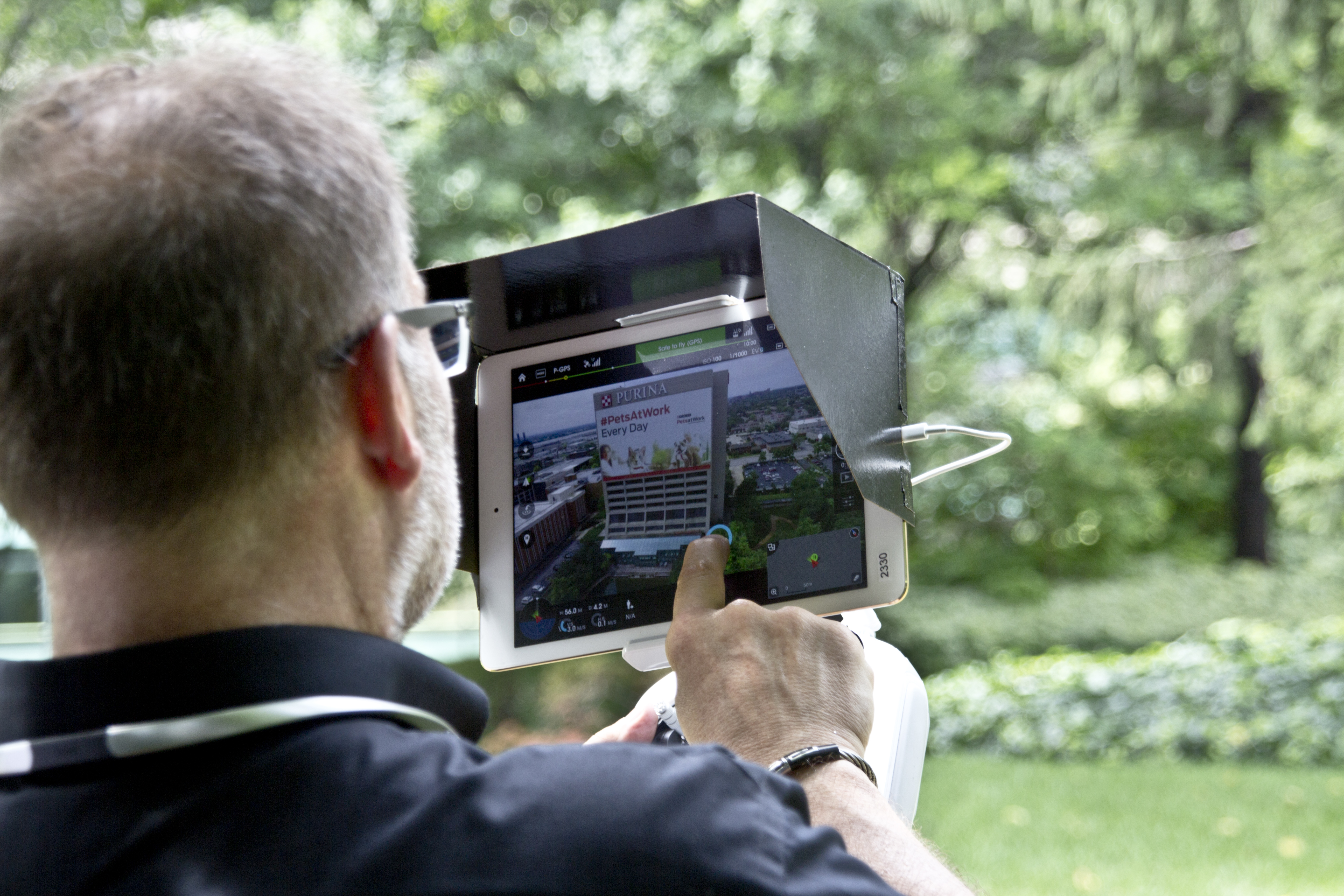
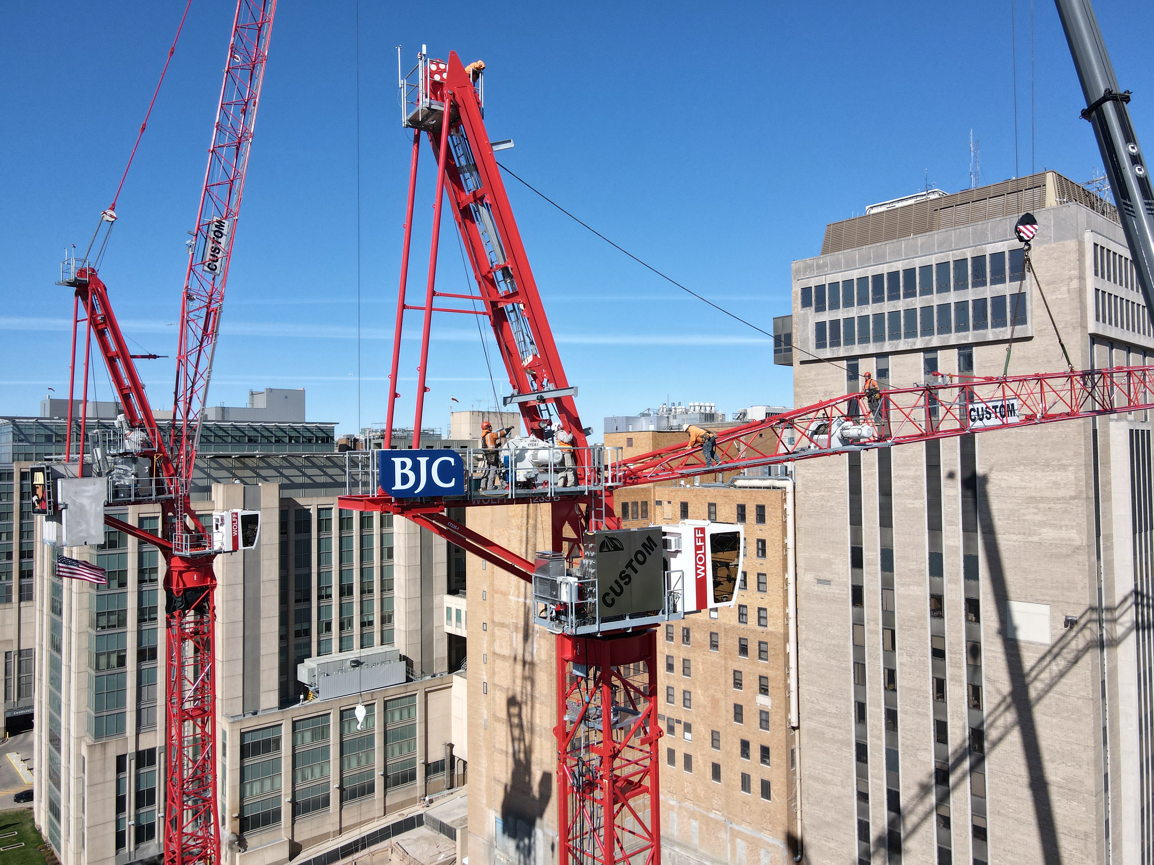
Drones can access areas that may be hazardous or difficult to reach, allowing for safe inspection of rooftops, scaffolding, and other elevated structures.

Enhanced Visual Documentation

Traditional methods of documenting construction progress often involve ground-level photography and static images. While these methods have their place, they can fall short in delivering a comprehensive view of a site. Drone videos offer a dynamic perspective, allowing you to capture wide-angle shots that illustrate the entire site, showcasing everything from foundational work to structural development.

By integrating drone footage into your project reports, you can create a compelling narrative of progress that is easily digestible for stakeholders. This high-quality visual documentation not only enhances your presentations but also serves as a valuable resource for future projects.

Real-Time Monitoring

One of the most significant advantages of utilizing drones for construction progress videos is the capability for real-time monitoring. Drones can fly over construction sites at scheduled intervals, providing up-to-date footage that reflects current conditions. This immediacy allows project managers and decision-makers to assess progress, identify potential delays, and make informed decisions without the need for extensive on-site visits.

Moreover, real-time drone footage can enhance communication with clients, as they can witness the ongoing work and understand project timelines better. This transparency builds trust and strengthens client relationships.

Comprehensive Analysis and Reporting

Drone videos can be used not just for documentation but also for in-depth analysis. By capturing aerial footage over time, you can create time-lapse videos that visually represent the evolution of a project from groundbreaking to completion. This type of reporting is invaluable for stakeholders, as it provides clear evidence of progress and adherence to timelines.

Furthermore, drones equipped with advanced imaging technology can capture detailed images that can be analyzed for various construction parameters, such as material placement, site logistics, and worker safety. This data can be used to optimize operations and improve efficiency on site.

Safety and Accessibility

Drones can access areas that may be hazardous or difficult to reach, allowing for safe inspection of rooftops, scaffolding, and other elevated structures. This capability not only minimizes risks associated with manual inspections but also ensures that you are capturing accurate footage from all necessary angles.

Additionally, drones can be utilized to assess damage after extreme weather events or accidents, providing immediate feedback that can guide recovery efforts. The ability to assess sites safely and quickly is a considerable advantage in maintaining project momentum.

Customizable Production for Diverse Media Requirements

At St Louis Drone Services, we understand that every construction project is unique, and we are committed to providing customized solutions tailored to your specific media requirements. As a full-service professional commercial photography and video production company since 1982, we offer a comprehensive suite of services that includes:

  • Full-Service Studio and Location Video and Photography: Our team can manage everything from initial concept development to final delivery.
  • Editing and Post-Production: Our skilled editors can enhance your footage, ensuring that it meets your branding standards and messaging goals.
  • Licensed Drone Pilots: Our experienced drone operators are fully licensed and trained to capture stunning aerial footage safely and effectively.

Our private studio is equipped with advanced lighting and visual setups, making it perfect for small productions and interviews. We can seamlessly incorporate props and other elements to create a compelling set that resonates with your audience.

Conclusion

Incorporating drone technology into your construction project documentation can elevate your reporting capabilities and enhance stakeholder engagement. St Louis Drone Services stands ready to assist you in achieving your production goals. With our extensive experience working with businesses, marketing firms, and agencies in the St. Louis area, we have the right equipment and creative crew service experience to ensure successful image acquisition. Let us help you repurpose your photography and video branding to gain more traction. We are well-versed in all file types, styles of media, and accompanying software, ensuring that your project reflects the quality and professionalism you demand.

Contact us today to learn more about how we can customize your next production and make it truly exceptional!

314-604-6544

stlouisdroneservices@gmail.com

Safety Regulations for FPV Drone Pilots

The world of FPV (First Person View) drone piloting has revolutionized the photography and video production industry, offering breathtaking aerial shots and dynamic perspectives previously unimaginable. However, with the increasing popularity of FPV drones, it’s essential to navigate the regulatory landscape to ensure safe and compliant operations, especially in commercial settings.

FPV drone pilots must respect privacy laws and ethical guidelines, especially when capturing video or photography in residential or sensitive areas.

Understanding the Basics of FPV Drone Safety

FPV drones provide pilots with a real-time video feed from the drone’s camera, allowing them to fly the drone as if they were in the cockpit. While this offers incredible creative possibilities, it also comes with unique safety challenges. The pilot’s field of view is limited to what the drone’s camera captures, which can make obstacle avoidance and situational awareness more difficult compared to traditional line-of-sight flying.

Key Safety Regulations for FPV Drone Operations

  1. FAA Part 107 Certification
    • In the United States, the Federal Aviation Administration (FAA) mandates that all commercial drone pilots must hold a Part 107 certification. This certification ensures that pilots understand airspace regulations, weather patterns, emergency procedures, and the technical aspects of drone operations.
  2. Visual Line of Sight (VLOS)
    • The FAA requires that a visual observer maintain a line of sight with the drone at all times during FPV operations. This is to ensure that the drone does not collide with obstacles, other aircraft, or people. The visual observer must be in direct communication with the pilot to relay any potential hazards.
  3. Flying in Controlled Airspace
    • FPV drone pilots must be aware of the airspace they are operating in. Controlled airspace near airports requires specific authorization from the FAA, which can be obtained through the Low Altitude Authorization and Notification Capability (LAANC) system. Understanding airspace classifications and respecting no-fly zones are critical to maintaining compliance.
  4. Altitude Limits
    • FPV drones are typically restricted to flying at or below 400 feet above ground level (AGL) to minimize the risk of interference with manned aircraft. This altitude limit is particularly important in urban environments where the presence of buildings, power lines, and other structures can pose additional risks.
  5. Night Operations
    • Flying FPV drones at night requires special consideration. The FAA allows night operations under Part 107, but the drone must be equipped with anti-collision lights that are visible for at least three statute miles. Pilots should also be aware of the challenges of reduced visibility and the increased difficulty of depth perception when flying at night.
  6. Privacy and Ethical Considerations
    • FPV drone pilots must respect privacy laws and ethical guidelines, especially when capturing video or photography in residential or sensitive areas. Infringing on personal privacy or capturing unauthorized footage can lead to legal consequences and damage a company’s reputation.
  7. Emergency Procedures
    • Pilots must be prepared for potential emergencies, such as loss of signal, low battery, or unexpected weather changes. Establishing a predefined return-to-home (RTH) point and knowing how to initiate it quickly can prevent accidents. Regularly practicing emergency procedures ensures that pilots can respond calmly and effectively in real-world scenarios.

Best Practices for Safe FPV Drone Operations

  • Pre-Flight Checklist: Before every flight, conduct a thorough pre-flight inspection of the drone, checking the battery levels, propellers, and camera equipment. Ensure that the firmware is up-to-date and that the drone’s GPS and compass are calibrated.
  • Flight Planning: Plan your flight path carefully, considering obstacles, weather conditions, and the specific shots you need to capture. Use flight simulation software to practice complex maneuvers in a controlled environment.
  • Communication: Maintain clear communication with your team, including the visual observer and any other crew members. Use radios or other reliable communication tools to ensure that everyone is aware of the flight plan and any changes that may arise.
  • Insurance: Ensure that your FPV drone operations are covered by adequate insurance. This should include liability coverage for third-party damages and coverage for the drone and equipment in case of an accident.

St Louis Drone Services: Your Trusted Partner in Safe and Creative FPV Drone Operations

At St Louis Drone Services, we understand the importance of safety and compliance in drone operations. As a full-service professional commercial photography and video production company, we bring decades of experience, advanced equipment, and a creative crew that is committed to delivering exceptional results.
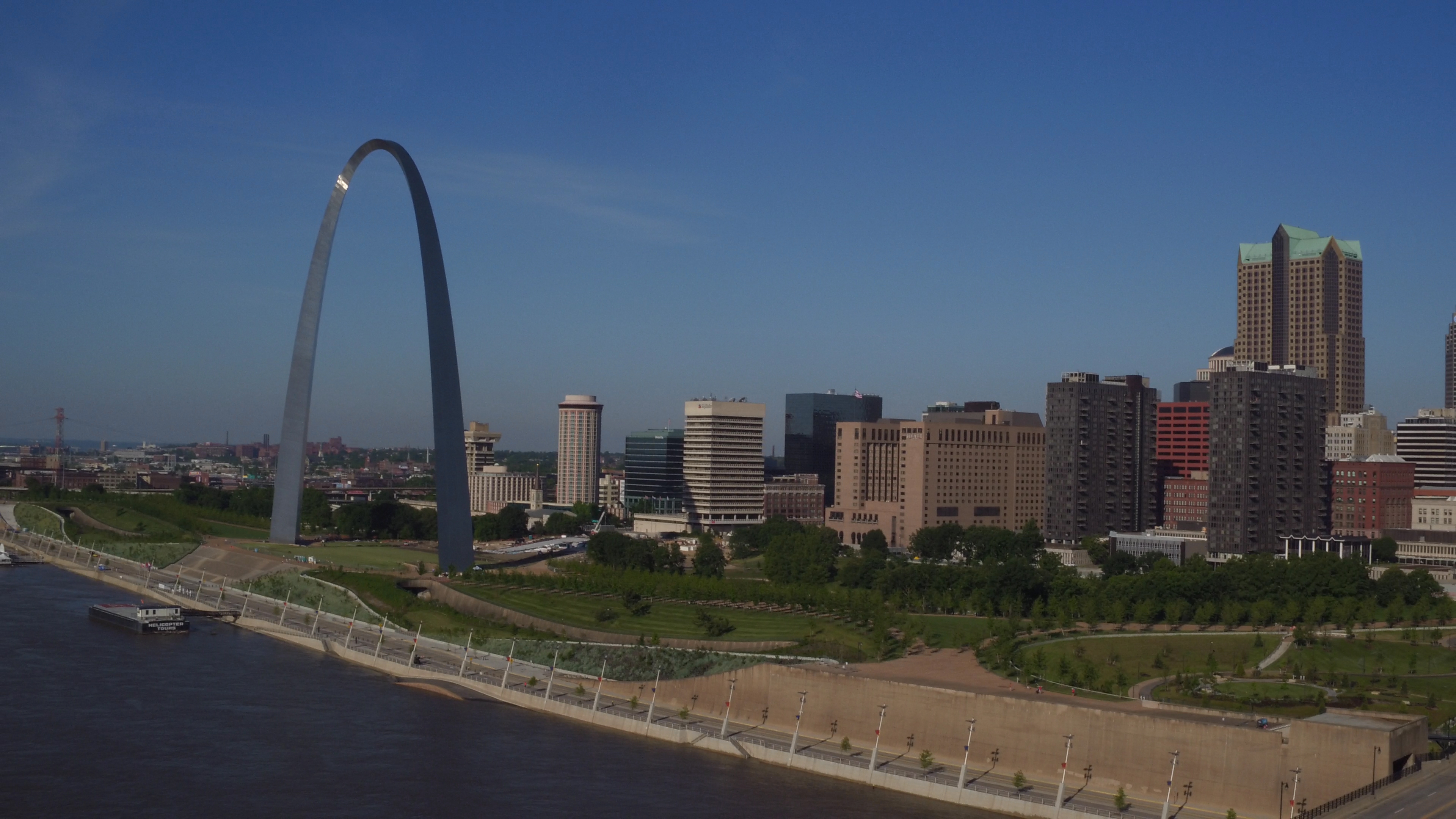
Our team is fully licensed, including FAA Part 107-certified drone pilots, and we are well-versed in all aspects of drone safety and regulations. Whether you need aerial footage for a corporate video, marketing campaign, or any other media requirement, we can customize our services to meet your specific needs.

We offer a range of services, from full-service studio and location video and photography to editing, post-production, and specialized indoor drone operations. Our private studio is ideal for small productions and interview scenes, equipped with top-notch lighting and visual setups. For larger productions, our studio can accommodate various props to enhance your set.

St Louis Drone Services has been a trusted partner for businesses, marketing firms, and agencies in the St. Louis area since 1982. We have the expertise to repurpose your photography and video branding to gain more traction across diverse media platforms. With our state-of-the-art equipment and comprehensive service offerings, we are ready to make your next video production perfect, from concept to completion.

Let us help you elevate your brand with stunning aerial visuals and expert production services. Contact us today to learn how we can collaborate on your next project and ensure it is both safe and successful.

314-604-6544

stlouisdroneservices@gmail.com

How to Use Drones to Measure Stockpiles and Track Volumes More Accurately

In the mining, construction, and aggregates industries, precise stockpile measurement is essential for effective inventory management and operational efficiency. Traditional methods can be time-consuming, labor-intensive, and often less accurate. However, with the advent of drone technology, measuring stockpiles has become significantly more efficient and accurate. This guide explores how drones are transforming stockpile measurement and how your organization can benefit from this innovative approach.

The Advantages of Using Drones for Stockpile Measurement

Typically, a drone survey can be completed in a few hours, including flight time and initial data processing.

Accurate and Efficient Data Collection

Drones enable quick and precise data collection by capturing geo-referenced images from above your worksite. Using photogrammetry, these images can be transformed into detailed 3D maps. Drone survey visualization software ensures high data accuracy, allowing for precise stockpile volume measurements.

Track Progress and Compare Surveys

Drone technology simplifies the process of comparing current stockpile volumes to previous surveys, helping you effectively track site progress. You can also compare drone surveys to final grade design files to determine how much material needs to be added or removed, ensuring your project stays on target.

Comprehensive 3D Mapping

Drones create detailed 3D maps of your site, providing both a visual representation and actionable data, including stockpile volume calculations. This level of detail and accuracy is invaluable for informed decision-making in inventory management and site planning.

Improved Safety

Traditional stockpile measurement methods often require personnel to climb stockpiles, posing safety risks. Drones eliminate this hazard by collecting data remotely, ensuring the safety of your workforce. At St Louis Drone Services, safety is our top priority. Our licensed pilots are FAA 107 compliant and Safe-To-Fly certified, meeting the highest safety standards.

Speed and Cost-Effectiveness

Drone surveys are faster than traditional methods, allowing for more frequent data collection and quicker turnaround times. This efficiency can lead to significant cost savings by reducing the time and labor needed for stockpile measurement while maintaining high accuracy.

Applications of Drone Surveying in Various Industries

Mining and Aggregates

For professionals in the mining and aggregates industries, stockpile inventory management is a key application of drone surveying. Accurate volume measurements are critical for managing inventory, planning operations, and meeting regulatory requirements. Drones provide a reliable and efficient means to collect this essential data.

Construction

Construction sites benefit greatly from drone surveying. Quick site surveys and detailed 3D maps help project managers track progress, manage resources, and ensure projects stay on schedule and within budget. The actionable data collected from drone flights supports informed decision-making and enhances overall project efficiency.

Frequently Asked Questions About Drones and Volumetric Measuring

1. How accurate are drone surveys for volumetric measurements?

Drone surveys are highly accurate for volumetric measurements, often achieving accuracy within 1-2% of traditional ground survey methods. Accuracy depends on factors such as the drone’s camera quality, flight plan, and processing software used for generating 3D models and measurements.

2. What equipment is needed for drone volumetric measurements?

To conduct volumetric measurements using drones, you need:

  • A high-quality drone equipped with GPS and a high-resolution camera.
  • Photogrammetry software for processing images and generating 3D models.
  • Ground control points (GCPs) to enhance survey accuracy.
  • A computer capable of handling the processing software and large datasets.

3. How long does it take to complete a drone survey?

The time required for a drone survey depends on the site’s size and terrain complexity. Typically, a drone survey can be completed in a few hours, including flight time and initial data processing. Larger or more complex sites may take longer.

4. What are ground control points (GCPs) and why are they important?

Ground control points (GCPs) are physical markers placed on the ground at known coordinates. They improve the accuracy of the drone survey by providing reference points for the photogrammetry software, ensuring that the generated 3D models and measurements are correctly scaled and geo-referenced.

5. Can drones be used to measure stockpiles indoors?

Yes, drones can measure stockpiles indoors using specialized drones equipped with sensors that navigate in GPS-denied environments. While indoor measurements can be more challenging due to limited space and potential obstacles, accurate measurements can be achieved with the right equipment and expertise.

6. What types of materials can be measured using drones?

Drones can measure various materials, including aggregates like rock and gravel, coal, sand, soil, and more. As long as the stockpiles are accessible and visible to the drone’s camera, volumetric measurements can be accurately obtained.

7. How are the volumetric measurements calculated from drone data?

Volumetric measurements are calculated using photogrammetry software that processes the images captured by the drone. The software generates a 3D model of the site and calculates the volume of the stockpiles by analyzing differences in elevation and surface area.

8. What are the benefits of using drones for volumetric measurements compared to traditional methods?

The benefits of using drones for volumetric measurements include:

  • Increased safety by eliminating the need for personnel to climb stockpiles.
  • Faster data collection and processing times.
  • High accuracy and detailed 3D models.
  • Cost savings due to reduced labor and time requirements.
  • The ability to frequently update measurements for better inventory management.

9. Are there any regulatory requirements for using drones in volumetric measurements?

Yes, there are regulatory requirements for using drones, including:

  • Obtaining a Remote Pilot Certificate from the FAA for commercial drone operations.
  • Adhering to FAA Part 107 regulations, which cover operational limitations, airspace restrictions, and safety guidelines.
  • Ensuring the drone and pilot comply with local regulations and any additional permits required for specific areas.

10. How can St Louis Drone Services help with drone volumetric measurements?

At St Louis Drone Services, we provide comprehensive drone surveying services, including volumetric measurements. Our team of licensed and experienced pilots, equipped with the latest technology, ensures accurate data collection and processing. We prioritize safety and compliance with FAA regulations, offering customized solutions to meet your specific needs. Whether you need regular inventory updates, detailed site surveys, or custom media production, we have the expertise and equipment to deliver exceptional results.

Why Choose St Louis Drone Services

At St Louis Drone Services, we are a full-service professional commercial photography and video production company with extensive experience in drone surveying for stockpile inventory management. Our team of licensed drone pilots is equipped with the latest technology to provide accurate and reliable data acquisition. Here’s what sets us apart:

  • Expertise and Equipment: We have the right equipment and creative crew to handle all aspects of your project, from data acquisition to post-production.
  • Comprehensive Services: We offer full-service studio and location video and photography, as well as editing, post-production, and licensed drone pilots. Whether you need custom video productions, sound and camera operators, or specialized drone flights, we have you covered.
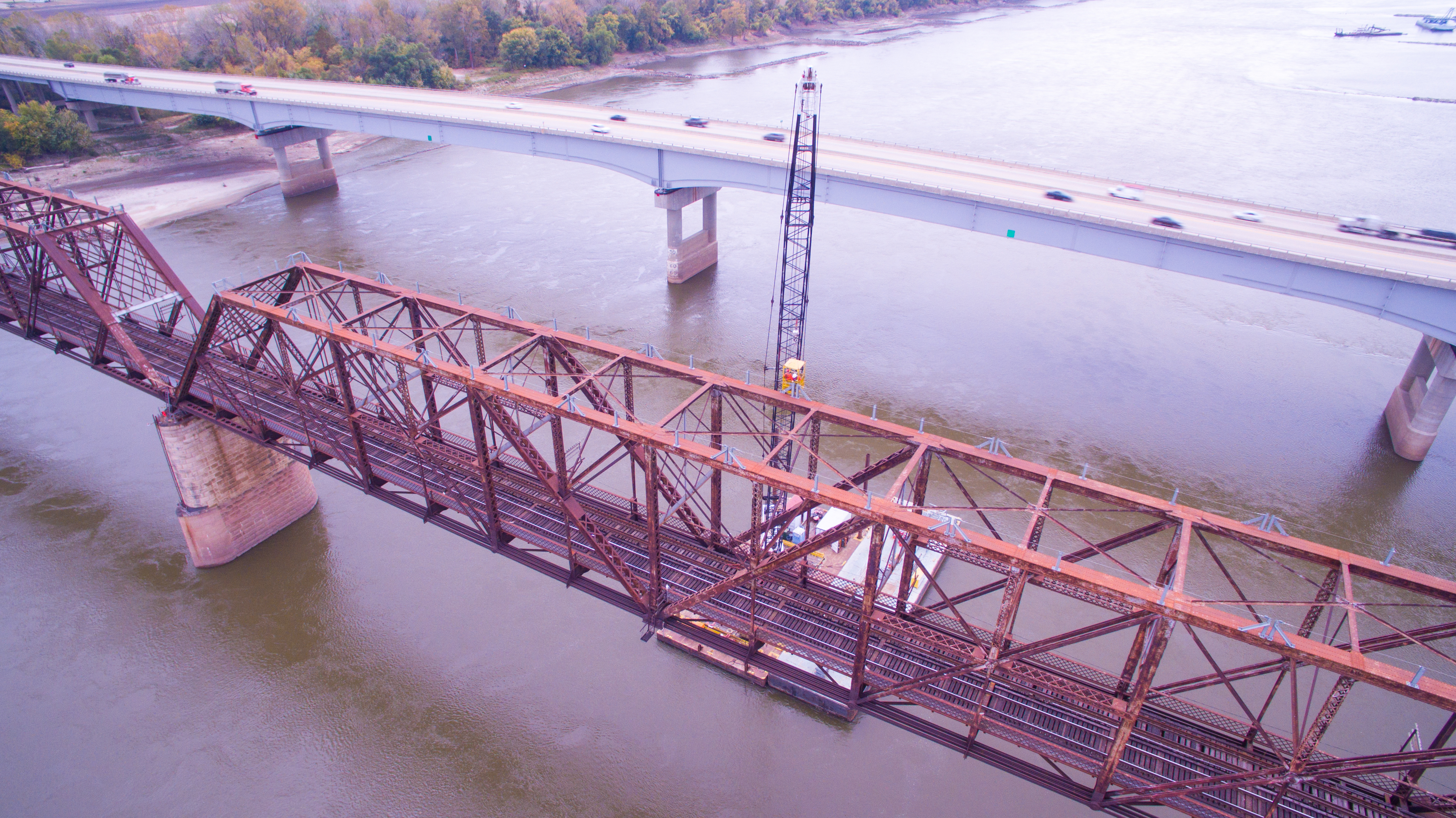
  • Customization: We can tailor our services to meet diverse media requirements, ensuring that your content is optimized for maximum impact.
  • Safety and Compliance: Our operations are FAA approved, and all our pilots are FAA 107 compliant. We prioritize safety and adhere to the highest standards in the industry.
  • Experience: We have worked with numerous businesses to gather data and measure stockpiles accurately, helping them make informed decisions and improve operational efficiency.

By leveraging our expertise and state-of-the-art technology, St Louis Drone Services can help you achieve accurate stockpile measurements and optimize your inventory management processes. Contact us today to learn more about how we can support your business needs with our comprehensive drone surveying services.
314-604-6544

stlouisdroneservices@gmail.com

What are the Top 10 FAQs For Hiring a Drone Photographer?

In today’s competitive market, businesses and organizations are constantly seeking innovative ways to stand out. Aerial photography and videography, facilitated by drones, have become a game-changer in creating captivating visual content. As decision-makers, understanding the nuances of hiring a licensed drone photographer is vital for ensuring quality, compliance, and effective visual storytelling. Below, we delve into the top 10 frequently asked questions about hiring a licensed drone photographer, tailored to your specific needs.

A drone photography session begins with a site survey to identify optimal shooting locations and ensure safety.

1. Why is it essential to hire a licensed drone photographer?

Hiring a licensed drone photographer ensures adherence to legal and safety standards. Licensed photographers have passed the FAA’s Part 107 certification, demonstrating their knowledge of airspace regulations, safety protocols, and operational guidelines. This minimizes legal risks and enhances the safety of your project.

2. What should I look for in a drone photographer?

When selecting a drone photographer, consider their FAA Part 107 certification, experience, portfolio, and client reviews. Additionally, assess their familiarity with your industry and their ability to understand and meet your specific project needs. A reputable drone photographer will also have liability insurance, providing an extra layer of protection.

3. What types of drones are used in professional photography and videography?

Professional drone photographers typically use high-end drones like the DJI Phantom series, DJI Mavic series, and DJI Inspire series. These drones offer superior imaging capabilities, such as 4K video resolution, high-resolution stills, and advanced stabilization systems. They also feature obstacle avoidance and GPS for precise navigation.

4. How do drone photographers address safety and privacy concerns?

Safety and privacy are paramount in drone operations. Licensed drone photographers conduct thorough pre-flight assessments to identify potential hazards and obtain necessary flight permissions. They adhere to strict privacy guidelines, avoiding unauthorized footage of private properties and complying with all relevant privacy laws.

5. What are the advantages of using drones for commercial projects?

Drones offer unique perspectives and the ability to capture dynamic, wide-angle shots that traditional photography cannot achieve. They are ideal for real estate showcases, construction progress documentation, event coverage, and scenic landscape photography. Drones provide a cost-effective way to achieve high-impact visual content that engages audiences.

6. What is the cost structure for hiring a drone photographer?

The cost of hiring a drone photographer varies based on project complexity, duration, and post-production requirements. On average, prices range from $200 to $500 per hour. Discussing your specific needs and budget with the photographer will help you get a tailored quote that meets your project goals.

7. What post-production services do drone photographers provide?

Professional drone photographers offer a suite of post-production services, including video editing, color grading, sound design, and special effects. They can also enhance still images, create panoramic shots, and develop promotional materials tailored to your brand’s identity. These services ensure your final product is polished and professional.

8. Can drones be used for indoor photography and videography?

Yes, drones can be used indoors, provided the space allows for safe operation. Specialized drones with obstacle avoidance and precise controls are used for indoor shoots, capturing unique angles in venues such as event halls, warehouses, and large indoor spaces. Indoor drone photography requires careful planning and skilled operation.

9. How do drone photographers handle unexpected weather conditions?

Experienced drone photographers monitor weather forecasts and plan shoots during optimal conditions. They are trained to recognize adverse weather signs and have contingency plans in place. If weather conditions deteriorate unexpectedly, photographers may reschedule the shoot or adjust their approach to ensure safety and quality.

10. What can I expect during a drone photography session?

A drone photography session begins with a site survey to identify optimal shooting locations and ensure safety. The photographer will set up equipment, conduct test flights, and capture footage based on your project’s requirements. Professional conduct, adherence to timelines, and delivery of high-quality content are standard expectations.


Why Choose St Louis Drone Services for Your Photography and Video Production Needs?

At St Louis Drone Services, we are committed to delivering exceptional visual content through professional drone photography and videography. Our team of experienced photographers, videographers, and licensed drone pilots is equipped with cutting-edge technology and creative expertise to meet your unique needs.

We provide comprehensive services, including studio and location video and photography, editing, post-production, and customized productions for various media requirements. Our private studio is perfect for small productions and interview scenes, offering ample space for props and tailored setups. We specialize in repurposing your visual content to maximize impact and engagement across different platforms.

Our offerings include:

  • Licensed Drone Operations: Ensuring safety and compliance with all regulations.
  • High-Quality Equipment: Utilizing top-of-the-line drones for superior image and video quality.
  • Customized Productions: Tailoring services to meet specific branding and marketing needs.
  • Studio Services: Providing a fully equipped studio for controlled environment shoots.
  • Post-Production Excellence: Offering advanced editing and post-production services to enhance your visual content.
  • Indoor Drone Flights: Capturing unique indoor perspectives with specialized drones.

Having collaborated with numerous businesses, marketing firms, and agencies in the St. Louis area, St Louis Drone Services has built a reputation for delivering high-quality corporate photography and video services. We are well-versed in all file types and media styles, ensuring compatibility with your existing systems and requirements.

Contact us today to elevate your visual content and experience the professional difference with St Louis Drone Services. Let us help you create compelling visuals that resonate with your audience and drive your business forward.

314-604-6544

stlouisdroneservices@gmail.com